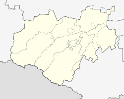
Ekaterinogradskaya
| Staniza
Yekaterinogradskaya
Екатериноградская
|
||||||||||||||||||||||||
|
||||||||||||||||||||||||
|
||||||||||||||||||||||||
Yekaterinogradskaya ( Russian Екатериноградская ) is a Staniza near prokhladny in the Russian Caucasus -Republik Kabardino-Balkaria with 3675 inhabitants (as of October 14, 2010).
The village is not far from the mouth of the Malka in the Terek .
history
In 1777, Prince Potjomkin had the Ekaterinograd fortress, named after Catherine the Great (Russian: Ekaterina ), built there, from which the Georgian Military Road began. In 1786 Stanitsa received city rights as the capital of the newly created Caucasus governorate . After the administration was transferred to Georgievsk in 1790, Ekaterinograd remained the administrative center of a Ujezd until 1802 . In 1822 the fortress was razed and Jekatarinograd became Stanitsa again under its current name.
In the Soviet period, the stanitsa was given the name Krasnogradskaja (from Russian krasny for red ), but in the 1990s it was given the original name again.
| year | Residents |
|---|---|
| 2002 | 3729 |
| 2010 | 3675 |
Note: census data
literature
- Nikolai Ivanovich Kuznetsov (botanist): Ekaterinogradskaya . In: Энциклопедический словарь Брокгауза и Ефрона - Enziklopeditscheski slowar Brokgausa i Jefrona . tape 11 a [22]: Евреиновы – Жилон. Brockhaus-Efron, Saint Petersburg 1894, p. 581 (Russian, full text [ Wikisource ] PDF ).
- Ekaterinograd . In: Meyers Großes Konversations-Lexikon . 6th edition. Volume 10, Bibliographisches Institut, Leipzig / Vienna 1907, p. 218 .
Individual evidence
- ↑ a b Itogi Vserossijskoj perepisi naselenija 2010 goda. Tom 1. Čislennostʹ i razmeščenie naselenija (Results of the All-Russian Census 2010. Volume 1. Number and distribution of the population). Tables 5 , pp. 12-209; 11 , pp. 312–979 (download from the website of the Federal Service for State Statistics of the Russian Federation)

