
Conventer lake
| Conventer lake | |
|---|---|

|
|
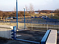
| The Conventer See from the south bank | |
| Geographical location | Mecklenburg-Western Pomerania , Germany |
| Tributaries | Bridges |
| Drain | Canal to the mill flow, historically: Jemnitz |
| Places on the shore | Börgerende |
| Location close to the shore | Heiligendamm , Bad Doberan , Kühlungsborn |
| Data | |
| Coordinates | 54 ° 8 '28 " N , 11 ° 53' 15" E |
| Depth below sea level | 0.1 m below sea level |
| surface | 91 ha |
| length | 1.7 km |
| width | 790 m |
| volume | 920,000 m³ |
| Maximum depth | 1.7 m |
| Middle deep | 1.0 m |
| PH value | 8.6 |
| Catchment area | 39 km² |
|
particularities |
Brackish water lake |

|
|
| Location of the lake | |
The Conventer See is located directly behind the Baltic Sea coast between Heiligendamm and Börgerende-Rethwisch in the Rostock district . It is around 1.7 kilometers long and around 0.8 kilometers wide. The main inflow is the old lower course of the footbridges . The connection to the Baltic Sea is called Jemnitz . Since 1968, the relocation of the mill flow has led the greater part of the water from the hinterland to the southwest by the Conventer Niederung. In the Jemnitz lock built in the process , the Jemnitz now flows into the sea next to the Mühlenfließ, a wall separates both mouths from each other.
history
The Conventer See used to be a bay. The name of the lake is derived from the convent , the assembly of the monks of the monastery. The Cistercian monks of Doberan Monastery gave the lake its name. They worked the lake and probably began to drain the lowland around 1260. At the end of the 1960s, the Conventer Niederung was meliorated , thus causing a partial lowering of the ground by around 80 cm. With the construction of the Jemnitz lock, the exchange of water between the lake and the Baltic Sea was stopped. The vegetation conditions deteriorated and the lake was threatened with silting up .
Nature reserve
The lake is located in the Conventer Niederung, a moor area of approx. 1200 hectares. As early as 1939, 216 hectares of this area were declared a nature reserve bird sanctuary Conventer See and Heiligen Damm . A variety of marsh and water birds live in this area. It is considered to be one of the most important breeding and resting areas for water birds on the Baltic Sea coast.
Renaturation and flood protection
In order to avert the threatening silting up of the Conventer See and to meet the demands of flood protection, the State Office for Environment and Nature (StAUN) in Rostock carried out extensive measures. This includes the construction of a canal that connects the Baltic Sea with the Conventer See and thus ensures water exchange, the replacement of the Jemnitz lock and the renovation of the two existing piers. The Jemnitz lock and the adjoining dyke systems were built in such a way that the coastal section can withstand a flood in a severe storm surge at 2.8 meters above normal. Since 1998, around 19 million euros have been invested in the Conventer Niederung storm surge protection system in the coastal section between Heiligendamm and Börgerende from the joint task of “improving the agricultural structure and coastal protection”. With the systems handed over on August 17, 2006, the prerequisites for an ecological improvement of the entire Conventer lowlands were created.
See also
gallery

View of the south bank
View from the Jemnitz
lock to the lake
Sea side of the Jemnitz lock

