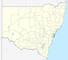
Jervis Bay (bay)
Coordinates: 35 ° 5 ′ 4 ″ S , 150 ° 43 ′ 55 ″ O
The Jervis Bay is a bay in southeastern Australia . The bay with an area of 102 square kilometers opens in the east to the Tasman Sea , a marginal sea of the Pacific . The west and north of the bay belong to New South Wales , while the south coasts and a stretch of coast north of the bay's exit belong to the Jervis Bay Territory .
landscape
Jervis Bay is around 200 kilometers south of Sydney , the next larger town, Nowra, is around 40 kilometers away. To the south is the Behwere Peninsula , which ends at Governors Head and forms most of the Jervis Bay Territory. To the north is the Beecroft Peninsula , which ends at Point Perpendicular , where the Point Perpendicular Lighthouse is located. The 21 meter high lighthouse is administered by New South Wales and is an enclave in the Jervis Bay Territory , which includes a strip of coast in the south of the peninsula. A large area of the Beecroft Peninsulta is reserved by the Royal Australian Navy for target training for their warships. Bowen Island is at the exit of the bay . Notable rivers do not flow into the bay.
On the coast of the bay are the settlements of Jervis Bay Village , Hyams Beach , Vincentia , Huskisson and Callala Beach . There is a naval port in the southwest of the bay. Jervis Bay Airport is just two kilometers south of it . The HMAS Creswell Cadet School of the Royal Australian Navy is also located in the port .
history
James Cook was the first European to see the bay and named it St George's Head because he sighted it on St George's Day April 1770. The Point Perpendicular he called Long Nose . In 1791 the bay was named by Lieutenant Bowen Jervis Bay after the British Admiral John Jervis . In 1811, New South Wales Governor Lachlan Macquarie came to the bay and visited the southern part of the bay and Bowen Island . In 1822, the Aborigines living there were relocated to Wreck Bay . The first lighthouse was built in the 1860s; later it had to be rebuilt in a more suitable place. The first European settlement took place during the same period. In 1911, the elected Australian Capital Territory to Captain Point as the site for the Royal Australian Naval College and the naval port. In 1915 the area officially became part of his state.
HMS Jervis Bay , sunk in November 1940, was named after the bay. A ferry and a catamaran ferry of the Royal Australian Navy, which today operates in the English Channel as the civil HSC Condor Rapide , were named HMAS Jervis Bay .
In the southeast of the bay on Murray Beach , Australia's first nuclear power plant was planned, the Jervis Bay nuclear power plant . This construction project was abandoned in 1971.
In 1986, the Aboriginal people living in Wreck Bay were granted land rights under the Aboriginal Land Grant (Jervis Bay Territory) Act .
tourism
Most of the water in the bay is part of the Jervis Bay Marine Park . Large areas of the shore belong to the Jervis Bay National Park and the Booderee National Park .
The places along the bay are all seaside resorts. Jervis Bay is known for its clear, clean water and very white beaches. Hyams Beach is listed in the Guinness Book of Records as the beach with the whitest sand. The offered tourist attractions also include trips on which the dolphins and bottlenose dolphins that are common in the bay as well as humpback whales and southern right whales passing by at certain times can be observed.
Web links
Individual evidence
- ^ Peter Crabb: Jervis Bay and St Georges Basin 1788-1939: an emptied landscape . Lady Denman Heritage Complex, Huskisson 2007, ISBN 0-9586447-3-X .
- ↑ Jervis Bay History on www.ag.gov.au ( Memento of the original from September 23, 2008 in the Internet Archive ) Info: The archive link was inserted automatically and has not yet been checked. Please check the original and archive link according to the instructions and then remove this notice. . Retrieved January 10, 2011
- ↑ Aboriginal Land Grant (Jervis Bay Territory) Act at www.comlaw.gov.au . Retrieved January 10, 2011
- ↑ Tony Grantham: Gazing onto the world's whitest sands. The Sydney Morning Herald, January 1, 2006, accessed on January 27, 2013 (English): “It has an entry in the Guinness Book of Records as having the whitest sand in the world (officially at Hyams Beach, though many others around there are similarly blessed) [...] "
- ^ Jervis Bay Marine Park Education Kit. In: Marine Parks Authority NSW. Retrieved on January 27, 2013 (English): “Marine mammals are a common sight in the marine park. Humpback and southern right whales attract many spectators during their seasonal migrations and often enter the bay with young calves to rest. [...] and bottlenose and common dolphins are also regularly observed throughout the marine park. "


