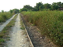
Jianan Plain
The Jianan Plain or Chianan Plain ( Chinese 嘉南 平原 , Pinyin Jiānán Píngyuán ) is an alluvial plain in western Taiwan . It is the largest plain on the island and extends between the central and southern parts of the west coast along the Formosa Strait . Most of the plain is divided between the districts of Jiayi and the city of Tainan , from which its name is derived (Jianan ( 嘉南 , Jiānán ) is made up of the first syllable of Jiayi ( 嘉義 , Jiāyì ) and the second syllable of Tainan ( 台南 , Táinán )). It also extends into Yunlin County to the north and Kaohsiung City to the south .
Originally the plain was settled by indigenous peoples of Taiwan , who have been largely displaced by immigrating Han Chinese since the time of the Qing dynasty and are now only minorities. Since the Japanese rule over Taiwan , the plain has produced many agricultural goods for the whole island.
geography

The Jianan Plain is located between Formosa Strait in the west and the foothills of Alishan, which belongs to the Taiwanese central mountains, in the east. It is crossed by numerous rivers that have their source in the central mountains. To the south the Pingdong Plain joins, in the north the Jianan Plain merges into the Zhanghua Plain, which is part of the Taichung Basin .
The plain has an area of about 2500 km², its extension is 35 km in width and 145 km in length.
Average annual rainfall in this area is around 1,600mm, less than the rest of Taiwan. The rainy season falls in summer, so winter is the dry season. The rivers that cross the plains include the Beigang , Puzi , Bazhang , Jishui , Zengwen , Yanshui (river) / Yanshui and Erren , which head from the mountainous region to the east through the plains towards the coast and then empty into the Formosa Strait.
Settlement history
About 6,000 years ago, the land on the seashore of the Jianan Plain was flooded by rising sea levels, and about 5,000 years ago the land rose tectonically. Various archaeological sites testify, among other things, to the late Stone Age Tau culture (大湖 文化), which existed here between 1500 BC. BC and the beginning of our calendar existed, and the Niaosong culture (蔦 松 文化) from the Iron Age , which existed here until around 1500.
From the time of written tradition it is known that the Hoanya lived in the northern part of the plain and the south was inhabited by the Siraya . The Han Chinese began to settle in the plain since Taiwan was under Dutch rule . After Zheng Chenggong defeated the Dutch East India Company and took possession of Taiwan in 1662, the Han Chinese became masters of the region and later became the majority of the population. Most of them immigrated from Zhangzhou and Quanzhou in Fujian and from Chaozhou in Guangdong during the Qing Dynasty .

In 1895, Japan began to rule Taiwan. During this time, the Japanese colonial government began to build the infrastructure on the plain - for example the western railway line and the Jianan Canal with its connections, as well as the sugar manufacturing companies , which were later merged into the Taiwan Sugar Corporation . After the collapse of the Japanese Empire, the island was taken over by the Republic of China . The two major highways through the region, motorways 1 and 3, were completed at the end of the 20th century.
Economic use
The Jianan Plain is used to grow rice and, to a lesser extent, other grains . It is the main growing area for sugar cane in Taiwan, but sugar production is continuously declining. Since the completion of the Jianan Canal, three rice harvests can be carried out annually. In addition, here peanuts , corn , sweet potatoes and some ornamental flowers and vegetables grown. Salt was also produced in the past , but most of the salt pans have since been abandoned. There are also fish farms on the coast .
The industrial use of the area takes place in various industrial parks , heavy industries include oil refineries , steel production and shipbuilding .
Individual evidence
- ↑ Joyce Jong-Wen Wann, Tso-Kwei Peng and Mei-Huey Wu: Taiwan . In: M. Ali (Ed.): Dynamics of vegetable production, distribution and consumption in Asia ( en ), Asian Vegetable Research and Development Center, Shanhua, Tainan 2000, pp. 379-415 (accessed December 17, 2010).
- ↑ 謝瑞麟: 雲 嘉南 區域 水利 建設 概況 ( Chinese ) National Policy Fundation. Archived from the original on June 19, 2008. Info: The archive link was inserted automatically and has not yet been checked. Please check the original and archive link according to the instructions and then remove this notice. Retrieved July 17, 2008.
- ↑ Yu-gao Chen: Sea-level change and neotectonics in southern part of Taiwan region since late pleistocene . In: National Taiwan University (ed.) . 1993, p. 158.
- ↑ Yi-chang Liu: 考古學 研究所 見 人群 互動 關係 與 分布 界線: 以 嘉南 平原 東側 丘陵 山地 地區 為例 ( Chinese ) Tainan County Government. Pp. 39-60. 2006. Accessed on December 17, 2010. ( Page no longer available , search in web archives ) Info: The link was automatically marked as defective. Please check the link according to the instructions and then remove this notice.
- ↑ Jack F. Williams, Yu-Chen Wu: Sugar: The Sweetener in Taiwan's Development. Archived from the original on February 10, 2012. In: Environment And Worlds . November 1997.
- ↑ Alexandra Liu: Country Travel, New Style. Archived from the original on July 18, 2011. In: Taiwan Panorama . June 2001. Retrieved July 15, 2008.
