Jose Panganiban
| Municipality of Jose Panganiban | ||
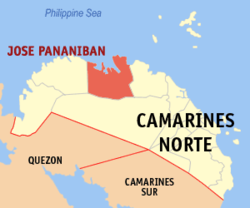
| Location of Jose Panganiban in the Camarines Norte Province | ||
|---|---|---|

|
||
| Basic data | ||
| Region : | Bicol region | |
| Province : | Camarines Norte | |
| Barangays : | 27 | |
| District: | 1. District of Camarines Norte | |
| PSGC : | 051605000 | |
| Income class : | 2nd income bracket | |
| Households : | 8969 May 1, 2000 census
|
|
| Population : | 59,639 August 1, 2015 census
|
|
| Coordinates : | 14 ° 18 ' N , 122 ° 42' E | |
| Postal code : | 4606 | |
| Area code : | +63 54 | |
| Mayor : | William A. Lim | |
| Geographical location in the Philippines | ||
|
|
||
Jose Panganiban is a Filipino municipality in the Camarines Norte Province . It has 59,639 inhabitants (August 1, 2015 census).
The village was previously known under the name "Mambulao" , the name of which is derived from the word Mambulawan , which means something like in gold .
Barangays
Jose Panganiban is politically divided into 27 barangays .
|
|
