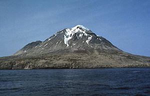
Kagamil Island
| Kagamil Island | ||
|---|---|---|
|
Kagamil |
||
| height | 893 m | |
| location | Aleutian Islands ( Alaska ) | |
| Coordinates | 52 ° 58 '26 " N , 169 ° 43' 4" W | |
|
|
||
| Type | Stratovolcano | |
| Last eruption | December 1929 | |
Kagamil Island ( Aleutian : Qagaamila ) is one of the Islands of Four Mountains , a group of islands in the Aleutian Islands in Alaska . It is located 6 km north of Chuginadak Island and 2 km south of Uliaga Island . It is 10 km long and 5 km wide. The island is difficult to get to.
The volcano
The southern half of the island is determined by the Kagamil volcano . It is a stratovolcano . This has two peaks, the higher one is 893 m above sea level, the lower one is 690 m high. Hot springs and fumaroles on the south-east side of the island also bear witness to the volcanic activity . The last (known) eruption occurred in December 1929.
Web links
Commons : Kagamil Island - collection of pictures, videos and audio files
- Kagamil Island in the Global Volcanism Program of the Smithsonian Institution (English)
- Alaska Vulcano Observatory
- National Geographic 1999/2000 (engl.)
- Image and short description (Engl.) ( Memento of 23 December 2010 at the Internet Archive )
- Canadian Mountain Encyclopedia (Eng.)

