
Kaisergarten (Palatinate Forest)
| Kaisergarten | ||
|---|---|---|
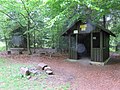
.jpg) Refuge on the Kaisergarten |
||
| height | 519 m above sea level NHN | |
| location | In Lambrecht , district of Bad Durkheim , Rhineland-Palatinate | |
| Mountains | Palatinate Forest | |
| Coordinates | 49 ° 21 '18 " N , 8 ° 3' 6" E | |
|
||

The Kaisergarten is 519 m above sea level. NHN high mountain in the Palatinate Forest ( Rhineland-Palatinate ). Its summit is on the boundary between Lambrecht and Neustadt an der Weinstrasse .
geography
The Kaisergarten is located in the northern part of the Palatinate Forest-Vosges Biosphere Reserve , the Palatinate Forest Nature Park . It is an elevation (519 m) on a long ridge that stretches from the Schauerberg near Lambrecht to the mountain Platte (560.6 m). The Kaisergarten is located 1.2 km southwest of Lambrecht as the crow flies and 4 km northwest of the Hohen Loog .
history
Kaisergarten
A celebration was arranged to mark the appointment of Napoleon Bonaparte hereditary emperor. Therefore, a fairground with two stone rondelles was created here in 1804, on which the celebration took place for Napoleon's birthday on August 15, 1804. Celebrations were also ordered on March 20, 1811, this time for the birth of Napoleon's son Napoleon Franz Bonaparte . Until the 20th century, the place served the population as a popular fairground.
Old Unger
This place previously served as forest cattle pasture, a common use of the forests until the middle of the 19th century. The traditional term “Unger” generally refers to a camp or resting place for cattle and herdsmen.
Access and walks
The Kaisergarten is located on the Palatinate Forest Association hiking trail from Deidesheim to Rhodt unter Rietburg , marked with a blue-yellow bar. From the east it can be reached from the Naturfreundehaus Heidenbrunnental on the connecting path marked with a white circle.
gallery

Alte Unger, former forest pasture

Information board Kaisergarten and Alte Unger
Kaisergarten with refuge

Kaisergarten refuge

Path to the former forest pasture "Alte Unger"


.jpg)

Web links
Individual evidence
- ↑ a b Map service of the landscape information system of the Rhineland-Palatinate nature conservation administration. Ministry of the Environment, Energy, Food and Forestry, accessed July 28, 2019 .
- ↑ Information board at the refuge in the Kaisergarten
- ↑ Old Unger. In: rainers blog. Retrieved August 12, 2019 . Private website on the etymology of the term “Unger” using Grimm's dictionary .
- ↑ See also: Hiking trail from Deidesheim to Rhodt unter Rietburg at OpenStreetMap
- ↑ See also: Hiking trails in the Palatinate Forest at OpenStreetMap