Cold loaves
| Cold loaves | ||
|---|---|---|
|
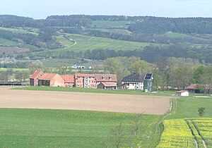
View over Wilhelmsglücksbrunn to the Großer Pferdeberg (center) and the Kalten Laibe (left edge of the picture) |
||
| height | 388.5 m above sea level NN | |
| location | Thuringia ( Germany ) | |
| Coordinates | 51 ° 3 '51 " N , 10 ° 12' 37" E | |
|
|
||
| rock | limestone | |
| particularities | Quarries, Landwehr | |
The mountain Kalte Laibe - also called "Creuzburger Stadtberg" - has a summit height of 388.5 m above sea level. NN and is part of the Eichsfeld-Hainich-Werratal Nature Park . It is located on the western boundary of the city of Creuzburg to the Treffurter district of Volteroda in the Wartburg district in Thuringia .
The partly wooded side knolls and spur-like slopes (position and height) also belong to the ridge:
The mountain, which is wooded and used for forestry on the west side, belongs to the Thuringian Forestry Office Creuzburg. There are several small quarries on its west side. On the north side, the field names "Auf der Wacht" and "Spindelskoppe" mark two former control rooms, an old road and a Landwehr "Lampertsgraben" also run here. The pasture and arable land on the south side are divided by two dry trenches - the "Vorderer and Hinterer Geheißgraben".
Today's road network differs from the mountain - at the former rest house "Red Head" joins the national highway 250 in the federal highway 7 a. The B 250 leads from there through the Pfaff valley , on the western slope of the Kalten Laibe into the Schnellmannshäuser valley and on to Treffurt.
Individual evidence
- ↑ Official topographic maps of Thuringia 1: 10,000. Wartburgkreis, district of Gotha, district-free city of Eisenach . In: Thuringian Land Survey Office (Hrsg.): CD-ROM series Top10 . CD 2. Erfurt 1999.

