
Karlstrasse (Radebeul)
The Charles Street is a city road in the Saxon town of Radebeul , in the district Niederlößnitz . The historic connecting route extends Moritzburger Strasse directly to Obere Bergstrasse . Immediately to the east of the confluence, Burgstrasse leads through the mountain cut of the notch onto the highlands of Kötzschenbroda Oberort , directly west of the Friedensburg past.
Karlstrasse, along with Borstrasse and Moritzburger Strasse , is mentioned in the Dehio manual as an example of the beautiful villa stock in Niederlößnitz.
Development
The numbering of the house addresses starts at the intersection of Winzerstraße / Moritzburger Straße with No. 1 on the west side, i.e. left. From there the odd numbers run to no.11, the even numbers on the east side to no.10.
Various cultural monuments are located along Karlstrasse and are therefore included in the list of cultural monuments in Radebeul-Niederlößnitz (A – L) :
- Villa Frieda (No. 1) , Haus Gotendorf (No. 4) , Villa Viktoria (No. 5) , Frenzelsches Haus (No. 8) with a listed garden, Villa Meta (No. 9) , No. 10
Opposite the confluence of Karlstrasse and Obere Bergstrasse is the house Obere Bergstrasse 64.
Naming
The path leading straight from Moritzburger Strasse to Steinrücke was known as Steinberggäßchen in the 16th century ; around 1600 the name Steinigtweg was used.
Around 1880 the street was named Carlstraße , after 1900 the more modern form Karlstraße was used. It was named after Carl Barthel, a local resident, innkeeper, wine merchant and 1st community elder and local judge. He owned the adjacent Schweizerhaus restoration .
literature
- Volker Helas (arrangement): City of Radebeul . Ed .: State Office for Monument Preservation Saxony, Large District Town Radebeul (= Monument Topography Federal Republic of Germany . Monuments in Saxony ). SAX-Verlag, Beucha 2007, ISBN 978-3-86729-004-3 .
Web links
- City map Niederlößnitz around 1924
- Manfred Richter: Karlstrasse. In: Niederlößnitz from yesteryear. Retrieved January 24, 2015 .
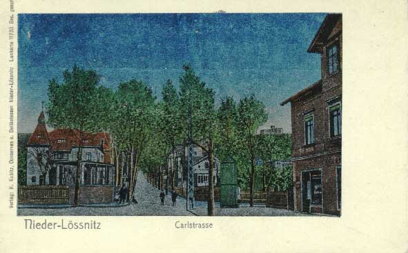
- View of the beginning of Karlstrasse (silver effect card, around 1900)
Individual evidence
- ↑ Barbara Bechter, Wiebke Fastenrath u. a. (Ed.): Handbook of German Art Monuments , Saxony I, Dresden District . Deutscher Kunstverlag, Munich 1996, ISBN 3-422-03043-3 , p. 739 .
- ↑ Barbara Bechter, Wiebke Fastenrath u. a. (Ed.): Handbook of German Art Monuments , Saxony I, Dresden District . Deutscher Kunstverlag, Munich 1996, ISBN 3-422-03043-3 , p. 730–739 (building mentioned as an example).
- ^ Manfred Richter: Schweizerhaus; Karlstrasse 2. In: Niederlößnitz from yesteryear. Retrieved June 14, 2011 .
Coordinates: 51 ° 6 ′ 48 " N , 13 ° 38 ′ 2" E