Katendrecht
 flag |
 coat of arms |
| province |
|
| local community |
|
|
Area - land - water |
1.18 km 2 0.55 km 2 0.63 km 2 |
| Residents | 4,760 (Jan 1, 2017) |
| Coordinates | 51 ° 54 ′ N , 4 ° 29 ′ E |
| Important traffic route | P. 122 |
| prefix | 010 |
| Postcodes | 3072 |
| Location of the Katendrecht neighborhood in Rotterdam | |
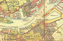
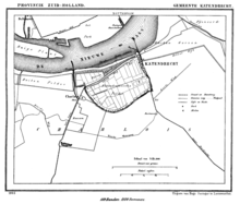
Katendrecht is a peninsula in the Feijenoord district of Rotterdam . The district with 4,760 inhabitants is located on a peninsula between the Maashaven in the south and Rijnhaven and Nieuwe Maas in the north and is called De Kaap by the locals .
Originally a rural area, Katendrecht was a tranquil village in which a number of dignitaries had built their weekend houses until Rotterdam was incorporated into a port area in 1895. The construction of several docks and, in particular, the completion of the Maashaven in 1905 transformed the area into a typical seaman's quarter with a rich nightlife. The migration of the port of Rotterdam towards the North Sea in the years since the Second World War and the introduction of the container economy , which reduced the berthing times of the ships, led to social decline in the quarter. Although in recent years it has also benefited from the Rotterdam urban renewal in neighboring Kop van Zuid , the district with its still inadequate infrastructure and a very high proportion of foreigners is still considered a socially hotspot. The city has therefore adopted a catalog of measures that has been implemented since the beginning of 2007. The main measure consists in a radical improvement of the infrastructure, including the construction of a new bridge (2010), with the plans for a cable car being abandoned, the settlement of employers, the construction of more schools and day-care centers, the construction of small shopping centers within the residential areas and a mixed construction method that combines single and multi-family houses, freehold and rental apartments on the free market and social housing. A total of 1,600 new apartments, 90,000 m² of commercial space and a new recreational area are currently being built, where, among other things, the old passenger ship Rotterdam was opened on February 15, 2010 and is now to become a tourist attraction.
literature
- Eric van Hooydonkl, Patrick Verhoeven: The Ports Portable - Antwerp, Hamburg & Rotterdam . Pandora Publishers, Antwerp, ISBN 90-5325-250-9 , pp. 396ff.
Web links
Individual evidence
- ↑ Kerncijfers wijken en buurten 2017 Centraal Bureau voor de Statistiek , accessed on June 10, 2018 (Dutch)


