Kii peninsula
| Kii peninsula | ||
| Geographical location | ||
|
|
||
| Coordinates | 34 ° 18 '10 " N , 135 ° 57' 18" E | |
| Waters 1 | Pacific Ocean | |
| Waters 2 | Seto Inland Sea | |
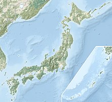
The Kii Peninsula ( Japanese 紀 伊 半島 , Kii-hantō ) is one of the largest peninsulas on the main Japanese island of Honshū , the southernmost part of which it forms. The prefectures of Wakayama , and the southern part of Osaka prefecture , and large parts of the prefectures of Nara and Mie are located on the Kii Peninsula. In the west of the peninsula are the Bay of Osaka and the Kii Channel , in the south the Pacific , in the southeast the Kumano-nada ( 熊 野 灘 ) area of the Pacific, and in the northeast the Bay of Ise .
The southernmost point is Cape Shionomisaki and the largest island in front of the peninsula is Kii-Ōshima , which is adjacent to the Cape .
There are many hot springs on the Kii Peninsula, so many well-known onsen can be found here.
This is also where the Kii Mountains are located, which were declared a World Heritage Site by UNESCO in 2004 .
Significant places on the Kii Peninsula are:
- Nara , the former capital
- The mountain region of Koya ( Kōya-san ) with the eponymous headquarters of the Buddhist Shingon school
- The Negoro Temple ( Negoro-ji ), headquarters of the "New Shingon Teaching"
- The Kongō Sanmai-in Temple
- Wakayama , formerly the seat of the Kii or Kishu branch of the Tokugawa family
- Matsusaka , an important center of cattle breeding
- Ise , seat of the Ise shrine and center of pearl production
- Iga , famous for his ninja
- Yoshino, a heavily forested mountain region, retreat of the southern imperial court in the Nanboku-chō period
- the Kumano region , where the Kumano Shrines and Nachi Waterfall are located.

