Little Aupa
|
Small aupa in Czech Malá Úpa |
||
|
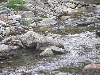
A dipper on a stone at the Kleine Aupa |
||
| Data | ||
| location | Královéhradecký kraj , Czech Republic | |
| River system | Elbe | |
| Drain over | Aupa → Elbe → North Sea | |
| origin | Below the Grenzbaudenpass (Czech. Pomezní Boudy , Polish. Przełęczy Okraj ) 50 ° 45 ′ 11 ″ N , 15 ° 48 ′ 44 ″ E |
|
| Source height | 1180 m | |
| muzzle | At Marschendorf in the Aupa coordinates: 50 ° 40 ′ 34 ″ N , 15 ° 47 ′ 37 ″ E 50 ° 40 ′ 34 ″ N , 15 ° 47 ′ 37 ″ E
|
|
| length | 10 km | |
| Left tributaries | Schwarzwasser, Rennerbach ( Rennerův potok ) |
|
| Right tributaries | Löwenbach | |
The Kleine Aupa is a left tributary of the Aupa ( Úpa ) in the Czech Republic .
Location and course
The Kleine Aupa rises in the eastern Giant Mountains at 1,180 m above sea level south of the Kammstein (also Kammsteig , Polish Czoło , Czech Čelo , 1268 m) east of the Schneekoppe (Polish Śnieżka , Czech Sněžka ) on the Schmiedeberger or Forstkamm (Polish Kowarski Grzbiet , Czech. Lesní hřeben ). The source is located approx. 800 m northwest of the Czech-Polish road border crossing Pomezní Boudy / Przełęcz Okraj ( Grenzbaudenpass ).
The two most important tributaries are the Black Water ( Černá voda ) on the left and the Löwenbach ( Jelení potok , translated Hirschbach ) on the right , the source valleys of which are located directly southeast of the Schneekoppe and are designated as a protected area. After a 10 km long run in a southerly direction, the Kleine Aupa flows into the Aupa (Úpa) at the old restaurant "Kreuzschänke" in Dunkelthal ( Temný Důl ), a district of Marschendorf ( Horní Maršov ).
On the upper course of the river is the place Kleinaupa ( Malá Úpa ), which is formed by the sub-towns of Ober ‑ Kleinaupa ( Horní Malá Úpa ), Nieder ‑ Kleinaupa ( Dolní Malá Úpa ) and the border buildings.
geomorphology
The valley of the Kleiner Aupa and after its confluence the Aupatal as well as the elongated ridge of the piston ridge running parallel to it (also border ridge , Polish Grzbiet Lasocki , Czech Pomezní hřeben ), separate the Giant Mountains from their southeastern foothills, the Rehorn Mountains ( Rýchory ).
In the geomorphological classification of the Giant Mountains, as it is valid in the Czech Republic, the Kleine Aupa gives the name for the subordinate sub-unit "Marschendorfer Mountains" = podokrsek Maloúpská rozsocha . This area, together with the stretch of land between Aupa and Kleiner Aupa = Růžohorská rozsocha, forms the superordinate sub-unit "Rosenberger Hochland" = okrsek Růžohorská hornatina , which is part of the micro-region of southern branch ridges = Krkonošské rozsochy .
History
Before World War II, the body of water named "Small Upa" had no separate source, but emerged only by the confluence of the Black Water ( Cerna voda ) and Fichtigbach ( Fichtigův Potok ), now the source of the Little Upa is locates at the upper reaches. The Fichtigbach is named for the Fichtiglehne, which is drained through it. Fichtig is a German name for the saddle that separates the Schmiedeberger ridge from the main ridge of the Giant Mountains .
The catchment area of the Kleine Aupa was repeatedly hit by devastating floods until recently . Despite flood protection and torrent control , the water level can rise dramatically within a very short period of time.
Individual evidence
- ↑ Map of the Giant Mountains from 1937, new edition 1995 Čeno, Pec pod Sněžkou
- ↑ The Forst- or Schmiedeberger Kamm ( Memento from February 9, 2015 in the Internet Archive )
- ↑ 2002 flood
- ^ Flood disaster of 1897
