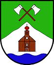
Malá Úpa
| Malá Úpa | ||||
|---|---|---|---|---|
|
||||
| Basic data | ||||
| State : |
|
|||
| Region : | Královéhradecký kraj | |||
| District : | Trutnov | |||
| Area : | 2666 ha | |||
| Geographic location : | 50 ° 45 ′ N , 15 ° 49 ′ E | |||
| Height: | 1041 m nm | |||
| Residents : | 139 (Jan. 1, 2019) | |||
| Postal code : | 542 27 | |||
| traffic | ||||
| Street: | Trutnov - Pec pod Sněžkou | |||
| structure | ||||
| Status: | local community | |||
| Districts: | 2 | |||
| administration | ||||
| Mayor : | Jan Patzelt (as of 2008) | |||
| Address: | Horní Malá Úpa 116 542 27 Malá Úpa |
|||
| Municipality number: | 579505 | |||
| Website : | www.malaupa.cz | |||
Malá Úpa (German Kleinaupa ) is a municipality in the Okres Trutnov in the Czech Republic. It belongs to the Královéhradecký kraj region and is part of the Giant Mountains National Park. The area lies on the border with Poland, which can be reached via the Pomezni Boudy border crossing.
geography
Malá Úpa is located in the eastern Giant Mountains in the valley of the Little Aupa ( Malá Úpa ), which joins the Aupa at Velká Úpa .
Neighboring towns are Horní Maršov in the south, Velká Úpa and Pec pod Sněžkou in the southwest. Beyond the border with Poland are Kowary in the north, Stara Białka in the northeast, Jarkowice and Miszkowice in the east, Opawa and Niedamirów in the southeast and Karpacz in the northwest. To the west rises the 1602 m high Schneekoppe . Malá Úpa is the highest village in the Czech part of the Giant Mountains.
The path of Polish-Czech friendship ends in Malá Úpa .
history
Kleinaupa was founded in the 16th century on land owned by the country as a forest workers' settlement. Most of the wood was delivered to the Kuttenberg mines. The mining of iron ore later acquired economic importance. In 1779, Emperor Joseph II visited Kleinaupa and, as part of his religious policy, which became known as Josephinism , initiated the construction of the Church of St. Peter and Paul . Tourism developed from the second half of the 19th century. In 1930 Kleinaupa had 473 inhabitants, in 1939 there were 397.
After the Munich Agreement , Kleinaupa, which was mainly populated by German-Bohemian people, was annexed to the German Reich in 1938 and belonged to the Trautenau district until 1945 . After the Second World War, the German-Bohemian residents were expelled in 1945/46 .
Community structure
The community Malá Úpa consists of the districts Dolní Malá Úpa ( Nieder-Kleinaupa ) and Horní Malá Úpa ( Upper-Kleinaupa ), which also form cadastral districts.
The scattered settlements of Černá Voda ( Schwarzwasser ), Dolské Boudy ( Grundbauden ), Eliščino Údolí ( Elisabeth Valley ), Haida ( Haide ), Mokré Jámy ( puddle pit ), Niklův vrch ( Nickelberg ), Nové Domky ( Neuhäuser ), Pomez belong to Malá Úpa. Grenzbauden ), Rennerovy Boudy ( Rennerbauden ), Rottrovy Boudy ( Rotterbauden ), Seidlův Důl ( Seidelgraben ), Šímovy chalupy ( Simmaberg ), Smrčí ( Fichtig ), Tonovy Domky ( clay houses ) and Žacléřské Boudy ( Schatzlarbauden ).
The Braunbaude, Hübnerbaude and Laubplan settlements have expired.
Attractions
- The Church of St. Peter and Paul, built in 1779 .
Anti-fascist Giant Mountains meeting
Since the 1920s there have been various contacts between German and Czech leftists, which were also expressed in international meetings in Malá Úpa. In recent years this tradition has been continued and the meetings take place annually.
Web links
Individual evidence
- ↑ http://www.uir.cz/obec/579505/Mala-Upa
- ↑ Český statistický úřad - The population of the Czech municipalities as of January 1, 2019 (PDF; 7.4 MiB)
- ↑ The Church of Kleinaupa
- ↑ http://www.uir.cz/casti-obce-obec/579505/Obec-Mala-Upa
- ↑ http://www.uir.cz/katastralni-uzemi-obec/579505/Obec-Mala-Upa
- ^ Call of the initiative group Giant Mountains meeting Malá Úpa 2014


