
Path of Polish-Czech friendship
| Path of Polish-Czech friendship | |
|---|---|

|
|
| Data | |
| length | 28 km |
| location | Czech Republic, Poland |
| Supervised by | Krkonose National Park |
| Markers | red |
| Starting point |
Szrenica , Poland 50 ° 47 ′ 38.4 " N , 15 ° 30 ′ 3.2" E |
| Target point |
Malá Úpa , Czech Republic 50 ° 44 ′ 49.6 ″ N , 15 ° 49 ′ 24.2 ″ E |
| Type | trail |
| The highest point | Schneekoppe ( Czech Sněžka , Polish Śnieżka ), 1602 m |
| Lowest point | Malá Úpa ( German Kleinaupa ), 1041 m |
| Level of difficulty | medium |
| season | all year round |
| particularities | Take ID with you |
The Path of Polish-Czech Friendship , also known as the Path of Czech-Polish Friendship , Czech-Polish Friendship Path or Polish-Czech Friendship Path ( Czech Cesta česko-polského přátelství , Polish Droga Przyjaźni Polsko-Czeskiej ), is a 28 km long binational hiking trail along of the main ridge in the Giant Mountains .
description
The hiking trail follows the ridge line , mostly below the peaks, and thus a natural border between Bohemia and the Hirschberg Valley in Silesia . The course also roughly corresponds to the political border that was established by the Habsburgs in 1526 and has remained almost unchanged since then under changing states. The border between the Czech Republic and Poland has been running here since the end of the Second World War .
The maintenance of the path is carried out by the employees of the two national park administrations. The path is marked in red and the signs are mostly bilingual. The starting point is on the Szrenica ( German Reifträger , 1362 m) and the end point in Malá Úpa ( German Kleinaupa ). In good weather conditions, impressive panoramic views open up on the route. The hiking trail is accessible all year round, individual sections such. B. on the Hohen Rad , but can be closed during the winter season due to avalanche danger.
history
The friendship path goes back to a hiking trail that was laid out by the Riesengebirgsverein (RGV) in the years 1881–1886 . The starting point at that time was the New Silesian Baude (the Reifträgerbaude was built later), the goal was the border buildings ( Pomezní Boudy ) above Kleinaupa.
When the so-called Kammweg was opened in 1904 , this route formed the stage between the Jizera Mountains in the northwest and Rehorn and Glatzer Schneegebirge in the east. This longest tourist route in German-speaking countries existed until the end of World War II .
This section has been part of the Sudeten main hiking trail since October 24, 1947 .
The path with today's marking was officially opened on June 16, 1961 as the path of Polish-Czechoslovak friendship , as a result of a corresponding treaty between the People's Republic of Poland and the Czechoslovakia. Before that, however, considerable preparatory work had been done.
In 1925, the first tourism convention between Poland and what was then Czechoslovakia was signed as a direct result of the so-called “Krakow Protocols”. An agreement was reached on the course of the border in the disputed areas and the establishment of several nature reserves in the border area was envisaged, although the border area at that time did not, of course, include the Giant Mountains.
During the political thaw after Stalin's death and the beginning of the subsequent de-Stalinization , a follow-up agreement was concluded in 1955, which allowed a certain liberalization of the border regime between the two countries, which now also bordered along the former German-Czech border along the ridge of the Giant Mountains and the German residents of this region each had displaced. The follow-up agreement was expanded in 1961/1962.
At first, border protection was not as liberal as it was at the time of the Schengen Agreement and it was not yet permitted to cross the border in places other than those intended. The following border crossings have been set up:
- Soví sedlo - Przełęcz Sowia ( Owl Pass )
- Luční bouda - Slaski Cathedral (meadow hut - Silesian house)
- Luční bouda - Równia pod Śnieżką (Koppenplan)
- Vosecka bouda - Szrenica ( Wosseckerbaude - Reifträger)
In the summer half-year (April 1 to September 30) the times for crossing the border were set at 8 am to 8 pm, during the winter half-year (October 1 to March 31) at 9 am to 4 pm.
This made it possible to hike along the border, provided you could identify yourself. These regulations were in force until the early 1980s and became a model for the cross-border euroregions as they gradually emerged in the European Union .
When martial law was imposed in Poland on December 13, 1981, the route was closed and only reopened in 1984, but only for Polish and Czech citizens. After the dissolution of Czechoslovakia in 1993, the name was changed to Path of Polish-Czech Friendship , and controls were significantly reduced. After the two neighboring countries joined the Schengen Agreement at the same time in 2004, all border controls were finally removed in 2007. Nevertheless, cross-border hikers must carry a valid identity card or passport.
course
The path runs over the following mountain peaks or in their immediate vicinity:
- Szrenica ( German Reifträger , Czech Jínonoš ), 1362 m.
- Veilchenstein ( Polish Łabski Szczyt , Czech Violík or Labský štít ), 1472 m.
- High wheel ( Polish Wielki Szyszak , Czech Vysoké Kolo ).
- Large balaclava ( Śmielec in Polish , Velký Šišák in Czech ), 1424 m.
- Man stones ( Polish Czeskie Kamienie , Czech Mužské Kameny ), 1416 m.
- Mädelsteine ( Polish Śląskie Kamienie , Czech Dívčí Kameny ), 1414 m.
- Spindlerpass , ( Polish Przełęcz Karkonoska ), 1198 m.
- Small balaclava ( Polish Mały Szyszak , Czech Malý Šišák ).
- Smogornia ( German Mittagsberg , Czech Stříbrný hřbet ), 1489 m.
- Schneekoppe ( Czech Sněžka , Polish Śnieżka ), 1602 m.
- Black Koppe ( Polish Czarna Kopa , Czech Svorová hora ).
- Border pass ( Polish Przełęcz Okraj , Czech Sedlo na Pomezní boudy ), 1046 m.
The following gallery contains three versions of the map, with German ①, Polish ② and Czech ③ names:
.svg)
.svg)
.svg)
photos

The rock formation Twarożnik (German Quarksteine , Czech Tvarožník ) has a border post on the top.

The former Schronisko "Nad Śnieżnymi otłami" ( snow pit hut ) is now used as a television and weather station.

The Słonecznik ( midday stone ) literally means sunflower .
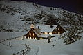
The Schronisko Samotnia (Teichbaude) is near the path.

The Równia pod Śnieżką (Koppenplan) is a 1500 meters long and 800 meters wide plateau.

The Schneekoppe ( Sněžka in Czech , Śnieżka in Polish ) is the highest peak on the hiking trail at 1602 m.


Distinctions
The European long-distance hiking trail E3 , virtually the successor to the former ridge trail, does not go along here, but bypasses the Giant Mountains to the north and leads through the Hirschberg Valley . The path should not be confused with the similarly named International Mountain Hiking Trail of Friendship Eisenach-Budapest , which also does not run over the ridge of the Giant Mountains.
Web links
Individual evidence
- ↑ On the way of the Czech-Polish friendship across the Giant Mountains. In: www.hkregion.cz. Retrieved November 1, 2015 .
- ↑ Giant Mountains season 2010; P. 5. (PDF) Retrieved March 15, 2016 . (PDF; 9.9 MB)
- ↑ Frank Schüttig, Discovering the Giant Mountains. P. 113 ;. In: GoogleBook. 1999, accessed March 14, 2016 .
- ↑ Polsko-czechosłowackie konwencje turystyczne. Retrieved March 15, 2016 .
- ^ Poland and the Czech Republic. (No longer available online.) Archived from the original on March 16, 2016 ; accessed on March 15, 2016 .
- ↑ J. Czerwinski: Sudety . Sport i Turystyka, Warszawa 1996, ISBN 83-7079-677-X .
- ↑ Państwowe Przedsiębiorstwo Wydawnictw Kartograficznych Karkonoski Park Narodowy - mapa turystyczna , Warszawa - Wrocław 1986