Szrenica
| Szrenica | ||
|---|---|---|
|
South - east view |
||
| height | 1362 m npm | |
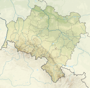
| location | Poland , Lower Silesia | |
| Mountains | Giant Mountains | |
| Coordinates | 50 ° 47 '35 " N , 15 ° 30' 46" E | |
|
|
||
| rock | granite | |
The Szrenica [ ʃrɛ'ɲitsa ] ( German Reifträger , Czech Jínonoš ) is at 1362 m a prominent elevation in the western part of the Giant Mountains and belongs to its main ridge . Since the state border between Poland and the Czech Republic runs south of the main ridge at this point, the summit is on Polish territory. The summit consists - like the peaks of numerous other mountains in the Giant Mountains - from rubble of old granite rocks , which form impressive rubble heaps. Interesting rock formations can be found on its slopes, including the horse headstones ( Końskie Łby ) and the boaring stones ( Trzy Świnki ).
Location and surroundings
The Szrenica is the local mountain of Szklarska Poreba ( Schreiberhau ) and the center of the Szrenica Ski Arena , the largest ski area in the Polish part of the Giant Mountains. A two- seater chairlift leads from the city to the summit in two stages. At the summit there is the Reifträgerbaude ( Schronisko na Szrenicy ) and a meteorological observation station of the University of Wroclaw . The PTTK mountain hut “ Schronisko na Hali Szrenickiej ”, which can be translated as “hostel on the Reifträgerwiese”, is located on the pristine border meadow ( Hala Szrenicka ) on the northwest slope of the Reifträger at an altitude of 1200 m as a successor to the “ New Silesian Baude ” .
A leveling niche was created in the so-called Reifträgerloch ( Kocioł Szrenicki ) between the eastern slope of the frost carrier and the northern slope of the Veilchenstein , probably during the last glacial period . Geomorphologically, it is a preliminary stage to the Kar and not, as the Polish part of the name " Kocioł " suggests, a glacier basin. There is an extensive hillside moor that has a very interesting and diverse vegetation. With bog blue grass ( Sesleria uliginosa Opiz ), hedgehog sedge ( Carex echinata ), swamp violet ( Viola palustris ) and narrow-leaved cotton grass , only a few of the species occurring here are mentioned here.
Nearby peaks
| Przedział | ||
| Luboch |

|
Vysoká pláň |
| Ptačinec | Lysá hora | Sokolnik |
Paths to the summit
- A chairlift leads from Szklarska Poręba to the summit, but it is also possible to get to the summit on foot past the Zackelfall ( Wodospad Kamieńczyka ) and the New Silesian Lodge ( Schronisko na Hali Szrenickiej ). This path is marked in red and begins at the Josephine Hut (today: Huta Szkła Julia , Museum) in Szklarska Poręba.
- From Harrachov in the Czech Republic ( Harrachsdorf ), a hiking trail marked with a blue crossbar leads through the Mummeltal and (then marked in yellow) past the Wossecker Baude to the summit.
- The path of Polish-Czech friendship begins at Szrenica .
Web links
- Skiarena Szrenica - pictures and suggestions for excursions ( memento from October 23, 2015 in the Internet Archive ) - multilingual


