Large balaclava (Giant Mountains)
| Big balaclava | ||
|---|---|---|
|
Large balaclava from the west |
||
| height | 1424 m npm | |
| location | Lower Silesia , Poland | |
| Mountains | Giant Mountains | |
| Coordinates | 50 ° 46 '49 " N , 15 ° 34' 42" E | |
|
|
||
| rock | granite | |
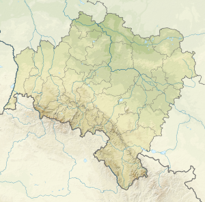
The Great Balaclava (Polish Śmielec, Czech. Smělec) is a mountain in the western part of the Giant Mountains, 6 km north-north-west of Spindleruv Mlyn (Czech: Špindlerův Mlýn) and 7 km south of Szklarska Poręba ( Schreiberhau ). The summit is located near the Czech-Polish border, entirely on the Polish side.
location
The large balaclava lies between Veilchenstein (Polish. Łabski Szczyt, Czech. Violík) and the Mannstones (Polish. Czeskie Kamienie, Czech. Mužské Kameny). In the northeast it is bounded by the glacier cirque of the Agnetendorfer Schneegrube (also Black Snow Pit, Polish Czarny Kocioł Jagniątkowski ).
Nearby peaks
| Ostroga | Koralowa Góra | Kozielec |
| Vysoká pláň |

|
Hraniční hřeben |
| Harrachstones | Medvědín | Festungshübel |
Hydrology
The mountain stream Schneegrubenwasser (Polish: Wrzosówka ) flows through the Black Snow Pit, and the source of the Kochel (Polish: Szklarska ) lies on the northeast side . The small tributary of the Zacken (Polish: Kamienna ) then takes the path north-west to drain the north-eastern slope of the Hohen Rad (Polish: Wielki Szyszak ). The water of the southern slopes flows into the Elbe River ( Labský důl ).
Names
Contrary to what the name suggests, the summit is 15 meters lower than the Kleiner Sturmhaube . The old Polish name of the mountain is "Wielki Szyszak", which today means the High Wheel (Czech: Vysoké Kolo ), the former Polish name of which was "Wielkie Koło" (Big Wheel). The name change took place shortly after the Second World War after the description on German cartographic maps. The Czech and German names of the two mountains remained unchanged.
Flora, fauna and nature conservation
The Big Balaclava is located on the territory of two national parks. In Poland in Karkonoski Park Narodowy (KPN) and in the Czech Republic in Krkonošský národní park (KRNAP) on the Kammweg ( Path of Polish-Czech Friendship ).
The summit is forestless and covered by scree fields that continue on the northeast slope. The flora corresponds to the subalpine vegetation level with lichens and mountain pines as the predominant plants. The climatic conditions only allow herbivorous bugs, spiders and wood-dwelling beetles to stay here for a long time, because only they can find adequate protection from wind and weather. The insects, however, are food for various bird species such as B. alpenbrown , mountain pipit or redstart .
Surroundings
- 400 meters to the east, in the saddle in front of the Mannstones, a memorial commemorates the tragic death of the Czech journalist Rudolf Kalman, who died here during a snow storm on January 14, 1929.
- Less than a kilometer south of the summit is Martinova bouda ( Martinsbaude ), one of the oldest mining towns in the Giant Mountains, which was founded around 1642.


