Hraniční hřeben
| Hraniční hřeben
Border ridge
|
||
|---|---|---|
|
The west summit, the man stones |
||
| height | 1416 m | |
| location | Sudeten | |
| Mountains | Giant Mountains | |
| Coordinates | 50 ° 46 '36 " N , 15 ° 35' 30" E | |
|
|
||
| rock | granite | |
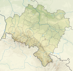
The Hraniční hřeben (German border ridge) is a mountain ridge in the West Sudeten . It lies on the main ridge of the Giant Mountains , which form the state border between Poland and the Czech Republic. About 6 km north Spindleruv Mlyn ( Spindleruv Mlyn ) on the Czech side and 5 km south of the Silesian Agnetendorf ( Jagniątków ).
location
The rock formations Mannsteine ( 1416 m ) (Polish. Czeskie Kamienie , Czech. Mužské Kameny ) and Mädelsteine ( 1414 m ) (Polish. Śląskie Kamienie , Czech. Dívčí Kameny ) together form its double peak.
The ridge stretches between the Great Balaclava (Polish Śmielec , Czech Smělec ) in the west and the Mädelwiese ( 1178 m ) (Polish Przełęcz Dołek , Czech Slezské sedlo ), the deepest saddle of the Krkonoše main ridge near the Spindler Pass ( Polish Przełęcz Karkonoska , Czech Slezské sedlo ) ( 1198 m ) below the Kleiner Sturmhaube in the east.
The northern slope drops steeply between the streams Wrzosówka ( snow pit water ) and Polski Potok ( tower water ) after the approximately 550 m high Agnetendorf. The southern slope is no less steep, but the difference in altitude into the Elbe Valley , which is 840 m above sea level, is significantly lower. In the north-west it is bounded by the glacier cirque of the Agnetendorfer Schneegrube (also Black Snow Pit, Polish Czarny Kocioł Jagniątkowski ).
The summit rocks of the border ridge were mainly formed by repeated freezing and thawing of the water between the rock fissures. Further examples of this wool sack weathering , which is typical in the Giant Mountains, is the Vogelstein ( Ptačí kámen ) on the southern slope at an altitude of 1310 m and about 300 meters lower, the Festungshübel ( Pevnost ), several granite rocks up to 7 meters high, 500 m south of the Davidsbauden ( Davidovy bouda ).
Nearby peaks
| Ostroga | Koralowa Góra | Kozielec |
| Big balaclava |

|
Čihadlo |
| Gold height | Medvědín | Festungshübel |
natural reserve
The border ridge is in the area of national parks. In Poland in the Karkonoski Park Narodowy (KPN) and in the Czech Republic in the Krkonošský národní park (KRNAP), which have been part of the list of UNESCO biosphere reserves since 1992 .
tourism
The Spindlerpass, which is particularly popular with mountain bikers, connects the Polish and Czech sides of the Giant Mountains. Coming from the Elbe valley, a well-developed road leads past the Moravská Bouda up to the top of the pass above the Mädelwiese. Here is a collection of sports hotels that go back to historical mining sites. Right on the pass is the Spindlerbaude ( Spindlerova bouda ), slightly below the Erlebach- and Joseph Baude ( Erlebachova / Josefova bouda ) and the Lausitzer Baude ( Lužická bouda ) with the old name "Adolfbaude". The Peterbaude ( Petrova Bouda ) , which burned down in 2011, stood on the Mädelwiese . On the Polish side the path is not that good anymore and it goes, following the valley of the Sopot, past the so-called bog rocks ( Bażynowe Skały ) to Agnetendorf.
Another hiking trail leads from the Elbe valley to Agnetendorf. The coral Steinweg (Pol. Koralowa Ścieżka ) leads first to a height of 1050 m to bear basic Baude ( Medvědí bouda ), then higher to 175 meters Martin Baude ( Martinova bouda ), one of the oldest mountain chalets in the Giant Mountains, which was founded around 1642. At the Agnetendorfer Pass ( 1350 m ) it crosses the path of Polish-Czech friendship (Kammweg) before continuing along the edges of the Black Snow Pit. A descent into the basin would be possible, but is forbidden due to the strict nature protection regulations and so the path continues above the gorge in which the Wrzosówka drains the cirque. At an altitude of about 1070 m , it then leads past the coral stones (Polish Paciorki ), a group of rocks that gave the path its name.


