Černý Důl
| Černý Důl | ||||
|---|---|---|---|---|
|
||||
| Basic data | ||||
| State : |
|
|||
| Region : | Královéhradecký kraj | |||
| District : | Trutnov | |||
| Area : | 2218 ha | |||
| Geographic location : | 50 ° 38 ' N , 15 ° 43' E | |||
| Height: | 684 m nm | |||
| Residents : | 679 (Jan. 1, 2019) | |||
| Postal code : | 543 43 - 543 72 | |||
| License plate : | H | |||
| traffic | ||||
| Street: | Vrchlabí - Svoboda nad Úpou | |||
| structure | ||||
| Status: | Městys | |||
| Districts: | 3 | |||
| administration | ||||
| Mayor : | Zdeněk Kraus (as of 2011) | |||
| Address: | Černý Důl 48 543 44 Černý Důl |
|||
| Municipality number: | 579114 | |||
| Website : | www.cernydul.cz | |||
Černý Důl (German Schwarzenthal ) is a minority in the Czech Republic . It is located seven kilometers east of Vrchlabí and belongs to the Okres Trutnov .
geography
Černý Důl is located at the southern foot of the Giant Mountains in the valley of the Čistá ( Silberbach ). To the north rises the Liščí hora ( Fuchsberg , 1363 m), in the northeast the Černá hora ( Schwarzenberg , 1299 m), east the Zlatá vyhlídka ( Golden prospect , 806 m), in the southeast the Smrčina ( Fichtenkoppe , 686 m), southwest the Lánský kopec ( Zirmkoppe , 614 m), to the west of the Bíner ( Bienert , 691 m) and northwest of the Špičák ( Spitzberg , 1001 m) and Jelení vrch ( Bönischberg , 1024 m). The Burgstall Purkhybl is located below the town above the Pfaffenzell valley. The forest extends to the south and the Ovčí les forest to the southwest. To the west of Černý Důl, limestone quarries are operated on the Bíner, of which an 8.25 km long cable car leads to the building materials plant in Kunčice nad Labem . The road II / 297 from Čistá to Janské Lázně and Svoboda nad Úpou runs through the village .
Neighboring towns are boudy Nová Ves, Tetřeví and Hrnčířské boudy in the north, Zrcadlovky in the Northeast, Na Bolkovské Pasece and Hoffman Bouda in the east, Čistecký Bolkov and Bolkov the southeast, Čistá v Krkonoších the south, Kovársko and Prostřední Lánov in the southwest, Horní Lánov and Peklo in the west and Bönischovy boudy, Prislova Bouda and Dolní Dvůr in the northwest.
history
The origins of iron ore mining in the upper Silberbachtal go back to the year 1383 by the Lords of Turgov on Arnau . In 1525 Johann Tetour von Tetov also acquired the village of Neudorf when the Trautenauer fief was divided. He sold the goods in 1533 to the mining captain Christoph von Gendorf . He had Gießdorf in the Elbe Valley expanded into a mountain town and presented King Ferdinand I with his plans for extensive gold, silver and iron mining in the Giant Mountains. In the following year Ferdinand I. elevated Gießdorf / Wrchlab to the town of Hohenelbe and at the same time granted the mining towns of Langenau an der Kleine Elbe and Neudorf am Silberbach extensive mining privileges, as well as brewing and licensing rights, the free exercise of the craft and the holding of a weekly market. The wood felled in the mountain forests was rafted across the Elbe to Kuttenberg .
In 1556 , at the “Gottes Hilf” colliery in Neudorf, Gendorf had the chapel of the same name built, at which an urban settlement was built around a square market square in the middle of the Waldhufendorf village . In 1561 Gendorf, who had no male descendants, signed the Hohenelbe rule over to his second oldest daughter, Eustachia. One year after the death of her father in 1564, Eustachia Bock von Hermsdorf elevated the Gotteshilf settlement to the submissive mountain town of Schwarzenthal , whose privileges included not only mountain freedom, but also the settlement of craftsmen and wood extraction and the holding of three annual markets. In 1607 the chapel was expanded to become a church and was subordinate to the then Protestant parish of Langenau . The Thirty Years War ended the economic boom. The looting by the Swedes and several fires ruined Schwarzenthal, and mining also came to a standstill. This decline led to Schwarzenthal losing its market rights. Linen weaving, spinning, cattle breeding and mountain pasture farming were the new sources of income for the population. Numerous buildings were built on the areas suitable for grazing in the surrounding mountains. In 1651 the overwhelming majority of the population was Protestant; only six Catholics lived in the town. The efforts of the owner of the Hohenelbe lordship, Paul von Morzin, to enforce re-Catholicization with a hard hand were not very successful. Some of the Protestants fled to the mountains, and at the same time Protestant writings were repeatedly smuggled in along the road leading from Silesia over the Giant Mountains. In 1705 Wenzel von Morzin had an Augustinian monastery founded in Hohenelbe in order to fight Protestantism among his subjects and transferred the parish of Langenau to this order. In 1736, lessons in a one-class school began in Schwarzenthal. During the War of the Bavarian Succession , Prussian troops invaded in August 1778. Between August 26 and September 7, 1778, the old Fritz took up positions on the ridge of Forst , Schwarzenthal and Ober Langenau ; the Duke of Anhalt's brigade stayed in Schwarzenthal for four weeks. In 1787, the Religionsfond established a parish in Schwarzenthal under the Hohenelbe Vicariate, whose district still included Neudorf and the surrounding buildings. In the Theresian cadastre for Schwarzenthal u. a. 23 weavers, three spinners, three millers, various trades, but only one miner listed. Limestone mining began in the 18th century at Weißenstein am Bienert. In 1834 the town of Schwarzenthal or Schwarzthal consisted of 61 houses, including a school, a mill and a tavern, and had 442 inhabitants. From 1841 the children from the III. Part of the mountains taught by an assistant teacher in pottery huts. In 1844 Alois Renner bought the lime quarry including several lime kilns. Until the middle of the 19th century, Schwarzenthal remained subject to the Hohenelbe rule.
After the lifting of patrimonial formed Schwarzenthal / Cerny Dul 1850 a town in the jurisdiction Hohenelbe or in the district Hohenelbe . At the site of the former iron hammer, a wood grinding shop and a bleaching facility were opened in 1859. The paper mill, which was founded in the same year, soon stopped operations and was bought by Josef Menčík, who from 1874 ran a dye works and cotton printing plant and expanded it to include a weaving mill. Other companies were the Renner family's lime distillery and marble manufacture. In addition, there were two board mills and a mess shop until 1899. From 1861 there was a branch of the Schwarzenthal School in Töpferbauden. The Schwarzenthal volunteer fire brigade was formed in 1874. In 1875 the school moved from the wooden chalet in Schwarzenthal to a new stone building. From 1876 there were two classes and from 1879 three classes. In 1900 Menčík expanded his company to include a mechanical weaving mill. In 1867 the first public water pipe was built, which supplied the well and the houses on the market via wooden pipes. In 1869 a post office and in 1891 a telegraph office were set up in Schwarzenthal. Since 1901 there has been a separate single-class school for the children from the mountain houses in the Töpferbauden district. On December 30, 1902, Neudorf, which had always been administered from Schwarzenthal since the city was founded, but had been a separate political municipality since 1850, was officially incorporated into Schwarzenthal by order of the imperial governor. After several local companies had already installed their own modern water supplies, a public water supply was established in 1901 in the Töpferbauden district. Two years later one was also made for Schwarzenthal, including Neudorf. In 1914 the town was connected to the electricity network. After the collapse of the Austro-Hungarian monarchy, the town declared itself part of the province of German Bohemia and against belonging to Czechoslovakia. Between December 7 and 15, 1918, the Czechoslovak army occupied Schwarzenthal and was able to secure the territorial claims. The Czech place name Černý Důl was introduced in 1921. In 1930 the town had 1,105 inhabitants, including 1,059 Germans and 42 Czechs. In the parliamentary elections of 1935, the Sudeten German Party won the absolute majority with 62% for the first time and clearly defeated the German Social Democratic Workers 'Party and the Farmers ' Union, which had dominated since 1927 .
As a result of the Munich Agreement , Schwarzenthal was annexed to the German Reich in 1938 and belonged to the Hohenelbe district until 1945 . In the Reichstag elections of 1938, the Henlein party got 80% of the vote. In 1939 there were 1066 people in Schwarzenthal. From April 1942 to February 1944 there was a forced labor camp in Schwarzenthal for 190 women, 90 of them Jewish.
On May 10, 1945 the Red Army occupied the place. After the Second World War, the place came back to Czechoslovakia and most of the German population was expelled by the end of 1946. In 1948 Černý Důl lost his status as Městys. In 1961, Čistá v Krkonoších and Fořt were incorporated. At the same time, Černý Důl was assigned to the Okres Trutnov as a result of the abolition of the Okres Vrchlabí. Since March 11th, 2008 Černý Důl is again a Městys.
Today Černý Důl is a winter sports center with several lifts.
Local division
The minority Černý Důl is divided into the districts Čistá v Krkonoších ( Lauterwasser ), Černý Důl ( Schwarzenthal ) and Fořt ( Forest ). The settlement Nová Ves ( Neudorf ) and the buildings of the III. Belong to the core town of Černý Důl . Mountain portion (III. Horský DIL): BoBi boudy ( Bohnwiesbauden ) Bönischovy boudy ( Bönisch Bauden ) Hrnčířské boudy ( Töpfer Bauden ) Liščí boudy ( Fuchs Mountain cottages ) Spieglovy boudy (also Zrcadlovky or Na Zrcadle; mirror Bauden ).
Attractions
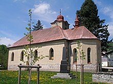
- Parish church of the Archangel Michael ; the renaissance building was built in 1607 by expanding the God's help chapel built in 1556 . In 1787 it was elevated to a parish church under the patronage of the Religionsfonds. It received its present form during the renovation and expansion between 1830 and 1832.
- Classicist rectory, built around 1830
- Neo-Gothic burial chapel, built in 1902 on the interdenominational municipal cemetery
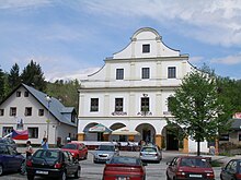
- Town hall with advance notice
- Baroque statue of St. Michael in the market, created in 1713
- Burgstall Purkhýbl ( Burghübl ), south of the town above the Pfaffenzell valley; ramparts and moats have been preserved from the complex, which was built in the 14th century; since the first half of the 16th century the castle has been considered desolate
- Barbara Chapel, east of the village on the road to Janské Lázně
Web links
Individual evidence
- ↑ Český statistický úřad - The population of the Czech municipalities as of January 1, 2019 (PDF; 7.4 MiB)
- ↑ Johann Gottfried Sommer : The Kingdom of Bohemia. Represented statistically and topographically. Volume 3: Bidschower Kreis. Calve, Prague 1835, p. 193.
- ↑ Michael Rademacher: German administrative history from the unification of the empire in 1871 to the reunification in 1990. Hohenelbe district (Czech. Vrchlabí). (Online material for the dissertation, Osnabrück 2006).
- ^ Rudolf M. Wlaschek: Jews in Böhmen . Munich: Oldenbourg, 1990, p. 151, there as Dunkelthal .


