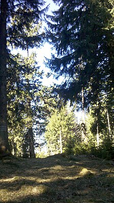
Kogelkopf
| Kogelkopf | ||
|---|---|---|
|
Summit of the Kogelkopf |
||
| height | 1324 m above sea level NHN | |
| location | Bavaria , Germany | |
| Mountains | Bavarian Prealps | |
| Dominance | 0.48 km → Luckenkopf | |
| Notch height | 33 m | |
| Coordinates | 47 ° 43 '9 " N , 11 ° 40' 27" E | |
|
|
||
The Kogelkopf ( 1324 m above sea level ) is a wooded peak in the Bavarian Prealps . It lies exactly on the municipality boundary between Bad Wiessee and Waakirchen .
topography
The Kogelkopf forms one of the summits of the ridge that stretches from the Luckenkopf to the Holzer Alm . The summit is pathless, but easily accessible from nearby forest roads. It is completely wooded and has no view.
Trivia
The Kogelkopf was briefly in local media because a missing hiker was found on its slopes.
credentials
- ↑ Tour description
- ↑ Tod am Kogelkopf , press release Police Headquarters Oberbayern Süd on rosenheim24.de

