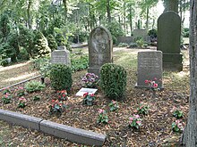
Wandlitz municipal cemetery
The communal cemetery Wandlitz is the burial place opened on October 26, 1913 for the community Wandlitz in the district of Barnim . It replaced the traditional church cemetery around the Wandlitz village church . Its system goes back to the activities of the mayor Karl Jünemann .
location and size
The community cemetery can be reached via the main entrance on Karl-Liebknecht-Straße and on the back from Berliner Weg. It was laid out on former priestly land (probably the parish of the village). The area measures approx. 18,000 m².
history
Prehistory: burials in the church and in the churchyard
The burial of important personalities of the village and its neighboring localities often took place directly in the church. Church documents and on-site investigations show that on June 17, 1718, the bailiff von Mühlenbeck , Johann Jakob Fabrizius, was buried not far from the altar ; the heirs of Arendsee , Conrad von Barfus in 1748, Dorothea von Stammen in 1762, Barbara von Hohenbergen in 1765 and Paul Erdmann von Barfus in 1795, also found their final resting place in the church.
The eleven remaining graves in the vicinity of the church indicate other people who are closely connected to the history of Wandlitz, including:
Louis Barth (January 16, 1851– January 31, 1907), "owner of the Wandlitzsee master fisherman", Julius Wiese (7 June 1826–27 September 1913), “building contractor” and the August Klein family, owners of the Seekrug restaurant .
New communal burial site
Urn burials dominated from the 1950s . In 1997, a large meadow with a polished marble stone on which a stylized flame is incorporated was set up as a communal urn facility for anonymous burial . At the request of the bereaved, the names of the buried can be affixed to the steles (semi-anonymous), with specifications in accordance with the statutes.
Cemetery chapel
Shortly after the cemetery went into operation, the municipal administration had a cemetery chapel built on the site , which initially had a wooden roof turret. The facility was looked after by the “ Evangelical Women's Aid ”. - It is not known when the roof turret was removed.
After the fall of the Wall , in 1999, the facade was restored and thoroughly renovated . A heating system and other items of equipment such as upholstered benches, candlesticks and plant arrangements turned it into a mourning hall that can be used all year round .
Honor graves
Two honorary graves were designated in the spring of 2010 (after the adoption of a guideline for honorary graves ).
A honors the active 1901-1937 Jewish Landarzt Bruno Landau (1875-1965), which after a denunciation due to the Nazi race laws in the Oranienburg came. In 1937 he emigrated to the USA with his wife Elisabeth Landau (1877–1961) . For their son Hans Landau, who died in 1917 at the age of five, the parents had made a separate tombstone from the sculptor Hermann Hosaeus , who had also designed the Wandlitz war memorial in front of the church area, and had it set up in the Wandlitz cemetery. In 1968 the remains of Bruno and Elisabeth Landau were transferred to Wandlitz and buried next to it. The municipal administration has been looking after and maintaining the family grave since 1994.
The second honorary burial site is for Karl Schweitzer (* 1886 in Schönerlinde ; † 1942) and his wife Hedwig (1894–1983). Karl Schweitzer was sentenced to death in a political show trial in 1942 (charges of undermining military strength ) and executed on July 18 of the same year in Berlin-Plötzensee .
literature
- Claudia Schmid-Rathjen: 90 years of the municipal cemetery. In: Wandlitzer Extrablatt, January 2004, p. 10f
Web links
Individual evidence
- ^ Cemeteries in the Wandlitz community
- ↑ Official Gazette for the Wandlitz community from May 28, 2011: Wandlitz community shows graves of honor. Five grave sites in Wandlitz and Klosterfelde marked with Liegestein ; P. 11
Coordinates: 52 ° 44 ′ 48.6 ″ N , 13 ° 27 ′ 14.4 ″ E

