Kozjanski Park
| Kozjanski Park | ||
|---|---|---|
|
|
||
| Location: | Slovenia | |
| Next city: | Celje | |
| Surface: | 206 km² | |
| Founding: | 1981 | |
| Address: | www.kozjanski-park.si | |
The Kozjanski Regional Park ( Slovenian : Kozjanski Park ) is a protected area in eastern Slovenia .
location
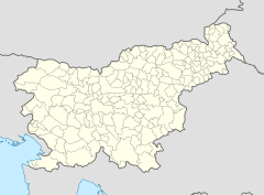
The park is located in the pre-alpine Posavsko hribovje (Posavina hills) and the plains west of the Sotla River in eastern Slovenia, right on the border with Croatia . It has a size of 20,650 hectares (206 km²). In the area of the park there are 78 villages with around 10,500 inhabitants and a population density of 51 inhabitants per km², the largest village is Kozje with around 740 inhabitants.
On the edge of Kozjanski Park runs the border fence between Slovenia and Croatia , which was erected in the course of the refugee crisis in Europe from 2015 , because the southeastern border of the Schengen area runs here.
The park
Kozjanski Park was founded in 1981 as Trebče Memorial Park . The highest point is the Oslica with 860 m, the lowest point Figarjev most ob Sotli with 151 m. 48% of the area is covered with forest. The Sotla, Bistrica , Buča , Dramlja and Gabernica watercourses flow through the park area. The average temperature is 9.5 ° C and the average precipitation is 1,060 mm. There are large orchards in the park.
In the park are the castles Podsreda , Pišece , Bizeljsko and Kunšperk (Königsberg) .
tourism
In terms of tourism, the nature experience on various hiking trails, including the European long-distance hiking trail E7, is particularly important for the park area . There are numerous castles in the park. Every year in the second week of October there is an apple festival.
literature
- Karl Baedeker : Slovenia , Verlag Karl Baedeker, ISBN 978-3-8297-1268-2
Web links
Individual evidence
- ↑ Podatki na ProtectedPlanet.net . World Database on Protected Areas (WDPA). Retrieved June 12, 2013.
- ↑ Trebče Memorial Park Act, Official Gazette of the Republic of Slovenia No. 1/811
