
Krapphof lock
| Krapphof lock | ||
|---|---|---|
 Krapphof lock from underwater, on the right the pontoon with the self-service facilities |
||
| location | ||
|
||
| Coordinates | 53 ° 28 '7 " N , 10 ° 11' 22" E | |
| Country: | Germany | |
| Place: | Hamburg | |
| Waters: | Dove Elbe , Schleusengraben | |
| Data | ||
| Owner: | FHH | |
| Operator: | Bergedorf district office, water authority | |
| Start of operation: | 1929 | |
| Modification: | 2006 | |
| lock | ||
| Is controlled by: | Self service | |
| Usable length: | 105 m | |
| Usable width: | 12 m | |
| Height upstream : | 1.35 m above sea level NHN | |
| Average height of fall : |
0.45 m | |
| Others | ||

The Krapphof lock in Hamburg-Allermöhe connects the sealed Dove Elbe with the Bille . It is located at the southern end of the Schleusengraben , one of the oldest artificial waterways in Germany, which is the entrance to the Bergedorf harbor. The lock was built in 1929 and equipped with self-service for recreational shipping in 2006 . Canoes can use a boat drag located in the arm of the lock trench east of the lock under a road bridge .

Krapphofschleuse towards Schleusengraben
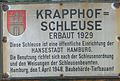
Sign at the Krapphof lock
Boat tow in the arm of the lock trench

Boat tow seen from the Dove Elbe


Individual evidence
- ↑ Krapphofschleuse: Setting up a semi-automatic user self-service ( Memento from January 7, 2016 in the Internet Archive )
Web links
Commons : Krapphofschleuse - Collection of images, videos and audio files
- FHH - LSBG: Project report on waters and flood protection No. 7/2016 , p. 23