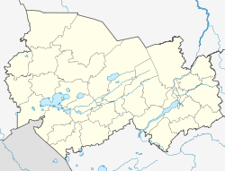
Krasnosnamenka (Novosibirsk)
| Village
Krasnosnamenka
Краснознаменка
|
||||||||||||||||||||||||||||||
|
||||||||||||||||||||||||||||||
|
||||||||||||||||||||||||||||||
Krasnosnamenka ( Russian Краснознаменка ) is a village in the West Siberian Novosibirsk Oblast ( Russia ). The village, about 25 km north of the small town of Bolotnoye , used to be predominantly inhabited by Russian Germans .
geography
The village is located in the southeastern part of the West Siberian lowlands , a good 100 km as the crow flies northeast of Novosibirsk in the far northeast of the oblast. Today it is part of the rural settlement of Varlamowo, which lies just under 5 km to the south-west, and belongs to the Bolotnoye district .
history
Germans ( Wolhyniendeutsche ) resettled from the area of today's Ukraine to what was then the Tomsk Governorate settled in the forests around the later village around 1900. The farms they settled were merged around 1933 to form a village called "Rote Fahne" (also known as Siberian Germans). The residents had to leave their previous houses and build new houses on the allocated land.
The village consisted of about 80 houses. Each farm had a plot of land for growing vegetables and keeping cattle, pigs and chickens from 5,000 to 7,000 m² in size. The village had its own cattle, pig, chicken and horse breeding. Within a radius of 5 kilometers there were a number of dams that were used to catch snowmelt water and to store water. In these waters the cattle were watered, wild birds and animals were given a habitat and fish was farmed on the side. There was a shop and a youth club.
In the 1950s, the place name was translated into Russian (from Russian Krasnoye snamja for red flag ). Pig and chicken coops were closed in the 1970s. There was a primary school until around 1985. In the 1990s, many Germans emigrated to Germany and sold their houses. The (block) houses are currently being dismantled by the Russian population and reused elsewhere or used as holiday homes.
literature
- V. Diesendorf: Nemzy Rossii. Nasseljonnyje punkty i mesta posselenija: enziklopeditscheski slowar . ERN, Moscow 2006. ISBN 978-5-93227-002-8 . (Russian)


