Kreßbachsee
| Kreßbachsee | ||
|---|---|---|

|
||
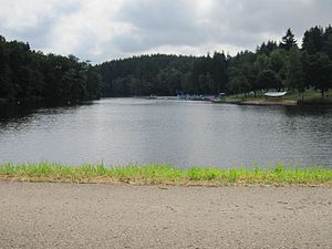
| View from the dam eastwards over the Kreßbachsee | ||
| Geographical location |
Swabian-Franconian forest mountains
|
|
| Tributaries | Kressbach , Rotkreuzbach | |
| Drain | Kressbach | |
| Location close to the shore | Ellwangen (Jagst) | |
| Data | ||
| Coordinates | 48 ° 58 '50 " N , 10 ° 8' 14" E | |
|
|
||
| Altitude above sea level | 433 m above sea level NN | |
| surface | 6.573 3 ha | |
| length | 730 m | |
| width | 150 m | |
| Catchment area | 7.9 km² | |
The Kreßbachsee , also called Kressbachsee or colloquially often just Kreßbach , is a storage and flood retention basin within the city limits of Ellwangen (Jagst) near the upper Jagst in northeast Baden-Württemberg.
description
The Subspace Ellwanger Berge of the natural environment Swabian-Franconian Forest Lake lying is in the upper middle Keuper or Upper Keuper created and is mainly from Kressbach fed that it km via his remaining term of only about 0.6 northwest to the nearby Jagst drained. The much shorter Rotkreuzbach flows towards this in the lake from the left , which rises at the eponymous Rindelbach residential area Rotkreuz on the south-western edge of the hill. A larger settlement in the core town of Ellwang, which adjoins Rotkreuz, is in the south, while Rindelbach is mostly a little out of the way in the northwest in the downward Jagst valley.
The lake area of around 6.6 hectares belongs mainly to the Rindelbach district marking, a small part near the south bank also to the core city marking. There the city operates a public natural open-air swimming pool for local recreation. The bank is mainly bordered by the Virngrund forest , with the exception of the small Vorsee, the bank area of the bath and the lower end of the lake with the dam, over which a road leads into the Bernhardrod forest to the north . The surface of the lake is about 433 m above sea level. NN , it is almost 750 meters long and at the widest point about 150 meters wide. Its water is brownish and cloudy.
Web links
- Map of Kreßbachsee and the surrounding area on: State Agency for the Environment Baden-Württemberg (LUBW) ( Notes )
- Map of Kreßbachsee and the surrounding area on: Geoportal Baden-Württemberg ( information )
- The Kreßbachsee on seen.de
Individual evidence
LUBW
Official online waterway map with a suitable section and the layers used here: Map of Kreßbachsee and the surrounding area
General introduction without default settings and layers: State Institute for the Environment Baden-Württemberg (LUBW) ( notes )
- ↑ Lake area after the layer standing waters .
- ↑ a b Dimensions measured on the topographic map background layer .
- ↑ Catchment area determined as the difference from that of the entire Kressbach after the basic catchment area layer (AWGN) , deducted from this the only small measured mouth wedge below the lake.
- ↑ Length measured on the background layer topographic map .
Other evidence
- ↑ Height according to the blue label on: Geoportal Baden-Württemberg ( information )
- ↑ Hansjörg Dongus : Geographical land survey: The natural spatial units on sheet 171 Göppingen. Federal Institute for Regional Studies, Bad Godesberg 1961. → Online map (PDF; 4.3 MB)
- ↑ Geology according to: Mapserver of the State Office for Geology, Raw Materials and Mining (LGRB) ( notes )
literature
- Topographic map 1: 25,000 Baden-Württemberg, as single sheet No. 7026 Ellwangen (Jagst) West
