Kungej-Alatau
| Kungej-Alatau | ||
|---|---|---|
| Highest peak | Chok Valley ( 4771 m ) | |
| location |
Issyk Kul , Tschüi ( Kyrgyzstan ), Almaty ( Kazakhstan ) |
|
| Mountain range of the | Tianshans | |
|
|
||
| Coordinates | 42 ° 47 ' N , 76 ° 41' E | |
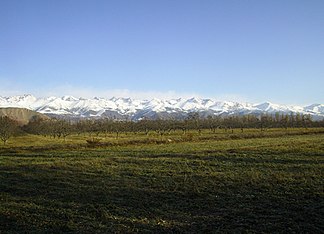
The Kungej-Alatau ( Kyrgyz Күнгөй Ала-Тоо Küngöi Ala-Too, Kazakh Күнгей-Алатау Küngei-Alatau ) is up to 4771 m high high mountains in Kyrgyzstan and Kazakhstan in Central Asia .
The mountain range, which is part of the Tianshan Mountains, is located in the northeast of Kyrgyzstan on the border with southeast Kazakhstan. It extends over a length of 280 km. In the north, the Kungej-Alatau is joined by the Transili-Alatau in Kazakhstan, in the east it descends to the valley of the Sharyns (a tributary of the Ili ). The valley of the Tschüi tributary Tschong-Kemin delimits the mountain range to the northwest. In the south the lake Issykköl extends and in the west the Kungej-Alatau borders on the Kyrgyz mountains .
The highest mountain of the Kungej-Alatau is the 4771 m high Tschok valley , the height of which is also given as only 4760 m .
The Kyrgyzstan Trail runs through the Kungej-Alatau , a long-distance hiking trail redesigned in 2007 , which opens up and connects the mountain ranges of the Issyk-Kul region in Kyrgyzstan.
In the source area of the Tschon-Kemin, at an altitude of 3116 m, there is the mountain lake Jaschylköl , which is also known as the “Green Lake” and is enclosed on two sides by moraines .
Web links
Individual evidence
- ↑ a b c Article Kungej-Alatau in the Great Soviet Encyclopedia (BSE) , 3rd edition 1969–1978 (Russian)
- ↑ Topomapper

