La Brea (Trinidad and Tobago)
| La Brea | ||
|---|---|---|
|
|
||
| Coordinates | 10 ° 15 ′ N , 61 ° 37 ′ W | |
| Basic data | ||
| Country | Trinidad and Tobago | |
| Siparia | ||
| ISO 3166-2 | TT-SIP | |
| Residents | 3072 (2011) | |
|
La Brea
|
||
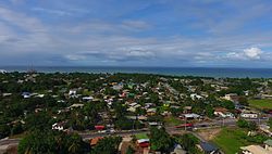
La Brea is a place in Trinidad and Tobago .
geography
La Brea is located in the southwest of the island of Trinidad in the administrative region of Siparia . The place is located on a headland on the Gulf of Paria , nestled between the elongated bays of Guapo Bay and Otaheite Bay. The next largest cities are Point Fortin, eleven kilometers southwest, and San Fernando, 25 kilometers northeast .
history
The name of the place ( Spanish brea for pitch , tar ) comes from La Brea Pitch Lake , a natural asphalt deposit ( asphalt lake ). This was already known to the Spanish colonial rulers of the 16th century, who called the region "Tierra de Brea". Walter Raleigh repaired ships in his expedition fleets here in 1595 and 1617. La Brea was founded between 1617 and 1797. At that time, the tar lake was not used economically, rather sugar and coffee were grown. A first refinery for the tar was built in 1792 at the behest of the governor José María Chacón . The cultivation of sugar was the most important economic factor; the place was the most important sugar producer on the island, and when the British took control of Trinidad in 1797 and carried out an inventory of the island, the place had 20 sugar mills, three coffee mills, six rum distilleries and a port; at that time the population of the place comprised 555 people. The commercial exploitation of the tar lake began in 1850 by Thomas Cochrane , who researched the possible uses of tar, which initially resulted in a patent for the propulsion of steam ships by burning bitumen . After Conrad Stollmeyer, of German descent, joined the company, the focus was on selling tar for road construction. The place flourished; In 1900 the population was just over 1000, in 1921 already 2616. Between 1920 and 1960 La Brea was a center of the Trinidadian oil industry, and the highest population of the place was measured in 1960 with 4848. With the decline of the oil and asphalt industry, the town's importance and population declined.
economy
Lake Asphalt of Trinidad and Tobago (1978), which mines the asphalt of the lake, is the town's largest employer. In the district of Brighton to the west and north of the lake, the La Brea Industrial Estate is an industrial area in which u. a. Suppliers to Lake Asphalt and a deep-sea port operated by the Trinidadian port authority are located.
Web links
Individual evidence
- ↑ Michael Anthony: Towns and Villages of Trinidad and Tobago . 2nd Edition. Printmaster, Marabella 2001, ISBN 978-0-00-976806-4 , p. 123 .
- ^ Port of Brighton. In: Searates.com. Retrieved August 12, 2017 .

