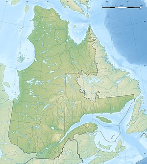
Lac Bacqueville
| Lac Bacqueville | ||
|---|---|---|
| Geographical location | Nunavik , North du Québec in Québec (Canada) | |
| Drain | Rivière La Goudalie | |
| Data | ||
| Coordinates | 58 ° 7 ′ N , 73 ° 51 ′ W | |
|
|
||
| Altitude above sea level | 202 m | |
| surface | 185 km² | |
| length | 58 km | |
| width | 5 km | |
The Lac Bacqueville is a lake in the north of the Canadian province of Quebec .
The lake is located 40 km east of Lac Chavigny , 80 km northeast of Lac Minto and 90 km southwest of Lac La Potherie . The elongated lake with west-east orientation has a strongly structured shoreline. It has a length of 58 km and a width of over 5 km. The lake area is 185 km². The lake is located in the area of the Canadian Shield at an altitude of about 202 m . Lac Bacqueville is drained by the Rivière La Goudalie , a left tributary of the Rivière aux Feuilles .
The lake was named in memory of Seigneur de Bacqueville et de La Potherie, Claude Charles Le Roy (1663-1736).
