Lac Saint-Pierre
| Lac Saint-Pierre | ||
|---|---|---|

|
||
| Lac Saint-Pierre | ||
| Geographical location | Québec (Canada) | |
| Tributaries | Saint Lawrence River , Yamaska , Saint-François , Richelieu , Nicolet , Maskinongé , Rivière du Loup , Yamachiche | |
| Drain | Saint Lawrence River | |
| Places on the shore | Louiseville | |
| Data | ||
| Coordinates | 46 ° 12 ′ N , 72 ° 50 ′ W | |
|
|
||
| Altitude above sea level | 3 m | |
| surface | 353 km² | |
| length | 35 km | |
| width | 10 km | |
| Maximum depth | 11.3 m | |

|
||
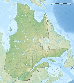
| Location of Lac Saint-Pierre on the lower reaches of the St. Lawrence River | ||
The Lac Saint-Pierre (also Wakefield Lake ) is a 353 km² large lake in the south of the Canadian province of Quebec .
It lies at a height of approx. 3 meters above sea level in the St. Lawrence River , between Sorel-Tracy in the southwest and Trois-Rivières in the northeast. The lake is 35 km long, up to 10 km wide and forms part of the St. Lawrence Seaway . The mean depth is 3 m, the maximum depth 11.3 m. On the south bank are the mouths of the Saint-François and Yamaska rivers .
The lake has dozens of small islands that are seasonally flooded. These form important resting places for hundreds of thousands of migratory birds and also important nesting places for herons ; Nowhere else in North America is the concentration of herons greater than here. In 1998, Lac Saint-Pierre was placed under the protection of the Ramsar Convention as a wetland of international importance . Since 2000, the lake is a biosphere reserve of UNESCO recognized. The area of the reserve is 480 km², of which 31 km² are in the core zone.
The lake got its name from the French explorer Samuel de Champlain . It happened on June 29, 1603, the feast day of the Apostle Peter (French: Saint-Pierre ). The previous French name (from around 1535) was Lac d'Angoulême . The Abenaki called the lake Nebesek , which means "by the lake".
The "Evans-Lou" quarry, located about two kilometers north-northeast of Lac Saint-Pierre and now abandoned, with granite pegmatites rich in rare earth metals is considered to be the type locality for the minerals caysichite (Y) , moydite (Y) and wakefieldite ( Y) .
Web links
- Lac Saint-Pierre - UNESCO Biosphere Reserve
- Toponymy of Lac Saint-Pierre
- Fauna and flora of Lac Saint-Pierre
Individual evidence
- ↑ a b c Commission de toponymie du Québec - Lac Saint-Pierre
- ↑ a b Mindat - type locality Evans-Lou Mine, Lac Saint-Pierre (Wakefield Lake), Val-des-Monts, Les Collines-de-l'Outaouais RCM, Outaouais, Québec, Canada
- ↑ UNESCO Biosphere Reserves. Lac Saint Pierre. In: Ecological Sciences for Sustainable Development. UNESCO , accessed April 11, 2013 .
