Ladenburghöhe
| Ladenburghöhe | ||
|---|---|---|
|
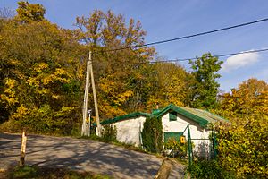
The intersection of Josef-Bindtner-Gasse and Ladenburghöhe. |
||
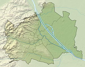
| location | Vienna , Austria | |
| Mountains | Vienna Woods | |
| Coordinates | 48 ° 14 '23 " N , 16 ° 17' 46" E | |
|
|
||
The Ladenburg height is a ridge in the 18th Vienna district , Währing , and the name of the leading along her path.
geography
The Ladenburghöhe is located in the southwestern area of the Währing district and forms the southern border of the Pötzleinsdorfer Schlosspark . The Ladenburghöhe adjoins the Schafberg to the northeast and is covered by forest in the north. On the southern slopes there is an allotment garden and the Schafbergbad . The Ladenburghöhe also separates the catchment area of the Währinger Bach from its southern tributary, the Dürwaring . A remnant of the headwaters of the Dürwaring is still preserved today on the upper Tichyweg, northeast of the Schafbergbad.
Origin of name
The name of the Ladenburghöhe is derived from Ludwig Ladenburg (1817 Mannheim - 1877 Frankfurt am Main ). The bank director, who came from the well-known Jewish Mannheim family, was the owner of the nearby Pötzleinsdorf Palace and a sponsor of the Austro-Hungarian North Pole expedition . The Ladenburg Island in Franz Josef Land was named after him. His sister Theodora Ladenburg (1819 Mannheim - 1911 Saint-Cloud near Paris) was the wife of the banker Eduard David Ellissen, whose family founded the Theresienthal paper mill . Ludwig Ladenburg and his wife Julie born. von Lämel, after whom today's Dr.-Heinrich-Maier-Strasse was named, are both buried in the Jewish cemetery in Währing .
Footnotes
- ^ City of Vienna - Street Lexicon [1]
- ^ Johann Jakob Egli : Nomina geographica. Language and factual explanation of 42,000 geographical names of all regions of the world. , Friedrich Brandstetter, 2nd edition Leipzig 1893, p. 520
literature
- Karl Fenzl: A landscape picture of the 18th district. The landscape and its basis. In: Währing. A home book of the 18th district of Vienna. Vienna 1923, pp. 9-16

