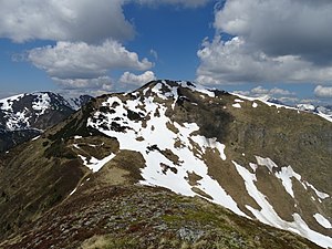
Lahnerleitenspitze
| Lahnerleitenspitze | ||
|---|---|---|
|
View of the Lahnerleitenspitze from the Speikkogel (near Wald am Schoberpass) |
||
| height | 2027 m above sea level A. | |
| location | Styria , Austria | |
| Mountains | Eisenerzer Alps | |
| Dominance | 2.1 km → Leobner | |
| Notch height | 173 m ↓ Zeiritztörl | |
| Coordinates | 47 ° 29 '30 " N , 14 ° 40' 42" E | |
|
|
||
| rock | Blasseneck porphyroid | |
The Lahnerleitenspitze is a 2027 m above sea level. A. high mountain in the Eisenerzer Alps . It lies on the border between the communities of Wald am Schoberpaß and Radmer in Upper Styria .
Routes
Possible marked climbs are:
- from Radmer an der Hasel via Seekaralm, Antonikreuz and Speikkogel
- from Wald am Schoberpaß via Brunnebenalm, Antonikreuz and Speikkogel
- from Vorwald via Aigelsbrunneralm and Leobner Törl
Allow around 3 hours to walk for all three variants. All climbs are not difficult .
literature
- Günther and Luise Auferbauer: Bergtourenparadies Steiermark , Styria, Graz 2000, ISBN 978-3-222-12783-0 , S. oA

