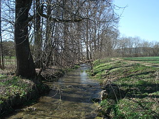
Long wadding
|
Langwatte ( Historically : Biberbach ) |
||
|
The long wadding |
||
| Data | ||
| Water code | DE : 1133412 | |
| location |
Alpine foothills
|
|
| River system | Danube | |
| Drain over | Biberbach → Danube → Black Sea | |
| source | west of Langenenslingen 48 ° 9 ′ 11 ″ N , 9 ° 21 ′ 8 ″ E |
|
| Source height | approx. 603 m above sea level NHN | |
| Spring discharge |
MNQ MHQ |
120 l / s 200 l / s |
| muzzle | in Langenenslingen in the Biberbach Coordinates: 48 ° 9 '2 " N , 9 ° 22' 35" E 48 ° 9 '2 " N , 9 ° 22' 35" E |
|
| Mouth height | approx. 564 m above sea level NHN | |
| Height difference | approx. 39 m | |
| Bottom slope | approx. 19 ‰ | |
| length | 2 km | |
| Catchment area | approx. 9.5 km² | |
The Langwatte is a right tributary of the Biberbach in the district of Biberach in Baden-Württemberg .
etymology
Two theories are put forward as to the origin of the name “Langwatte”.
According to the first, the name should come from the word wat , which means "swamp" in Upper Swabian , with umlaut it appears as a bet (= "pool of water").
After the second, he goes back to the Upper Swabian "Lang Wada", which means "long waiting" in German. The reason for the naming is that in the case of longer dry periods, usually in summer, you have to wait a long time until the spring pours water again.
geography
course
The Langwatte rises at about 603 m above sea level. NHN west of Langenenslingen in a grove in a karst spring . With the exception of dry periods, this pours between 120 l / s and 200 l / s. Water escapes from several secondary sources in a dammed area, and you can see how bubbles rise from the bottom. Until the 1970s, it flows through a small pond immediately after the source, which was partially filled in during the land consolidation. The long wadding then runs along a dirt road eastwards towards Sandhof.
Just two hundred meters after the source, the Emerfelder Graben flows from the west-north-west of the Korntal , which is around 3.5 km long. This rises at a source on Fürstenberger Straße in the eponymous village of Emerfeld and on its way past the Warmtal farmstead has mostly only inconspicuous sections, often and thus also in the area of the mouth it has no open bed at all.
At the Sandhof, the Langwatte drives a mill wheel , then flows further west towards Langenenslingen and through the village. In this it flows near the Bischof-Helding-Straße and opposite a row of long fish ponds on the flat left slope of the valley towards the bank, only 400 m down from its source in the Biberbach .
In old maps the Langwatte is shown as the upper reaches of the Biberbach.
Catchment area
The catchment area of the Langwatte is about 9.5 km² and extends in its longest extent about 5 km far east-south-east from the western edge of Emerfeld to the confluence in Langenenslingen, essentially along the axis of the Emerfeld trench, which is by far the largest part of it Catchment area contributes. Due to karstification, there is little open watercourse. From a natural point of view, it lies on both sides of the border between the Middle Alb in the west-northwest and the Alpine foothills in the east. The entire course of the Langwatte lies in this eastern part. The highest point is 732 m above sea level. NHN high summit of the Habsberg north-east of Emerfeld. The northern watershed, which borders the catchment area of the Zwiefalter Aach , the next tributary of the Danube after the receiving water Biberbach der Langwatte, runs over this. Opposite to the south and southwest on the right watershed is the catchment area of the Holzbach , which feeds the Biberbach via the Soppenbach further down. Behind a short stretch of western watershed near Emerfeld lies the catchment area of the Fischbach , a tributary of the higher Danube tributary Lauchert . Especially here, but also in the catchment areas of the other neighboring rivers, there is largely no open stream.
See also
Web links
Individual evidence
- ↑ a b Description of the Oberamt Riedlingen / Chapter A 3
- ↑ a b c d e f State Institute for the Environment Baden-Württemberg (LUBW) ( notes )
- ↑ See Hans W. Liepmann: Lessing and the Middle Ages Philosophy: Studies on the scientific reception and working method of Lessing and his time (= Tübinger Germanic works, Volume 13 ). Verlag W. Kohlhammer, Stuttgart 1931. p. 212.
- ↑ Tradition of old generations who live and have lived in Langenenslingen. Langenenslingen 935-today
- ↑ Friedrich Huttenlocher : Geographical Land Survey: The natural space units on sheet 178 Sigmaringen. Federal Institute for Regional Studies, Bad Godesberg 1959. → Online map (PDF; 4.3 MB)
- ^ Hans Graul : Geographical land survey: The natural space units on sheet 179 Ulm. Federal Institute for Regional Studies, Bad Godesberg 1952. → Online map (PDF; 4.8 MB)

