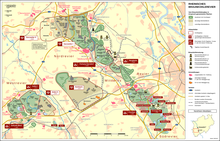
Boring 8
Langweiler 8 , municipality of Aldenhoven , district of Düren (LW 8 for short) is a band ceramic site in the now excavated municipality of Langweiler in the open - cast brown coal mine Zukunft-West in the Lower Rhine bay between Aachen and Cologne . The village of Langweiler belonged together with Laurenzberg , Lürken and Obermerz to the parish of Laurenzberg.
coat of arms
In blue a free-standing golden (yellow) Antonius cross, on the longitudinal shaft of which hangs a golden (yellow) little bell. This description suggests the old Antonius Chapel from 1683.
Digs
The excavations on the Aldenhovener Platte were started in 1965 by Rudolf Kuper after Hartmut Löhr was able to prove numerous Neolithic settlements through reading finds . Since 1968 a working group has been formed at the University of Cologne to investigate sites at the edge of the excavator's edge. Especially Petar Stehli , Rudolf Kuper and Jens Lüning should be mentioned as active participants. The excavations were supported by the State Office for Monument Preservation and the operator of the opencast mine. There were LBK-houses at 10 ha 98 a Erdwerk excavated and 1619 Bandkeramik pits, of which 623 finds received. Many interpretations of the band ceramic settlement structure are based on the analysis of this site. Ulrich Boelicke developed the so-called courtyard model based on the distribution of findings and the composition of finds around house 17 , which assigns certain pits to a ceramic house and which is also the basis for the chronology of the Merzbach valley via a series of settlement pits . Then pits that are located within an arbitrary radius of 25 m around a house floor plan are assigned to this. Boelicke (1988) assumes that mainly flint was used north of the houses , while ceramic shards were found in the south.
Jens Lüning speaks of a courtyard in this context , interpreting this area as the economic area of a ceramic house. However, this is not supported by further research.
In Langweiler 8 Boelicke identified 203 longitudinal pits that run on both sides of ceramic houses, 46 western, 39 eastern, 13 northern and 20 other pits. Other so-called “free pits” could not be allocated to any house. But it is precisely these pits that on average contain the greatest number of sherds on which the dating in the LBK is based.
location
The Merzbach , diverted at the beginning of the 1970s, is a tributary of the Rur . It drains the Aldenhovener Platte to the northeast. Langweiler 8 lies between 134 and 124 m above sea level on a gently sloping slope on the western edge of the Merzbach. The local substrate today consists of a parabrown earth over terrace gravel from the Vistula Ice Age, but in the early Neolithic period it may have consisted of a black earth from loess .
chronology
The settlement of Langweiler 8 begins in the older Bandkeramik ( Flomborn ) or level I according to Modderman. It is the oldest settlement on the Aldenhovener Platte.
function
On the basis of the flint raw material, Andreas Zimmermann assumes that Langweiler 8 supplied the other settlements in the Merzbachtal with Silex (redistribution). According to the current chronology, the earthwork is at the end of the settlement development. It does not contain house post holes, only pits. Perhaps this is also due to the poor conservation on the relatively steep slope on the eastern edge of the settlement. The interpretation from “central location” in the sense of Walter Christaller has so far been based solely on the flint raw materials.
literature
- Ulrich Boelicke: Pits and houses: Investigations into the structure of ceramic yard squares. In: Settlements of culture with linear ceramics in Europe. International Colloquium Nové Vozokany 1981 (Nitra 1982) 17-28.
- Ulrich Boelicke et al .: The flat ceramic settlement area Langweiler 8, community Aldenhoven, district Düren. Rhenish excavations 28 (Bonn 1988).
- Ulrich Boelicke: Bandkeramisches Erdwerk Langweiler 8 and associated settlement, a comparison of the inventories. In: Festschrift Günter Smolla (= materials on the prehistory and early history of Hesse 8) (Wiesbaden 1999) 85–94.
Coordinates: 50 ° 52 ′ 54 " N , 6 ° 15 ′ 10" E
