Merzbach
| Merzbach | ||
|
Course of Inde, Wurm and Merzbach |
||
| Data | ||
| Water code | DE : 282534 | |
| location | Germany | |
| River system | Rhine | |
| Drain over | Rur → Maas → Hollands Diep → North Sea | |
| River basin district | Meuse | |
| source | east of Würselen 50 ° 48 ′ 54 ″ N , 6 ° 12 ′ 35 ″ E |
|
| Source height | 209 m above sea level NN | |
| muzzle | near Linnich in the Rur coordinates: 50 ° 59 ′ 19 ″ N , 6 ° 16 ′ 17 ″ E 50 ° 59 ′ 19 ″ N , 6 ° 16 ′ 17 ″ E |
|
| Mouth height | 58 m above sea level NN | |
| Height difference | 151 m | |
| Bottom slope | 5.3 ‰ | |
| length | 28.4 km | |
| Catchment area | 106.282 km² | |
| Drain at the mouth |
MNQ MQ |
160.06 l / s 528.26 l / s |
| Left tributaries | Hoengener Fliess | |
| Medium-sized cities | Eschweiler , Alsdorf , Jülich | |
| Small towns | Linnich | |
| Communities | Aldenhoven | |
|
Crossing the Linnich mill pond |
||
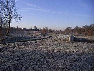
The Merzbach is a left tributary of the Rur in the western Rhineland . It has a length of 28 km and a catchment area of 105.8 km².
geography
course
The Merzbach rises at Gut Klösterchen ( Würselen ) near Propsteier Forest ( Eschweiler ) and forms its western boundary. It flows past Gut Merzbrück (Eschweiler) and crosses St. Jöris and Kinzweiler . Because of the future opencast mine , the stream was diverted and now flows past Warden . Before that it flowed through the towns of Lürken , Laurenzberg and Obermerz , which were excavated in the 1980s . It then flows along the towns of Niedermerz , Aldenhoven , Engelsdorf , Merzenhausen , Welz and Linnich . Here the stream crosses the Linnich mill pond and flows into the Rur at the bridge of the B 57 . The Hoengener Fließ also flows into the Merzbach near Koslar .
Tributaries
- Grubenrandbach ( right ), 1.4 km
- Wardener Bach ( left ), 2.1 km
- Schlangengraben ( right ), 3.9 km
- Hoengener Fliess ( left ), 9.4 km
- Freialdenhovener Fließ ( left ), 9.6 km
- Ederener Fließ ( left ), 2.0 km
history
The name is of Germanic origin.
In December 1905, a Roman complex was found at Merzbach near Röhe (Eschweiler) on an area of 20 m × 5 m with hand millstones, a mortar and shards of Terra Sigillata and Terra Nigra .
The Merzbach marks the municipal boundary between Eschweiler and Würselen-Broichweiden .

