Laramie River
| Laramie River | ||
|
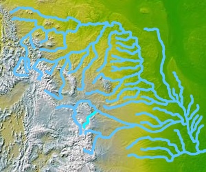
Course of the Laramie River (highlighted) |
||
| Data | ||
| Water code | US : 170459 | |
| location | Colorado , Wyoming (USA) | |
| River system | Mississippi River | |
| Drain over | North Platte River → Platte River → Missouri → Mississippi → Atlantic Ocean | |
| source | In northern Colorado, 40 ° 36 ′ 56 ″ N , 105 ° 51 ′ 29 ″ W |
|
| muzzle | In the North Platte River at Fort Laramie coordinates: 42 ° 11 ′ 50 " N , 104 ° 31 ′ 42" W 42 ° 11 ′ 50 " N , 104 ° 31 ′ 42" W.
|
|
| length | 348 km | |
| Reservoirs flowed through | Wheatland Reservoir | |
The Laramie River is a 348 km long tributary of the North Platte River in the US states of Colorado and Wyoming .
The river has its origin in the Roosevelt National Forest in northern Colorado. It flows north-northwest into Wyoming, along the eastern side of the Medicine Bow Mountains . Then north-east across the plain north of Laramie , through the Wheatland Reservoir and through the Laramie Mountains . Behind the mountains it meets the North Laramie River and finally flows into the North Platte River at Fort Laramie in Wyoming.
The name of the river comes from Jacques La Ramee , a French-Canadian fur trader who lived in the area in the 1820s. His body was found near the confluence with the North Platte, pierced by arrows. Later the Laramie Mountains and the town of Laramie were also named after him.
