
North Laramie River
| North Laramie River | ||
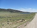
 North Laramie River near Friend Park in Medicine Bow - Routt National Forest |
||
| Data | ||
| Water code | US : 1604343 | |
| location | Wyoming , United States | |
| River system | Mississippi River | |
| Drain over | Laramie River → North Platte River → Platte River → Missouri → Mississippi → Atlantic Ocean | |
| source | Medicine Bow - Routt National Forest 42 ° 18 ′ 12 ″ N , 105 ° 37 ′ 27 ″ W. |
|
| muzzle |
Laramie River Coordinates: 42 ° 7 ′ 35 " N , 104 ° 55 ′ 27" W 42 ° 7 ′ 35 " N , 104 ° 55 ′ 27" W.
|
|
| length | 131 km | |
| Reservoirs flowed through | Toltec reservoir | |
The North Laramie River is an approximately 131 km long northern tributary of the Laramie River in southeastern Wyoming in the United States . It flows through the Platte and Albany Counties . Its headwaters are in Medicine Bow - Routt National Forest in the Laramie Mountains in northern Albany County. It flows first south, later in an easterly direction and joins the Laramie River about 8 kilometers north of Wheatland .
The name of the river comes from Jacques La Ramee , a French-Canadian fur trader who lived in the area in the 1820s.
reachability
The North Laramie River Trail begins at N42 ° 12,400, W105 ° 21,400 and leads about 8 kilometers, partly very steeply, through the North Laramie River Canyon along the river.
gallery
Toltec reservoir

Information sign in the Laramie Mountains

