Fort Laramie, Wyoming
| Fort Laramie | ||
|---|---|---|
 Main street from Fort Laramie |
||
| Location in Wyoming | ||
|
|
||
| Basic data | ||
| State : | United States | |
| State : | Wyoming | |
| County : | Goshen County | |
| Coordinates : | 42 ° 13 ′ N , 104 ° 31 ′ W | |
| Time zone : | Mountain ( UTC − 7 / −6 ) | |
| Residents : | 233 (as of 2007) | |
| Population density : | 332.9 inhabitants per km 2 | |
| Area : | 0.7 km 2 (approx. 0 mi 2 ) of which 0.7 km 2 (approx. 0 mi 2 ) is land |
|
| Height : | 1292 m | |
| Postal code : | 82212 | |
| Area code : | +1 307 | |
| FIPS : | 56-28230 | |
| GNIS ID : | 1588642 | |
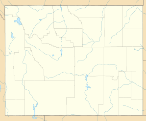
Fort Laramie is a city in Goshen County , eastern Wyoming in the United States . Cheyenne is about 120 kilometers south, the city of Laramie about 135 kilometers southwest and Casper about 165 kilometers northwest of Fort Laramie.
Surname
The name of the city and the army base Fort Laramie comes from Jacques La Ramee , a French-Canadian fur trader and Mountain Man . La Ramee lived in this area in the 1820s and died on the Laramie River , which was later also named after him , near Fort Laramie.
Demographics
According to a 2007 survey by the United States Census Bureau, Fort Laramie lived in 233 people, 111 men and 122 women in 119 households.
Attractions
About three kilometers southwest of the city is the historic Fort Laramie, a military fortification built around 1830, which is now administered as Fort Laramie National Historic Site by the National Park Service .
The Laramie River flows into the North Platte River near the city .

