Latrobe, Pennsylvania
| Latrobe | ||
|---|---|---|
 The 1890 Mozart Hall on Main Street. |
||
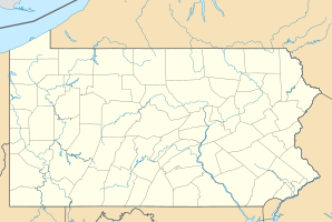
| Location in Pennsylvania | ||
|
|
||
| Basic data | ||
| Foundation : | 1852 | |
| State : | United States | |
| State : | Pennsylvania | |
| County : | Westmoreland County | |
| Coordinates : | 40 ° 19 ′ N , 79 ° 23 ′ W | |
| Time zone : | Eastern ( UTC − 5 / −4 ) | |
| Residents : | 8,338 (as of 2010) | |
| Population density : | 1,389.7 inhabitants per km 2 | |
| Area : | 6 km 2 (approx. 2 mi 2 ) of which 6 km 2 (approx. 2 mi 2 ) are land |
|
| Height : | 304 m | |
| Postal code : | 15650 | |
| Area code : | +1 724 | |
| FIPS : | 42-41680 | |
| GNIS ID : | 1178908 | |
| Website : | www.cityoflatrobe.com | |
| Mayor : | Barbara J. Griffin | |
Latrobe is a city in Westmoreland County , Pennsylvania , United States . It is located approximately 60 kilometers southeast of Pittsburgh . Latrobe had 8338 inhabitants in 2010. The city is considered the birthplace of the Banana Split .
In Latrobe there is the Latrobe Brewery and the St. Vincent College of the St. Vincent Archabbey .
The golfer Arnold Palmer came from here and the nearby regional airport was named after him. Leo Michael Haid OSB , bishop and abbot, was born here.
The city is served by Amtrak .
Web links
Commons : Latrobe, Pennsylvania - Collection of pictures, videos, and audio files
Individual evidence
- ↑ pabook.libraries.psu.edu ( Memento of the original from May 16, 2013 in the Internet Archive ) Info: The archive link was automatically inserted and not yet checked. Please check the original and archive link according to the instructions and then remove this notice.
