Legend (map)

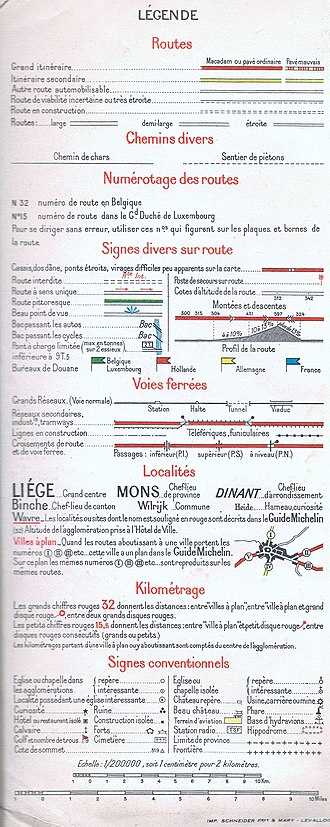
The legend or explanation of symbols is a description of the symbols, signatures and colors used on a map or plan .
The legend is usually placed on the edge of the map. It contains an exemplary representation (symbol, line or rectangular area) and a description of what is shown in text form.
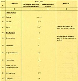
For some official applications, there are mandatory character codes that are specified in a law or regulation . If maps or plans are created on the basis of such a character key, the legend on the map itself is often omitted.
Examples of map symbols for a legend
Points
| Map sign | Explanation |
|---|---|
|
|
cave |
|
|
Archaeological site ( loop square ) |
| |
Mine ( mallets and iron ), closed / abandoned mine |
|
|
Castle , castle |
|
|
Castle ruins , castle ruins |
|
|
Church , chapel , monastery ( ♁ ) |
|
|
Church ruins, monastery ruins |
|
|
mosque |
|
|
monument |
|
|
tower |
|
|
Radio tower |
|
|
Trigonometric point |
|
|
hotel |
|
|
Airport |
|
|
camping |
|
|
Metro station |
|
|
railway station |
|
|
Stadion |
|
|
Tourist Information |
Lines and areas
- ways
Roads are typically divided into classes and marked with different line widths: Motorway, trunk road (federal road, state road), regional road (country and district roads), local road, paved farm road, unpaved farm road (field path) and footpath.
- relief
The map information about the terrain is summarized under the term relief . This includes:
- Contour line (depending on the scale of the map and the shape of the terrain with an equidistance from 0.5 m), partly with hillshading
- Terrain level
- Rock representation
- Embankment (both sides: embankment , incision ); in some cases the height of the slope is indicated by the length of the horizontal lines on large scales. Example:
- Pit and depression
- Waters
- River, stream, lake, additionally with water structures ( groynes etc.)
Topographic map
Character code for the Austrian surveying ordinance
In Austria there are such character keys for the following applications:
- Cadastral plan (current character code is specified in the surveying ordinance 2016)
- Zoning plan (key code according to the respective ordinance of the federal state )
- Austrian map 1: 50,000

