Lemon Cove
| Lemon Cove | ||
|---|---|---|
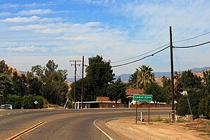
 Entrance to Lemon Cove. |
||
| Location in California | ||
|
|
||
| Basic data | ||
| State : | United States | |
| State : | California | |
| County : | Tulare County | |
| Coordinates : | 36 ° 23 ′ N , 119 ° 2 ′ W | |
| Time zone : | Pacific ( UTC − 8 / −7 ) | |
| Residents : | 298 (status: 2000) | |
| Population density : | 135.5 inhabitants per km 2 | |
| Area : | 2.2 km 2 (approx. 1 mi 2 ) of which 2.2 km 2 (approx. 1 mi 2 ) are land |
|
| Height : | 153 m | |
| Postal code : | 93244 | |
| Area code : | +1 559 | |
| FIPS : | 06-41110 | |
| GNIS ID : | 2408598 | |
Lemon Cove is a settlement area defined for statistical purposes ( census-designated place ) in Tulare County in the US state of California with 298 inhabitants (status: 2000). The geographical coordinates are: 36.23 ° north, 119.2 ° west. The settlement area has a size of 2.2 km².
Lemon Cove is located at the transition from the Central Valley to the western foothills of the Sierra Nevada , around 15 miles (24 km) northeast of the city of Visalia . The eastern end of California State Route 216 meets California State Route 198, which runs through town .
A few miles east of Lemon Cove is the south entrance to the Sequoia & Kings Canyon National Parks , which are popular with tourists due to their dense population of giant sequoia trees . At the eastern end of the village, the dammed Lake Kaweah forms a local recreation area.
Web links
- History of the site (English)
