Lichinga
| Lichinga | ||
|---|---|---|
|
|
||
| Coordinates | 13 ° 17 ′ S , 35 ° 14 ′ E | |
| Basic data | ||
| Country | Mozambique | |
| Niassa | ||
| District | Lichinga | |
| ISO 3166-2 | MZ-A | |
| height | 1284 m | |
| surface | 290 km² | |
| Residents | 213,361 (2017) | |
| density | 735.7 Ew. / km² | |
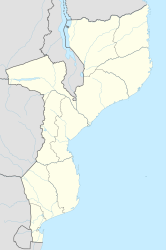
Lichinga (formerly Vila Cabral ) is the capital of the Niassa Province in Mozambique .
geography
Lichinga is located at 1369 m above sea level in the Lichinga highlands and east of Lake Malawi . About 50 kilometers to the west, the landscape falls steeply down to this inland lake.
The city was laid out in an octagonal, geometric plan. When the city was founded, it had a radius of 440 meters. The outskirts extend up to a distance of 3000 meters from the city center.
population
Lichinga had about 4,579 inhabitants in 1970, 85,758 in 1997, 142,331 in 2007 and 213,361 in 2017. Aldeamentos , so-called fortified villages, were built in the vicinity of Lichinga from 1964 , which means that the previously scattered population was concentrated in these geometrically designed settlements. This development was justified with their protection against terrorists and the prevention of cooperation with guerrilla groups.
Lichinga is the seat of the Lichinga diocese .
history
The city was founded in 1931 as Vila Cabral . It kept the name until independence from the colonial power Portugal in 1975.
Economy and Infrastructure
Lichinga Airport has a 1,800 meter long asphalt runway.
The Nacala- Lichinga railway ends here with its 262-kilometer branch from Cuamba and is an important connection to the Indian Ocean .
Due to the periodic rainy seasons, the road connections between Lichinga and Cuamba (National Road 13) are repeatedly interrupted. The long-planned start of the urgently needed route reconstruction was therefore planned in autumn 2012. In general, Lichinga is one of the most difficult to reach places in Mozambique.
literature
- Manfred Kuder: Moçambique, a geographical, social and economic country studies . Scientific regional customers Vol. 10, Darmstadt 1975, pp. 213, 215
Individual evidence
- ^ Kuder: Moçambique , 1975, p. 215
- ↑ INE, Mozambique via Geohive ( Memento of the original from September 24, 2014 in the Internet Archive ) Info: The archive link was inserted automatically and has not yet been checked. Please check the original and archive link according to the instructions and then remove this notice. (English)
- ↑ Mozambique: Provinces, Cities, Urban Settlements & Agglomerations - Population Statistics, Maps, Graphics, Weather and Web Information. Retrieved May 15, 2018 .
- ↑ Kuder: Moçambique , 1975, p. 215 text on picture 6
- ↑ African Development Fund: APPRAISAL REPORT, MONTEPUEZ-LICHINGA ROAD PROJECT, REPUBLIC OF MOZAMBIQUE, June 2006. at www.afdb.org ( Memento of December 3, 2013 in the Internet Archive ) PDF document p. 16
- ^ Railroad between Cuamba and Lichinga, in Mozambique, to be rebuilt. September 27, 2012, at www.macauhub.com.mo
- ^ Train services resume between Cuamba and Lichinga in northern Mozambique. September 20, 2006, at www.macauhub.com.mo
