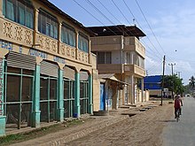
Lindi (district)
| Lindi District | |
|---|---|
 Location of the Lindi district in Tanzania |
|
| Basic data | |
| Country | Tanzania |
| region | Lindi |
| surface | 7538 km² |
| Residents | 272,984 (2012) |
| density | 36 inhabitants per km² |
| ISO 3166-2 | TZ-12 |
Coordinates: 9 ° 20 ' N , 37 ° 18' E
Lindi is a district in the Tanzanian region of Lindi with the administrative center in the city of Lindi . It borders in the north on the Kilwa district , in the east on the Indian Ocean , in the south on the Mtwara region and in the west on the Ruangwa district .
geography
The district has a size of 7538 square kilometers and 272,984 inhabitants (as of 2012). 1183 square kilometers of the surface are water. The land lies at an altitude of 0 to 759 meters above sea level. Most of the area is a lowland on the coast. To the west it rises to a plateau crossed by river valleys. The largest river is the Lukuledi , which forms the southern border of the district.
The climate is tropical, Aw according to the effective climate classification . The annual average precipitation in the rainy season from November to May is 1000 millimeters. In the cooler dry season the average temperature is 24 degrees Celsius, in the hotter rainy season it is 27 degrees Celsius.
history
Lindi District was established in 1958 during British colonial times. In 1972 the district was dissolved in the course of decentralization, but restored in 1982.
Administrative division
The district consists of the two councils Lindi District Council and Lindi Municipal Council with a total of 48 parishes (wards):
Lindi District Council
- Mipingo
- Kitomanga
- Mchinga
- Kilolambwani
- Kilangala
- Kiwalala
- Navanga
- Mnolela
- Sudi
- Nachunyu
- Mtama
- Nyangao
- Namupa
- Nyengedi
- Mtua
- Nahukahuka
- Nyangamara
- Mandwanga
- Mnara
- Chiponda
- Pangatena
- Longa
- Rutamba
- Milola
- Kiwawa
- Mtumbya
- Matimba
- Nangaru
- Majengo
- Namang whales
Lindi Municipal Council
- Ndoro
- Makonde
- Mikumbi
- Mitandi
- Rahaleo
- VAT amount
- Matopeni
- Wailes
- Nachingwea
- Rasbura
- Mtanda
- Jamhuri
- Msanjihili
- Mingoyo
- Ng'apa
- Tandangongoro
- Chikonji
- Mbanja
populationLindi is one of the poorest districts in Tanzania. In 2016, the average annual income was 1,127,104 Tanzanian shillings, which is less than five hundred euros. Among those over five, the illiteracy rate was forty percent in rural areas and thirty percent in cities. Facilities and services |
 |
 |
- Education: There are 117 elementary schools and 27 high schools in the district. One of the main problems is the shortage of teachers; in 2015 there was a shortage of 335 teachers in primary schools.
- Health: A hospital, six health centers and 42 pharmacies are available to provide medical care for the population (as of 2019). The main diseases are malaria, acute respiratory infections and pneumonia.
Economy and Infrastructure
|
 |
Others
- Dinosaur fossils from Tendaguru: Between 1909 and 1913, 230 tons of fossilized dinosaur bones were found and transported to Berlin, where they are exhibited in the Museum of Natural History .
Web links
Individual evidence
- ^ Tanzania Regional Profiles, 08 Lindi Regional Profiles. (PDF) The United Republic of Tanzania, 2016, p. 15 , accessed on March 6, 2020 .
- ↑ Maps for the World, Map 500k - xc37-2, Map 500k - xc37-4. Russian Army Maps, accessed April 19, 2020 (Russian).
- ↑ a b Lindi District Council, Medium Term Rolling Strategic Plan 2016/17 - 2020/21. (PDF) September 2017, p. 8 , accessed on March 6, 2020 .
- ^ Lindi climate: Average Temperature, weather by month, Lindi water temperature - Climate-Data.org. Retrieved March 6, 2020 .
- ↑ 2012 Population and Housing Census. (PDF) National Bureau of Statistics and Ministry of Finance, March 2013, pp. 81, 85 , accessed on March 6, 2020 .
- ↑ a b c d Lindi District Council, Medium Term Rolling Strategic Plan 2016/17 - 2020/21. (PDF) September 2017, pp. 9–10 , accessed on March 6, 2020 .
- ^ Tanzania Regional Profiles, 08 Lindi Regional Profiles. (PDF) The United Republic of Tanzania, 2016, p. 70 , accessed on March 6, 2020 .
- ↑ a b Statistics. Retrieved March 6, 2020 .
- ^ Lindi District Council, Medium Term Rolling Strategic Plan 2016/17 - 2020/21. (PDF) September 2017, p. 15 , accessed on March 6, 2020 .
- ^ Lindi District Council, Medium Term Rolling Strategic Plan 2016/17 - 2020/21. (PDF) September 2017, p. 12 , accessed on March 6, 2020 .
- ^ Tanzania Regional Profiles, 08 Lindi Regional Profiles. (PDF) The United Republic of Tanzania, 2016, pp. 127, 130 , accessed on March 6, 2020 .
- ^ Tanzania Trunk Road Network. Retrieved March 6, 2020 .
- ↑ Dinosaur World. Museum für Naturkunde, Berlin, April 23, 2019, accessed on March 6, 2020 .
- ↑ The mountain of bones. Rundfunk Berlin-Brandenburg, accessed on March 6, 2020 .

