List of the main roads in Andorra
The list of the main roads in Andorra gives an overview of the approximately 100 km of the highest road category in the dwarf state.
Road system
The state road network of the dwarf state of Andorra consists on the one hand of main roads ( Catalan carretera general , abbreviation CG) and on the other hand secondary roads ( Catalan carreteras secundarias , abbreviation CS). The numbering of the secondary streets is based on the main street system, the first of the three numbers is that of the main street. Main street 5 was originally the CS 410, main street 6 the CS 110.
Two of the six main streets start in the capital Andorra la Vella (CG 1 and 2).
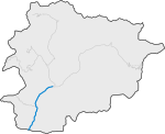
List of main streets
| No. | length | course | map |
|---|---|---|---|
|
|
11.2 km |
|

|
|
|
32.1 km |
Andorra la Vella |

|
|
|
21 km |
Escaldes |

|
|
|
18 km |
La Massana |

|
|
|
2.5 km |
Erts |

|
|
|
6 km |
Aixovall |

|
Web links
- Agència de Mobilitat Govern d'Andorra
- Road map of Andorra (PDF; 6.4 MB) on mot.ad