List of cultural monuments in Kirchheimbolanden
In the list of cultural monuments in Kirchheimbolanden all cultural monuments of the Rhineland-Palatinate city of Kirchheimbolanden are listed. The basis is the list of monuments of the State of Rhineland-Palatinate (as of August 15, 2017).
Monument zones
| designation | location | Construction year | description | image |
|---|---|---|---|---|
| Old town monument zone | approximately bounded by Neumayerstraße, Neuer Allee, Vorstadt, Liebfrauenstraße and Schillerstraße Lage |
16th to 19th century | Building structure from the 16th to 19th centuries, mainly Baroque overformed town houses from the 18th century as well as sacred, stately and urban buildings as excellent focal points |

|
| Monument zone Bahnhofstrasse | Bahnhofstrasse 1–17, 6–18, Vorstadt 48 location |
1874-1925 | Wilhelminian style avenue development with representative public buildings (train station, rent office, post office, fire insurance building, district office) and high-class town houses, 1874–1925 |

|
| Monument zone castle | Neumayerstrasse 16-20, Gartenstrasse, Schloßplatz Lage |
from 1738 | East wing of the three-wing complex, which burned down in 1861, 1738–40, architect Guillaume d'Hauberat : stately mansard hipped roof building (increased in 1862), former courtyard portal and main garden portal, former coach house with castle gate, the core probably from 1738; former ballroom (Neumayerstraße 16–20): representative late Baroque hipped roof building, 1752/53, architect Sigmund Jacob Haeckher , Weilburg, late classical gable project around 1890; Former palace garden: late baroque complex, 1746–57 by court and pleasure gardener LW Koellner, redesign in English landscape garden probably in 1770s by court gardener JW Hilcke, renewed change from 1807, in the kitchen garden orangery, marked 1776; So-called tea house in the former Kappes gardens (Gartenstrasse without number) |
 more pictures more pictures
|
| Jewish cemetery monument zone | west of the city at the end of the Judental Valley; District Im Judental Lage |
around 1700 | walled area, probably laid out in the 18th century (around 1700?), expanded in 1843, 172 tombstones from 1832 (?) to 1939 |

|
Individual monuments
| designation | location | Construction year | description | image |
|---|---|---|---|---|
| City fortifications |
location |
after 1368 | Tower-reinforced wall started soon after 1368 with upstream kennels and partly still recognizable moat, the northern suburb mentioned since 1431 with its own circular wall, large parts of it were laid down around 1740 and around 1770; extensive remains on the west and south sides between the Graues Turm and Am Wehrgang 11 restored and reconstructed (1971 / 77–88); also preserved: three wall towers (red, gray tower and so-called powder or apothecary tower; on the battlements, behind Langstrasse 15 and behind Langstrasse 29) and gothic, baroque-shaped gate towers (town house tower / upper gate, suburban tower / lower gate); the remains of the late medieval city fortifications are the most extensively preserved in the northern Palatinate |
 more pictures more pictures
|
| Red Tower | Location on battlements |
south-western, round wall tower of the medieval city fortifications |
 more pictures more pictures
|
|
| Residential building | On battlement 11 position |
1731 | stately late baroque hipped roof building, marked 1731; Inner courtyard, outbuilding with portico |
 more pictures more pictures
|
| Paulskirche | District road without number location |
1739-44 | former Lutheran palace and parish church; towerless hipped roof building with side extensions, 1739–44, architect Julius Ludwig Rothweil ; with equipment, Stumm organ from 1745 |
 more pictures more pictures
|
| Lutheran Chaplaincy and School for Girls | Amtsstrasse 1 location |
around 1760 | former "Lutheran Chaplaincy and Girls' School"; sophisticated rococo building with hipped roof, around 1760 | |
| Residential building | Amtsstrasse 2 location |
1772 | three-storey baroque building, partly half-timbered (plastered), marked 1772, the core is probably older; defining the townscape | |
| Residential building | Amtsstrasse 5 location |
around 1750 | Late baroque house, partly half-timbered (plastered), slated gable, around 1750 | |
| Reformed school and rectory | Amtsstrasse 7 location |
1751 | former reformed school and parsonage with teacher's apartment; stately corner building, partly half-timbered (slated), marked 1751; Outbuildings, partly half-timbered | |
| House of Youth | Amtsstrasse 10 location |
1897 | former Progymnasium; three-storey hipped roof building from the late founding period with gable projections, marked 1897, architect district architect Ginand, Kirchheimbolanden; defining the streetscape | |
| school | Amtsstrasse 12 location |
1823/24 | former elementary school; three-storey classical plastered building, 1823/24, extension and elevation in 1883/84, architect Jacob Hoerner , Kircherheimbolanden | |
| Museum in the city palace | Amtsstrasse 14 location |
former city palace, museum of local history since 1935; stately rococo corner building with mansard hipped roof; with equipment; defining the townscape |

|
|
| Guild hostel | Amtsstrasse 15 location |
1752 | former guild hostel for builders, inn and bakery; Corner building, gate drive, 1752; defining the townscape |

|
| Residential building | Amtsstrasse 17/19 location |
1752 | late baroque house, partly half-timbered (plastered), marked 1752 | |
| Residential and guest house | Amtsstrasse 21 location |
1752 | large living and inn, partly timber-framed (plastered), marked 1752 |

|
| Residential building | Amtsstrasse 23 location |
1753 | late baroque house, partly half-timbered (plastered), marked 1753, farm building | |
| Office clerkship | Amtsstrasse 27/29 location |
around 1750 | former office clerk; late baroque hipped roof building on an L-shaped floor plan, around 1750, stair tower around 1920; arcades in the courtyard of the former brewery, before 1759; garden | |
| Kirchheimbolanden train station | Bahnhofstrasse 1 location |
1874 | former train station; three-and-a-half-storey plastered late classicist building, 1874, goods shed; defining the streetscape |

|
| Post office | Bahnhofstrasse 7 location |
1925 | Post office; Hipped roof on a high rectangular base, 1925 |

|
| Commercial building | Bahnhofstrasse 10 location |
around 1890 | former office building of the Bavarian fire insurance; stately cubic hipped roof building, gable elevation, around 1890 |

|
| Heinrich Matthias Sengelmann House | Bahnhofstrasse 17 location |
1914/15 | former Royal Bavarian District Office; Representative two-part assembly group with a stair tower, Heimatstil and neo-classical motifs, 1914/15, Architect, Bauamtsassessor Frauenholz, Kaiserslautern |

|
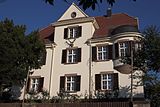
| Forestry Office | Dr.-Carl-Glaser-Straße 2 location |
1909 | Forest office; Country house-like building with a hip hipped roof, Heimatstil, 1909 based on plans by the Supreme Building Authority, Munich |
|
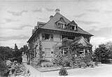
| Villa Seyler | Dr.-Carl-Glaser-Straße 4 location |
1919-23 | stately villa, neo-classical hipped roof building, 1919–23 |
|
| Orangery | Dr.-Edeltraud-Sießl-Allee 4 location |
1776 | former orangery of the palace gardens; three-part plastered building under a hipped roof, 1776 |
|
| Freischarendenkmal and gravestones | Freiheitsstrasse, in the cemetery location |
1839 | Created in 1839, expanded in the second half of the 19th century and the early 1990s; Freischarendenkmal 1849, Germania from 1872; classical tombstone of the mass grave for the fallen from 1849; Gravestones from the 19th and early 20th centuries |

|
| Tea house | Gartenstrasse without number location |
former tea house of the castle; eight-sided two-storey half-timbered building under a broken canopy |

|
|
| villa | Gasstrasse 1 location |
1898 | one and a half storey villa on a T-shaped floor plan, neo-renaissance, marked 1898 |

|
| Residential building | Gutenbergstrasse 5/7 location |
1768 | late baroque double house with gate, marked 1768 | |
| Rich house | Husarenhof 2 location |
early 18th century | Baroque plastered building, partly with half-timbering, early 18th century; defining the streetscape |

|
| Höllriegl's house | Langstrasse 15 location |
16th to 19th century | stately three-winged building complex, 16th to 19th centuries: half-hip roof building, around 1830; Stair tower, around 1600, heightened in 1981/82; rear wing, partly half-timbered, probably from the 17th century; defining the streetscape |
 more pictures more pictures
|
| Gray tower | Langstrasse, behind No. 15 Lage |
Rectangular wall tower located in the middle of the western section of the medieval city fortifications |
 more pictures more pictures
|
|
| coin | Langstrasse 23 location |
18th century | former coin; Baroque four-wing complex, 18th century: half-hipped roof building, marked 1740, residential wing with doorway, residential building at the rear, partly timber-frame (plastered); defining the streetscape | |
| Residential building | Langstrasse 25 location |
around 1830 | classicist house with mansard roof, around 1830; defining the streetscape | |
| Protestant rectory | Langstrasse 28 location |
17th century | Half-hipped roof building, partly half-timbered (slated), probably from the 17th century, possibly older in the core; Barn, partly half-timbered, 18th century; Parish garden |

|
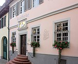
| Swan pharmacy | Langstrasse 29 location |
1725 | former princely court pharmacy, swan pharmacy since 1823; stately baroque plastered building, half-timbered partially protruding, 1725; Stone marked 1720, basement exit marked 1816 (renewal) |
|
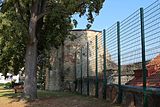
| Powder or apothecary tower | Langstrasse, behind No. 29 Lage |
northwestern wall tower of the medieval city fortifications |
|
|
| Townhouse tower (Obertor) | Langstrasse, between No. 29 and 30 location |
four-storey plastered building with slated dome and lantern from the 18th century; gothic at the core, redesigned baroque |
 more pictures more pictures
|
|
| Townhouse | Langstrasse 30 location |
Early 19th century | former town hall; three-story hipped roof building, early 19th century, renovation marked 1910, architect H. Grießhaber, Ludwigshafen; Wappenstein, marked 1551; Rest bench, 1921 |
 more pictures more pictures
|
| Executioner's House | Langstrasse 31 location |
17th century | two-part building complex; biaxial hipped roof construction, probably from the 17th century, single-axis extension, 18th century | |
| Residential building | Langstrasse 34 location |
1746 | late baroque hipped roof building, marked 1746 and 1776, partly with half-timbering | |
| portal | Langstrasse, at No. 39 location |
1772 | Skylight portal, sandstone walls marked 1772, rococo door leaf | |
| Residential building | Langstrasse 43 location |
around 1600 | stately corner house, around 1600, half-timbered upper floor from the first half of the 18th century; in the courtyard a fountain, former forge, partly with half-timbering, 18th century |

|
| Dutch house | Langstrasse 71 location |
1750 | single-storey late baroque mansard hipped roof building, marked 1750, barn with half-timbered storage | |
| Gasthaus "Zum Donnersberg" | Langstrasse 73 location |
Gasthaus "Zum Donnersberg"; late baroque hipped roof building, gate drive marked 1780; defining the streetscape | ||
| Church of Our Lady | Liebfrauenstrasse 11 location |
1731 | former Liebfrauenkirche, today multi-generation house; late baroque hall building with half-hip roof, marked 1731, possibly Gothic in core; baroque tombs |
 more pictures more pictures
|
| Fountain | Mozartstrasse location |
around 1880 | Running fountain, Gothicizing, Gienanth iron foundry, around 1880 |
 more pictures more pictures
|
| Residential building | Mozartstrasse 2 location |
18th century | Gateway house with half-timbered upper floor, 18th century |
 more pictures more pictures
|
| Roof truss | Mozartstrasse, at No. 4 location |
16th Century | Suspended frame construction of the roof truss, 16th century; Box oriel of the former office building |

|
| Residential building | Mozartstrasse 6 location |
around 1600 | Former craftsman's house, partly half-timbered, marked 1746 and 1752, the core around 1600 | |
| Freihof der Fauste von Stromberg | Mozartstrasse 7 location |
late 18th and first half of the 19th century | former Freihof der Fauste von Stromberg; elongated building, partly half-timbered (plastered), mainly late 18th and first half of the 19th century, older in the core; Wappenstein, marked 1589; defining the streetscape |

|
| Peterskirche | Mozartstrasse 8 location |
from the 12th century | Protestant parish church; Romanesque choir tower, 12th century, elevation probably in the 17th century, upper floor and helmet 1932, architect Eugen Dick ; the core of a late Gothic nave, extension probably in the first half of the 18th century, stair annex, marked 1630, partly half-timbered; with equipment; defining the townscape |
 more pictures more pictures
|
| Residential building | Mozartstrasse 10/12 location |
Early 18th century | former cantor's apartment; Baroque half-hipped roof, partly half-timbered (plastered), early 18th century | |
| Protestant deanery | Mozartstrasse 11 location |
first half of the 18th century | former corner house, from 1900 deaconess house, today Protestant deanery; partly half-timbered (slated), first half of the 18th century, probably older in the core, extension to the rear, 18th century |
 more pictures more pictures
|
| Cavalier House | New avenue 5 location |
1772 | former cavalier house; Hipped mansard roof building, marked 1772, neo-baroque courtyard gate wing, around 1910, architect Konrad Lehwaldt , former farm building , 19th century |

|
| Cavalier House | 7 new avenue location |
around 1770 | former cavalier house; seven-axis rococo building with mansard hipped roof, around 1770 |

|
| Cavalier House | New avenue 9 location |
around 1770 | former cavalier's house, stately rococo mansard hipped roof, around 1770 |

|
| Cavalier House | Neue Allee 11 location |
1772 | former cavalier house; Corner house with hipped mansard roof, marked 1772, outbuilding: single-storey mansard roof building |

|
| Tithe yard with tithe barn | Neue Allee 13-17 location |
around 1770 | former tithe yard, former tithe barn; late baroque mansard roof, around 1770, staircase porch marked 1932; Residential house, essentially from the 18th century; three-part basement |

|
| Post office | 19 Neue Allee location |
around 1816 | former post office; classical plastered building, around 1816, dwarf house around 1880; defining the streetscape |

|
| Catholic rectory | Neugasse 1 location |
1753 | former catholic rectory; late baroque building with a half-hipped roof, partly half-timbered (plastered), partly slated, 1753 | |
| Residential building | Neugasse 23 location |
1751 | late baroque hipped roof building on an L-shaped floor plan, marked 1751; defining the streetscape | |
| War memorial | Neumayerstraße, in front of No. 2 Lage |
1880 | War memorial 1870/71, Wilhelminian style obelisk, 1880 by J. Zepp | |
| Catholic Parish Church of St. Peter | Neumayerstraße 3 location |
1842-46 | Hall building in round arch style, 1842–46, architects August von Voit and Ludwig Hagemann , Speyer, tower helmet 1881, architect Jacob Hoerner, Kirchheimbolanden |

|
| Princely Oberjagerei | Neumayerstraße 4 location |
first half of the 18th century | former princely chief hunter's; baroque courtyard, first half of the 18th century; Residential house, partly half-timbered, half-hipped roof, barn with half-hipped roof, small residential house, around 1770, gate post marked 1727 | |
| Catholic rectory | Neumayerstraße 5 location |
1892 | Catholic parsonage, villa-like clinker brick building from the Gründerzeit era with hipped roof, marked 1892, architect probably Jacob Hoerner, Kirchheimbolanden | |
| Residential building | Neumayerstraße 6 location |
around 1750 | late baroque house, around 1750; defining the plaza | |
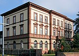
| Tax office | Neumayerstraße 7 location |
1881/82 | former district court , today tax office; stately three-storey building with a hip roof, built in 1881/82 according to plans by Ludwig Stempel , Landbauamt Kaiserslautern; defining the streetscape |
|
| Grenadier barracks | Neumayerstraße 9/11/13 location |
1780 | former "Grenadier barracks"; Hipped roof building, 1780, No. 9 marked 1810 (probably change of ownership) |

|
| Ballroom of the castle | Neumayerstraße 16/18/20 location |
1752/53 | former ballroom of the castle; two-storey plastered building under a hipped roof, 1752/53, architect SJ Haeckher | |
| Karl Ritter School | Schillerstraße 17 location |
1905 | former preparatory school; Two-and-a-half-story plastered building on an irregular floor plan, neo-renaissance and art nouveau motifs, 1905 based on plans by the Supreme Building Authority, Munich |
 more pictures more pictures
|
| Suburban tower (sub-tower) | Schlossstrasse without a number location |
five-storey gate tower with a baroque hooded roof, gothic core, baroque overformed |
 more pictures more pictures
|
|
| Residential and commercial building | Schloßstraße 1/3 location |
1717 | angular baroque residential and commercial building, partly half-timbered, marked 1717; defining the townscape |

|
| Residential and commercial building | Schlossstrasse 2 location |
in the middle of the 19th century | Residential and commercial building, mid-19th century |

|
| City palace of the Baron von Geispitzheim | Schlossstrasse 31 location |
around 1750/60 | former city palace of Baron von Geispitzheim; Rococo hipped roof building, around 1750/60; extensive cellar system; defining the street and townscape |

|
| Courtyard | Schloßstraße 32/34 location |
16th to 19th century | former manorial court, 16th to 19th century; two houses, probably late baroque in the core, partly half-timbered, classical remodeling around 1830; Barn, 18th century, with remains of the city wall; defining the townscape |

|
| Residential building | Schlossstrasse 35 location |
around 1830 | Late Classicist house, around 1830, with parts of the old castle, before 1618 |

|
| Residential and commercial building | Suburb 27 location |
at the end of the 19th century | Former residential and commercial building, historicizing hipped roof building, end of the 19th century |

|
| Police inspection | Suburban 48 location |
1893 | former Royal Bavarian Rent Office; New Baroque sandstone block building with a mansard roof, 1893, architects Ludwig Stempel and Theodor Bente , Kaiserslautern, increase in 1901, architect Joseph Rottler ; defining the streetscape |

|
| Former Premonstratensian monastery in Rothenkirchen | Rothenkircherhof, lonely on Wiesbach in the middle of a clearing island Lage |
around 1200 | Founded in 1160, looted in 1525, converted into a Nassau estate in 1554, devastated in the Thirty Years War, from 1821 several changes of ownership, owned by the city since 1990; 1961 Demolition of all buildings except for the late Romanesque former refectory (around 1200) and an attached residential building, marked in 1854, as well as remains of the cloister |

|
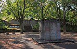
| War memorial |
Schillerhain location |
1933 | War memorial 1914/18 and 1939/45, shell limestone block in relief, 1933 by Heinrich Schuler , Kirchheimbolanden, extended after 1956 |
 more pictures more pictures
|
| Watch tower | Schillerhain, no number location |
before 1431 | former watch tower; late medieval quarry stone building, before 1431 |
 more pictures more pictures
|
| Snail tower | Schillerhain, no number location |
1880-84 | small Gründerzeit Belvedere, 1880–84 |
 more pictures more pictures
|
| Water tower | Schillerhain, at No. 1 location |
around 1900 | Former water tower, brick building from the late 19th century, around 1900 |
 more pictures more pictures
|
| Villa Michel | Schillerhain, No. 6 location |
1907 | Villa with veranda extension, central projection and semicircular porch, marked 1907 and 1908, in a park-like area; with equipment |
 more pictures more pictures
|
| Wichernhaus | Schillerhain, No. 8 location |
1903/04 | Former BASF rest home, stately two-and-a-half-storey building from the Wilhelminian era, rich roof landscape, 1903/04, architect P. de Lacy, Ludwigshafen |
 more pictures more pictures
|
literature
- Dieter Krienke (editor): Cultural monuments in Rhineland-Palatinate. Monument topography Federal Republic of Germany. Volume 15: Donnersbergkreis. Werner, Worms 1998. ISBN 3-88462-153-X
- General Directorate for Cultural Heritage Rhineland-Palatinate (ed.): Informational directory of the cultural monuments Donnersbergkreis (PDF; 5.3 MB). Mainz 2017.
Web links
Commons : Kulturdenkmäler in Kirchheimbolanden - Collection of pictures, videos and audio files