List of cultural monuments in Weilmünster
The following list contains the cultural monuments identified in the monument topography in the area of the market town of Weilmünster , Limburg-Weilburg district , Hesse .
- Note: The order of the monuments in this list is based first on the districts and then on the address; alternatively, it can also be sorted according to the name, the number assigned by the State Office for Monument Preservation or the construction time.
The basis is the publication of the Hessian list of monuments, which was created for the first time on the basis of the Monument Protection Act of September 5, 1986 and has been continuously updated since then.
Aulenhausen
| image | designation | location | description | construction time | Object no. |
|---|---|---|---|---|---|
 more pictures |
Former town hall school | Aulenhausen, Langenbergstraße 8-10 Location floor: 1, parcel: 70/2 |
The former town hall school was built as a simple saddle roof building on the corner facing Friedhofstraße according to a design by the then building inspector Spinn. The main floor and the habitable knee floor were built from a local field fire above the high quarry stone base with a corresponding staircase. The main structure is the sequence of stairs, covered entrance projections and diagonal ridge turrets. | 1888 |
52648 |
Dietenhausen
| image | designation | location | description | construction time | Object no. |
|---|---|---|---|---|---|
 |
Protestant church | Dietenhausen, Atzbachstraße 28 Location floor: 1, parcel: 74 |
1958 |
52654 |
|
 more pictures |
Half-timbered barn | Dietenhausen, Iserbachstraße 19 Location floor: 1, parcel: 103 |
1772 |
52650 |
|
 |
Courtyard | Dietenhausen, Iserbachstraße 19 Location floor: 1, parcel: 103 |
87164 |
||
 |
Dietenhausen, Iserbachstraße 26 Location floor: 1, parcel: 129 |
1695 to 1705 |
52651 |
||
 more pictures |
Old council and parish hall | Dietenhausen, Iserbachstraße 27 Location floor: 1, parcel: 76 |
52653 |
||
 more pictures |
Dietenhausen, Iserbachstraße 36 Location floor: 1, parcel: 136/2 |
52652 |
Ernsthausen
| image | designation | location | description | construction time | Object no. |
|---|---|---|---|---|---|
 more pictures |
Old school | Ernsthausen, Bahnhofstraße 2 Location hallway: 1, parcel: 1/3 |
The school is a two-storey, rectangular, plastered half-timbered building with a flat hipped roof, six-axis windows and a double entrance. It was built in the then modern "Italian style". The old, cast-iron place-name sign (Buderus catalog 1835) is now on the side facade. | around 1840 |
52656 |
 |
Ernsthausen, Bahnhofstraße 3 Location hallway: 1, parcel: 158 |
Early 18th century |
52659 |
||
 |
Ernsthausen, Bahnhofstraße 6 Location hallway: 1, parcel: 302 |
Early 18th century |
52660 |
||
 more pictures |
Ernsthausen, Bahnhofstraße 7 Location hallway: 1, parcel: 256 |
52662 |
|||
 more pictures |
Ernsthausen, Bahnhofstraße 32 Location hallway: 1, parcel: 275 |
Late 18th century |
52661 |
||
 more pictures |
Protestant church | Ernsthausen, Bahnhofstrasse no. Location floor: 1, parcel: 2/1 |
The church has a rectangular floor plan, but looks similar to the central building due to the hipped roof and rider turret. The building is characterized by high arched windows, wide corner pilasters and a suggested risalit with a small frontispiece. The interior is in the classicist style. The canonical gallery building with Doric columns and architraves is dominant. The marbling is original. The church has a simple organ by Daniel Raßmann . | 1831 |
52657 |
 |
Old cattle scale | Ernsthausen, Bahnhofstrasse no. Location floor: 1, parcel: 156/1 |
1825 to 1875 |
52658 |
|
 |
Ernsthausen, Weilburger Straße 66 Location hallway: 2, parcel: 104 |
1795 to 1805 |
52663 |
||
|
|
Complete facility in Ernsthausen | Ernsthausen location |
1725 to 1775 |
52655 |
Essershausen
| image | designation | location | description | construction time | Object no. |
|---|---|---|---|---|---|
 |
Half-timbered barn | Essershausen, Brückenstraße 1 Location hallway: 1, parcel: 39 |
1725 to 1775 |
52664 |
|
 more pictures |
Essershausen, Brückenstraße 4 Location hallway: 1, parcel: 96 |
52665 |
|||
 more pictures |
Old school | Essershausen, Brückenstraße 8 Location hallway: 1, parcel: 94 |
1830 to 1840 |
52666 |
|
 |
Evangelical rectory | Essershausen, Brückenstraße 13 Location corridor: 1, parcel: 78 |
1810 to 1820 |
52667 |
|
 |
Station building | Essershausen, Brückenstraße 15 Location corridor: 1, parcel: 79/1, 79/3 |
1891 |
52668 |
|
 |
Essershausen, Edelsberger Straße 2 Location floor: 1, parcel: 25/2 |
1625 to 1675 |
52669 |
||
 more pictures |
Essershausen, Freienfelser Straße 7 Location hall: 1, parcel: 31/2 |
1835 to 1845 |
52670 |
||
 more pictures |
Essershausen, Kirchstraße 4 Location hallway: 1, parcel: 72 |
1725 to 1775 |
52671 |
||
 more pictures |
Protestant church | Essershausen, Kirchstraße 6 Location hallway: 1, parcel: 71 |
52672 |
||
 |
Tunnel portal of the Fritz pit (Ferdinand tunnel) | Essershausen, no address (Waldfriede settlement), corridor location : 4, parcel: 9/2 |
52673 |
Laimbach
| image | designation | location | description | construction time | Object no. |
|---|---|---|---|---|---|
 more pictures |
Laimbach, Auf der Au 2 Location corridor: 2, parcel: 92 |
Late 18th century |
52675 |
||
 more pictures |
Parish hall | Laimbach, Grauensteinstraße 1, corridor location : 2, parcel: 27/1 |
1953 |
52676 |
|
 more pictures |
Laimbach, Grauensteinstraße 18 Location corridor: 2, parcel: 33 |
1695 to 1705 |
52677 |
||
 |
Laimbach, Grauensteinstraße 22 Location corridor: 1, parcel: 81 |
Early 18th century |
52678 |
||
 more pictures |
Fountain | Laimbach, Grauensteinstraße o. No. Location hall: 2, parcel: 20 |
see also cast iron fountains in the Taunus | 1864 |
52674 |
 |
Former elementary school | Laimbach, Waldschulstraße 10 Location floor: 1, parcel: 75/1 |
1935 |
52679 |
Langenbach
| image | designation | location | description | construction time | Object no. |
|---|---|---|---|---|---|
 |
Langenbach, Gäßchen 4 Location floor: 1, parcel: 237, 238 |
1625 to 1675 |
52681 |
||
 more pictures |
Evangelical church and rectory | Langenbach, Langgasse location floor: 1, parcel: 129, 131/1, 131/2 |
1717 |
52685 |
|
 |
Langenbach, Langgasse 10 Location floor: 1, parcel: 1 |
Late 18th century |
52682 |
||
| Langenbach, Langgasse 16 Location floor: 1, parcel: 4 |
Early 18th century |
52683 |
|||
 more pictures |
Langenbach, Schulstraße 1 Location hallway: 1, parcel: 119 |
1595 to 1605 |
52684 |
||
 |
Langenbach, Schulstraße 2 Location hallway: 1, parcel: 8 |
Late 17th century |
52686 |
||
 |
Langenbach, Schulstraße 3 Location hallway: 1, parcel: 126 |
1621 |
52687 |
||
 |
Old school | Langenbach, Schulstraße 5 Location hallway: 1, parcel: 125 |
1834 |
52688 |
|
| Langenbach, Wedegasse 5 Location floor: 1, parcel: 36 |
1932 |
52689 |
|||
 |
Langenbach, Wedegasse 6 Location floor: 1, parcel: 65 |
Early 18th century |
52691 |
||
 |
Old cattle scale | Langenbach, Wedegasse o. No. Location floor: 1, parcel: 62 |
1925 to 1935 |
52690 |
|
 |
Entire facility in Langenbach | Langenbach location |
Late 17th century |
52680 |
Laubuseschbach
| image | designation | location | description | construction time | Object no. |
|---|---|---|---|---|---|
 more pictures |
Gravestones in the side walls of the cemetery chapel | Laubuseschbach, Emmenhäuser Weg Location hallway: 3, parcel: 151 |
1825 to 1875 |
52694 |
|
 |
Former parish hall | Laubuseschbach, Kirchgasse 3 Location corridor: 2, parcel: 6/3 |
Early 20th century |
52692 |
|
 more pictures |
Monument 1870/71 | Laubuseschbach, Kirchgasse 3 location |
Late 19th century |
52693 |
|
 more pictures |
Protestant church | Laubuseschbach, Kirchgasse 4 Location floor: 2, parcel: 11 |
1725 to 1775 |
52695 |
|
 |
Schönbornscher Hof | Laubuseschbach, Laubusstraße 37 Location floor: 1, parcel: 105/4 |
52696 |
Lützendorf
| image | designation | location | description | construction time | Object no. |
|---|---|---|---|---|---|
 |
Lützendorf, Bergstraße 2 Location hallway: 2, parcel: 38 |
Early 18th century |
52698 |
||
 more pictures |
Old Town Hall School | Lützendorf, Ringstraße 26 Location hallway: 2, parcel: 7/1 |
1846 |
52699 |
|
 |
Lützendorf, Ringstraße 35 Location hallway: 2, parcel: 46/1 |
52700 |
|||
 |
Entire facility in Lützendorf | Lützendorf location |
52697 |
Möttau
| image | designation | location | description | construction time | Object no. |
|---|---|---|---|---|---|
 |
Former council and syringe house | Möttau, Backhausweg 1 Location hallway: 1, parcel: 88 |
1950 to 1960 |
52702 |
|
 |
Old Town Hall School | Möttau, Hessenstraße 10 Location hallway: 1, parcel: 34/3 |
1825 to 1835 |
52701 |
|
| Forsthaus Möttau | Möttau, Without Address Location Village: 6, plot: 3 |
1889 |
52703 |
||
| Wasserberg ruin Grebenstein | Möttau location hall: 7, parcel: 3/1 |
Ground monument |
52704 |
Rohnstadt
| image | designation | location | description | construction time | Object no. |
|---|---|---|---|---|---|
 more pictures |
Old council and bakery | Rohnstadt, Langenbacher Straße 4 Location floor: 1, parcel: 171 |
1927 |
52705 |
|
 |
Bleidenbach Bridge | Rohnstadt, without address (K 444) Location floor: 5, parcel: 25/1, 6 |
1895 |
52708 |
|
 |
Rohnstadt, Schultheissenstraße 8 Location hallway: 1, parcel: 186/2 |
Early 18th century |
52706 |
||
| Rohnstadt, Schultheissenstraße 19 Location floor: 1, parcel: 83 |
1725 to 1775 |
52707 |
Weilmünster
| image | designation | location | description | construction time | Object no. |
|---|---|---|---|---|---|
| Weilmünster, Alte Gasse 1 Location hall: 12, parcel: 189/19 |
Early 19th century |
52602 |
|||
| Weilmünster, Am Bleidenbach 11/13, corridor location : 10, parcel: 75/1 |
1675 to 1725 |
52605 |
|||
 |
Weilmünster, Am Bleidenbach 27/29 Location floor: 10, parcel: 54/2 |
1837 |
52607 |
||
| Weilmünster, Berggasse 4 Location floor: 11, parcel: 76/1 |
1575 to 1625 |
52609 |
|||
| Weilmünster, Berggasse 18 Location floor: 12, parcel: 49/1 |
Late 18th century |
52611 |
|||
 |
Former Buderuswerk Audenschmiede | Weilmünster, Buderusstraße 10a / b Location floor: 61, parcel: 30/3, 30/2 |
1434 |
52643 |
|
 |
Former administration and storage building | Weilmünster, Buderusstraße 12 Location floor: 61, parcel: 30/1, 29 |
1850 to 1860 |
52645 |
|
 |
Because Münster, former ring wall position corridor 12, parcel: 43/1; 109 |
52600 |
|||
| Coat of arms stone | Weilmünster, Hauptstraße 4 Location floor: 11, parcel: 110/41 |
1668 |
52614 |
||
 |
Public house sign | Weilmünster, Hauptstraße 7 Location hall: 11, parcel: 62/1 |
1895 to 1905 |
52616 |
|
| Weilmünster, Hauptstraße 8 Location floor: 11, parcel: 43 |
1695 to 1705 |
52617 |
|||
| Weilmünster, Hauptstraße 10 Location floor: 11, parcel: 132/52 |
1725 to 1775 |
52619 |
|||
 |
Weilmünster, Hauptstraße 12 Location floor: 11, parcel: 54/1 |
1610 |
52621 |
||
| Old rectory | Weilmünster, Hauptstraße 14 Location floor: 11, parcel: 51/1 |
1722 |
52622 |
||
| Weilmünster, Hauptstraße 30 Location hallway: 10, parcel: 28/1 |
1725 to 1775 |
52624 |
|||
 more pictures |
Station building | Weilmünster, Hauptstraße 50 Location hall: 3, parcel: 41/4 |
1891 |
52626 |
|
 |
Weilmünster, Hintergasse 12 Location floor: 10, parcel: 35 |
1745 to 1755 |
52628 |
||
| 'Dianenstein' hunting lodge | Weilmünster, Lichtertal 1 Location hallway: 36, parcel: 2, 3 |
1838 |
52647 |
||
 more pictures |
Former sub-gate | Weilmünster, Marktplatz 14 Location hallway: 9, parcel: 11/2 |
52629 |
||
| Former mining authority | Weilmünster, Mühlweg 2 Location hallway: 13, parcel: 26 |
1855 to 1865 |
52630 |
||
| Weilmünster, Neugasse 5 Location floor: 13, parcel: 23 |
1725 to 1775 |
52632 |
|||
| Weilmünster, Neugasse 7/9 Location floor: 13, parcel: 22/2 |
1625 to 1675 |
52633 |
|||
 |
Monument 1870/71 | Weilmünster, Rathausplatz location |
Late 19th century |
52635 |
|
 |
Weilmünster, Rathausplatz 1 Location floor: 11, parcel: 78 |
1713 |
52634 |
||
 more pictures |
Old office building and bakery | Weilmünster, Rathausplatz 4 Location hall: 11, parcel: 89/1 |
Late 17th century |
52636 |
|
 |
Ev. church | Weilmünster, Rathausplatz 6 Location floor: 11, parcel: 91/1 |
1175 to 1225 |
52637 |
|
 more pictures |
State psychiatric hospital | Weilmünster, Weilstraße 10 Location hallway: 28, parcel: 2/24, 2/26; 36; 26/3 |
Former insane asylum and sanatorium | Late 19th century |
52642 |
| Evangelical rectory | Weilmünster, Weilstraße 74 Location floor: 29, parcel: 80/2 |
1902 |
52638 |
||
 more pictures |
school | Weilmünster, Weilstraße 76 Location floor: 13, parcel: 93/1 |
The former elementary school and today's elementary school is located in an assembly of houses in the style between neo-baroque and classicism. The older main building was built in 1913/15 as a plastered building with a high hipped mansard roof, a dormer window and a clock tower. The new building dates from 1951–53 and corresponds to the old building in terms of design. | 1913/15 |
52639 |
| Hotel and inn | Weilmünster, Weilstraße 104 Location floor: 9, parcel: 53/1 |
1875 to 1885 |
52640 |
||
| Weilmünster, Weisse Roßgasse 5 Location floor: 12, parcel: 23 |
1839 |
52641 |
|||
| Complete facility in Weilmünster | Weilmünster location |
52601 |
|||
| Complete system at Buderusstrasse 29-41 | Weilmünster location hall: 1, parcel: 39 |
1725 to 1775 |
52644 |
Wolfenhausen
| image | designation | location | description | construction time | Object no. |
|---|---|---|---|---|---|
 more pictures |
Wolfenhausen, Blumenweg 2 Location hallway: 29, parcel: 103/2 |
Early 18th century |
52723 |
||
| Wolfenhausen, Bornbachstraße 11 Location floor: 31, parcel: 42 |
52712 |
||||
 |
Wolfenhausen, Bornbachstraße 9 Location floor: 31, parcel: 40 |
1795 to 1805 |
52711 |
||
 more pictures |
Wolfenhausen, Bornbachstraße 30/32 Location floor: 30, parcel: 52, 53 |
Early 18th century |
52713 |
||
 more pictures |
Fountain | Wolfenhausen, Grabenstrasse (at Hellstrasse 1) location |
1884 |
52716 |
|
 more pictures |
Fountain | Wolfenhausen, Grabenstrasse (at No. 7) location |
1893 |
52714 |
|
| Old rectory | Wolfenhausen, Grabenstrasse 5, corridor location : 30, parcel: 34/1 |
1575 to 1625 |
52717 |
||
 more pictures |
Wolfenhausen, Hellstraße 2 Location hallway: 31, parcel: 91 |
1729 |
52718 |
||
 more pictures |
Protestant church | Wolfenhausen, Kirchbergweg 10 Location floor: 30, parcel: 95/36 |
1752 |
52710 |
|
 more pictures |
Old school | Wolfenhausen, Kirchbergweg 15 Location hallway: 31, parcel: 101, 100/2 |
1625 to 1675 |
52721 |
|
 |
Wolfenhausen, Langhecker Weg 1/3 location floor: 31, parcel: 29, 31/4 |
Early 18th century |
52719 |
||
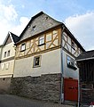 |
Wolfenhausen, Langhecker Weg 2 Location floor: 31, parcel: 14, 15 |
1695 to 1705 |
52720 |
||
 more pictures |
Fountain | Wolfenhausen, lupus road (. In # 11) capable corridor 29, plot 151 |
1884 |
52724 |
|
 |
Overall Wolfenhausen facility | Wolfenhausen location |
52709 |
Web links
Commons : Kulturdenkmäler in Weilmünster - collection of images, videos and audio files
- State Office for Monument Preservation Hessen (Hrsg.): Kulturdenkmäler in Weilmünster In: DenkXweb, online edition of cultural monuments in Hessen
