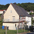
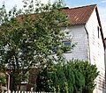
List of cultural monuments in Mengerskirchen
The following list contains the cultural monuments identified in the monument topography in the area of the municipality Mengerskirchen , district Limburg-Weilburg , Hesse .
- Note: The order of the monuments in this list is based first on the districts and then on the address; alternatively, it can also be sorted according to the name, the number assigned by the State Office for Monument Preservation or the construction time.
The basis is the publication of the Hessian list of monuments, which was created for the first time on the basis of the Monument Protection Act of September 5, 1986 and has been continuously updated since then.
Dillhausen
| image | designation | location | description | construction time | Object no. |
|---|---|---|---|---|---|
 |
Gartenfeldstraße 1 Location hallway: 2, parcel: 129 |
1695 to 1705 |
51680 |
||
 |
Gartenfeldstraße 2 Location hall: 2, parcel: 178/1 |
1725 to 1775 |
51687 |
||
 |
Gartenfeldstraße 3 Location hallway: 2, parcel: 128 |
Early 18th century |
51690 |
||
| Overall system | Overall Dillhausen location |
1625 to 1675 |
51676 |
||
 |
"Heiligenhäuschen" chapel | Heiligenhäuschen location hall: 4, parcel: 72 |
A popular pilgrimage site in the middle of the forest in Hansenberg | Early 20th century |
51718 |
 |
Catholic parish church St. Laurentius | Laurentiusstraße 9 Location hallway: 2, parcel: 90 |
Early 20th century |
51678 |
|
 |
Old church tower | Marktstraße 3 Location hall: 2, parcel: 134/1 |
1295 to 1305 |
51692 |
|
 |
Marktstraße 5 Location hallway: 2, parcel: 130, 131 |
Late 18th century |
51693 |
||
 |
Bakehouse | Marktstraße 11 Location hall: 2, parcel: 173/1 |
1821 |
51694 |
|
 |
Marktstraße 14 Location hallway: 2, parcel: 154 |
1695 to 1705 |
51697 |
||
 |
Marktstraße 22 Location hall: 2, parcel: 159 |
1725 to 1775 |
51699 |
||
 |
Marktstraße 26 Location hall: 2, parcel: 166 |
Early 19th century |
51698 |
||
| Marktstraße 7/9 Location hallway: 2, parcel: 175/2, 179 |
1625 to 1675 |
51696 |
|||
 |
Neugasse 6 position hallway: 2, plot: 191/1 |
1695 to 1705 |
51716 |
||
 |
Tunnel entrance | To the slate location hall: 1, parcel: 394 |
51719 |
Mengerskirchen
| image | designation | location | description | construction time | Object no. |
|---|---|---|---|---|---|
 |
Half-timbered house "Am Funkenberg" | On radio Berg 3 position hallway: 58, parcel: 109 |
Half-timbered house in the old town center | Late 18th century |
51638 |
 |
Am Funkenberg 4 location corridor: 58, parcel: 100, 101 |
Half-timbered house in the old town center | 1725 to 1775 |
51639 |
|
 |
Sacred Heart Chapel | Dillhäuser Weg (junction to Maienburg) Location hallway: 13, parcel: 69 |
1895 to 1905 |
51666 |
|
 |
Forest chapel | Dillhäuser Weg (agricultural route to Winkels) Location hallway: 3, parcel: 117/1 |
1795 to 1805 |
51663 |
|
| Elsoffer Straße o. No. Location hall: 1, parcel: 163 |
The barn fell victim to a major fire in August 2003. | 1795 to 1805 |
51640 |
||
 |
Monument 1914/18 | On Elsoffer Straße, location hall: 1, parcel: 167 |
War memorial in the cemetery |
51641 |
|
| Overall system | Entire facility Mengerskirchen location |
51635 |
|||
 |
Wayside shrine | Hauptstraße 29 Location hallway: 4, parcel: 48/2 |
so-called Josefskapelle | Late 19th century |
51643 |
 |
Former Residential building | Hauptstraße 68, location hall: 58, parcel: 244/5 |
House of the 18th / 19th century Century at the former Zehntscheuer, was dilapidated and was demolished in March 2018. | 1795 to 1805 |
51644 |
 |
Hauptstraße 75, corridor location : 58, parcel: 230/2 |
1725 to 1775 |
51645 |
||
 |
Hauptstraße 85, corridor location : 58, parcel: 173/1 |
Left part of a semi-detached house with a show facade on the ridge side. Half-timbering on the street side was plastered. |
51649 |
||
 |
Hauptstraße 90, corridor location : 58, parcel: 89/3 |
So-called. Craftsman's or day laborer's house, presumed half-timbered building around 1700. | 1695 to 1705 |
51648 |
|
 |
Hauptstraße 80/82, corridor location : 58, parcel: 122/1, 123/1 |
Double house (so-called mirror house) built around 1800. Half-timbering was clad. | 1795 to 1805 |
51646 |
|
 |
Museum barn | Hauptstraße 96a, corridor location : 58, parcel: 84/3, 85/1 |
The building was restored about 15 years ago by the “Turmmuseum Schloss Mengerskirchen eV” association. Exhibitions and events take place there every year. Further information is available on the association's website. | 1795 to 1805 |
51642 |
 |
Old nail forge | Kirchplatz 17 Location hall: 58, parcel: 113 |
Half-timbered house in the old town center | 1725 to 1775 |
51653 |
 |
Kirchplatz 19 Location hall: 58, parcel: 114, 119 |
Two-story residential building. The remote stable was demolished as part of the renovation. The basement converted into a garage. | 1745 to 1755 |
51654 |
|
 |
Kirchplatz 4/6 Location hall: 58, parcel: 60, 61, 62 |
1795 to 1805 |
51647 |
||
 |
Cross near the former Holy Cross Church | old country road to Arborn location hall: 11, parcel: 1/1 |
The cast-iron cross probably comes from the church in Mengerskirchen that was demolished in 1847. In the immediate vicinity was the so-called Heiligkreuzkirche, which was first mentioned in 1481. Detailed information is available on the website http://Projekt-Kreuzkirche.de |
51670 |
|
 |
Memorial cross (Baum's cross) above the village, towards Elsoff | Country road to Elsoff Location corridor: 7, parcel: 88/2 |
51667 |
||
 |
Wegekreuz (Wanderer's Cross) on the road to Elsoff | Country road to Elsoff Location hall: 7, parcel: 3 |
1809 |
51668 |
|
 |
Chapel ruins and wayside shrine at the lake pond | Country road to Waldernbach (L 3046) Location floor: 5, parcel: 67 |
51671 |
||
 |
Seemühle am Seeweiher | Country road to Waldernbach (L 3046) Location floor: 15, parcel: 142/3 |
The Seemühle is on the edge of an old quarry opposite the Seeweiher | 1787 |
51672 |
 |
Former City wall at the tithe barn | Main street 68 location |
The tithe barn was demolished in 1973 during the expansion of the state road. The southern city wall, which was also part of the tithe barn, has been preserved and was restored as part of the “urban renewal”. |
51636 |
|
 |
Ringstrasse 5 position hallway: 58, parcel: 205 |
small half-timbered house on the edge of the former city wall |
51656 |
||
 |
Ringstrasse 8 position corridor 58, parcel: 166, 167 |
House from the 18th century with Biedermeier stucco decor | 1725 to 1775 |
51657 |
|
 |
Half-timbered house in the courtyard | Schloßstraße 1 Location Village: 58 plot: 54/1 |
The half-timbering from the 18th or 19th century was slated after the renovation |
51660 |
|
 |
Mengerskirchen Castle | Schloßstraße 3 position hallway: 58 plot: 52/1, 53/6 |
Early 14th century |
51637 |
|
 |
Jewish Cemetery | Pond gardens location corridor: 1, parcel: 117 |
The small cemetery still contains around 10 older, round-arched tombstones. More details in WIKIDATA. |
51661 |
Probbach
| image | designation | location | description | construction time | Object no. |
|---|---|---|---|---|---|
 |
At the Old Church 1 Location Village: 1 parcel: 50 |
1725 to 1775 |
51723 |
||
 |
At the Old Church 3 Location Village: 1 parcel: 49 |
1725 to 1775 |
51737 |
||
 |
Church foundation | At the old church no. Location hall: 1, parcel: 52 |
1698 |
51721 |
|
 |
Bergstraße 3 Location hallway: 1, parcel: 80 |
1695 to 1705 |
51738 |
||
 |
Bergstraße 8/10 Location hall: 1, parcel: 26, 27 |
1625 to 1675 |
51740 |
||
 |
Sauerborn | Brunnenstraße o. No. Location hall: 3, parcel: 50 |
The Sauerbrunnen in Faulbachtal was first mentioned in 1459. The source is an iron-containing calcium-magnesium-hydrogen carbonate acid. |
51744 |
|
 |
Catholic parish church St. Michael | Dillhäuser Straße 10 Location hallway: 1, parcel: 280 |
1868 to 1878 |
51720 |
|
 |
Vicarie House | Schulgasse 1 Location hall: 1, parcel: 6 |
Completion of almost 5 years of renovation work in 2005,
The building was intended to be the residence of the local clergyman, the vicar (hence the vicarage house). |
1698 |
51743 |
 |
Schulgasse 2 Location hallway: 1, parcel: 19 |
1725 to 1775 |
51745 |
||
 |
Schulgasse 4 Location hall: 1, parcel: 15 |
Early 19th century |
51746 |
||
 |
Stegstraße 15 Location hall: 1, parcel: 88 |
1795 to 1805 |
51748 |
||
 |
Stegstraße 23/25 Location floor: 1, parcel: 114, 115, 116, 117 |
1725 to 1775 |
51750 |
Waldernbach
| image | designation | location | description | construction time | Object no. |
|---|---|---|---|---|---|
 |
Catholic parish church of St. Catherine | Kirchstraße 3 Location hall: 26, parcel: 66 |
1878 |
51752 |
|
 |
Kirchstraße 4 Location hall: 26, parcel: 71 |
1875 to 1925 |
51755 |
||
 |
Klingelbachstraße 16 Location floor: 25, parcel: 33/2 |
1725 to 1775 |
51759 |
||
 |
Kornbrunnenstraße 1 Location hall: 26, parcel: 74 |
1725 to 1775 |
51760 |
||
 |
Westerwaldstraße 16 Location floor: 27, parcel: 33/5 |
Early 18th century |
51757 |
||
 |
Westerwaldstraße 25 Location floor: 27, parcel: 27/1 |
1681 |
51762 |
||
 |
Westerwaldstraße 39 Location floor: 25, parcel: 9/2 |
Early 18th century |
51764 |
||
 |
War memorial chapel and parish cross | Westerwaldstraße (L 3046) Location floor: 36, parcel: 49/1 |
1921 |
51766 |
Angle
| image | designation | location | description | construction time | Object no. |
|---|---|---|---|---|---|
| Overall system | Entire plant angle location |
51771 |
|||
 |
Catholic parish church Mariae Birth | Marie Road 1 position hallway: 2, plot: 71, 72 |
1880 |
51774 |
|
 |
Nordweststraße 2 Location hallway: 1, parcel: 284 |
Small houses built around 1800 at the main intersection between the upper and lower villages. | 1795 to 1805 |
51773 |
|
 |
Half-timbered house in the upper village | Oberdorfstraße 8/10 location hall: 2, parcel: 57, 58/1 |
Particularly beautiful half-timbered house, unique in style in the Westerwald area. The compartments are lined with Hessian scratch plaster showing tendrils and figures. |
51775 |
|
 |
Eigenberg castle ruins | Without Address Location Corridor: 4, parcel: 52.122 |
51776 |
||
 |
Wayside cross | On the country road to Mengerskirchen (L 3281), junction Tongrube, location hall: 3, parcel: 44 |
1795 to 1805 |
51777 |
Web links
Commons : Kulturdenkmäler in Mengerskirchen - collection of pictures, videos and audio files
- State Office for Monument Preservation Hessen (Hrsg.): Kulturdenkmäler in Mengerskirchen In: DenkXweb, online edition of Kulturdenkmäler in Hessen
- Worth seeing in the large community Mengerskirchen
