List of cultural monuments in Bad Camberg
The following list contains the cultural monuments identified in the monument topography in the area of the city of Bad Camberg , Limburg-Weilburg district , Hesse .
- Note: The order of the monuments in this list is based first on the districts and then on the address, alternatively it can also be sorted according to the name, the number assigned by the State Office for Monument Preservation or the construction time.
The basis is the publication of the Hessian list of monuments, which was created for the first time on the basis of the Monument Protection Act of September 5, 1986 and has been continuously updated since then.
Bad Camberg
| image | designation | location | description | construction time | Object no. |
|---|---|---|---|---|---|
| Overall system | Bad Camberg location as a whole |
50319 |
|||
 more pictures |
city wall | Without address location |
50320 |
||
 more pictures |
Former Liebersches property | Altoranischer Platz 6 Location hall: 21, parcel: 101, 122, 123/1 |
Late 19th century |
50321 |
|
 more pictures |
Coat of arms stone | Am Amthof 4, location hall: 21, parcel: 98 |
In 1926 the coat of arms stone was embedded in the new courtyard wall of the local pharmacy. It is an arch stone with a deepened mirror and the coats of arms of Kurtrier and Nassau-Orange | 1743 |
50322 |
 more pictures |
Former Amthof | Am Amthof 7-15 location hall: 21, parcel: 85/1, 343/3 |
1625 to 1675 |
50323 |
|
 |
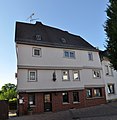
town hall | Chambray-Les-Tours-Platz 1 Location hall: 21, parcel: 97/1 |
1860 |
50324 |
|
 more pictures |
Bächelsgasse 1 Location hall: 21, parcel: 193 |
1675 to 1725 |
50325 |
||
 |
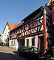
Bächelsgasse 4 Location hall: 21, parcel: 46, 47 |
50326 |
|||
 |
Bächelsgasse 6-8 Location hall: 21, parcel: 49, 50, 53 |
50327 |
|||
 |
Bächelsgasse 7 Location floor: 21, parcel: 201 |
1695 to 1705 |
50328 |
||
 |
Bächelsgasse 16 Location hall: 21, parcel: 58 |
50346 |
|||
 |
Bächelsgasse 19 Location floor: 21, parcel: 239 |
1625 to 1675 |
50329 |
||
 |
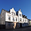
Bächelsgasse 21 Location floor: 21, parcel: 240, 241 |
Early 17th century |
50347 |
||
 |
Bahnhofstrasse 1 position corridor 21, parcel: 442 |
1875 to 1925 |
50350 |
||
 |
Bahnhofstraße 3 Location hall: 21, parcel: 443 |
Late 19th century |
50352 |
||
 |
Bahnhofstraße 16 Location hall: 21, parcel: 459/2 |
1892 |
50353 |
||
 |
Bahnhofstraße 19 Location hall: 26, parcel: 10/2 |
Early 19th century |
50355 |
||
 |
Bahnhofstraße 23 Location hall: 19, parcel: 214/2 |
1903 |
50359 |
||
 |
Bahnhofstraße 25 Location hall: 19, parcel: 247/1 |
1885 |
50356 |
||
 |
Bahnhofstraße 28 Location hall: 19, parcel: 133/5 |
50360 |
|||
 |
Bahnhofstraße 48 Location hall: 19, parcel: 20/2 |
1900 to 1910 |
50362 |
||
 more pictures |
Evangelical parish church and rectory | Burgstrasse 28 Location floor: 44, parcel: 23 |
1897 |
50365 |
|
 more pictures |
Eichbornstraße 2 Location floor: 21, parcel: 188 |
1768 |
50366 |
||
 |
Frankfurter Straße 1 Location hall: 21, parcel: 182 |
1855 to 1865 |
50367 |
||
 |
Frankfurter Straße 3 Location hall: 21, parcel: 181 |
1879 |
50370 |
||
 more pictures |
Frankfurter Straße 6 Location hall: 21, parcel: 435/1 |
Late 19th century |
50369 |
||
 more pictures |
School for the hearing impaired | Frankfurter Straße 15 Location floor: 21, parcel: 387/1, 387/2 |
1903 |
50373 |
|
 more pictures |
Former district court and prison | Frankfurter Straße 17 Location hall: 21, parcel: 374/1 |
1912 |
50376 |
|
| Frankfurter Straße 20 Location floor: 21, parcel: 425/1 |
1885 |
50380 |
|||
 |
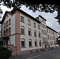
Street cross | Frankfurter Straße 26 Location floor: 21, parcel: 428/15 |
1739 |
50377 |
|
 more pictures |
Former citizen hospital | Gisbert-Lieber-Straße 1 Location hall: 29, parcel: 5/8 |
1861 |
50382 |
|
 |
Memorial stone | Gisbert-Lieber-Straße / Limburger Straße Location hall: 29, parcel: 5/8 |
50384 |
||
 |
1 grave road location corridor 21, parcel: 23/1 |
1595 to 1605 |
50386 |
||
| Grave Straße 2 position corridor 21, plot: 118/1 |
1875 to 1925 |
50389 |
|||
 more pictures |
5 grave road location corridor 21, parcel: 18/1 |
1695 to 1705 |
50387 |
||
 |
7 grave road location corridor 21, parcel: 17/1 |
1695 to 1705 |
50390 |
||
 |
Guttenberger Hof | Guttenbergplatz 1 Location hall: 21, parcel: 152/1 |
The former estate, one of the oldest aristocratic residences in the city, has been owned by the von Hattstein family since 1471. The estate later came into the possession of the von Guttenberg family. The main building was built close to the city wall in 1542. The renovation put the main house back in its original half-timbered construction. | 1501 to 1551 |
50392 |
 |
Former shepherds' houses | Hirtengasse 2,4,6 Location hall: 21, parcel: 320, 321, 322, 323 |
Late 17th century |
50394 |
|
 more pictures |
Old Jewish Cemetery | Kapellenstraße / Danziger Straße location floor: 43, parcel: 187 |
Early 20th century |
50396 |
|
 more pictures |
New Jewish cemetery | Kapellenstrasse o. No. Location floor: 43, parcel: 298 |
1908 |
50397 |
|
 |
Kirchgasse 1 Location hall: 21, parcel: 177 |
1745 to 1755 |
50399 |
||
 |
Kirchgasse 3 Location hall: 21, parcel: 179 |
1717 |
50401 |
||
|
|
Former school | Kirchgasse 5 Location hall: 21, parcel: 180/9 |
1820 |
50402 |
|
 more pictures |
Catholic parish church of St. Peter and Paul | Kirchgasse 7 Location floor: 21, parcel: 190/2 |
50418 |
||
 |
Kirchgasse 8 Location hall: 21, parcel: 37 |
1625 to 1675 |
50420 |
||
 |
Kirchgasse 10 and 12 position the corridor 21, parcel: 38/1, 39/2 |
Early 18th century |
50422 |
||
 |
Kirchgasse 11 Location floor: 21, parcel: 192 |
50424 |
|||
 |
Lahnstraße 2 Location hall: 20, parcel: 108 |
1875 to 1925 |
50426 |
||
 |
Lahnstraße 5 Location floor: 19, parcel: 165 |
1895 to 1905 |
50429 |
||
 |
Limburger Straße 2 Location hall: 21, parcel: 184/1 |
1888 |
50430 |
||
 |
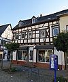
Limburger Straße 8 Location floor: 29, parcel: 204 |
1895 to 1905 |
50432 |
||
 |
Marktplatz 1 Location hall: 21, parcel: 76 |
1460 to 1470 |
50436 |
||
 |
Marktplatz 2 Location hall: 21, parcel: 12/1 |
1676 |
50440 |
||
 more pictures |
Tiefenbach House | Marktplatz 4 Location hall: 21, parcel: 13/1 |
1592 |
50438 |
|
 more pictures |
Marktplatz 7 Location hall: 21, parcel: 242 |
1725 to 1775 |
50441 |
||
 more pictures |
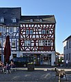
Marktplatz 9 Location hall: 21, parcel: 243 |
50444 |
|||
 more pictures |
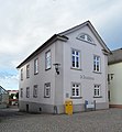
Marktplatz 11 Location hall: 21, parcel: 244 |
1695 to 1705 |
50446 |
||
 more pictures |
Former town hall | Marktplatz 13 Location hall: 21, parcel: 245/1 |
1827 |
50448 |
|
 more pictures |
Neumarkt 3 location hall: 21, parcel: 131/1, 132 |
1845 to 1855 |
50451 |
||
 more pictures |
Former Hohenfeld Chapel (City Museum) | Obertorstraße o. No. Location floor: 21, parcel: 93 |
1656 to 1666 |
50453 |
|
 more pictures |
Obertorturm | Obertorstraße o. No. Location floor: 21, parcel: 334/1 |
1360 to 1370 |
50461 |
|
 more pictures |
Pfarrgasse 1 position corridor 21, plot 36 |
1673 |
50468 |
||
 |
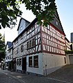
Pfarrgasse 3 position corridor 21, parcel: 35/1 |
1555 to 1565 |
50470 |
||
 more pictures |
Pfarrgasse 7 / 7a Location hall: 21, parcel: 36 |
1707 |
50472 |
||
 |
Pfarrgasse 13 Location hall: 21, parcel: 31 |
Late 17th century |
50484 |
||
 more pictures |
Votive pictures | Rosengasse 1 location hall: 21, parcel: 285 |
1762 |
50482 |
|
 |
Rotezäunstraße 8 Location hall: 29, parcel: 234/3 |
50486 |
|||
 |
Schmiedgasse 2 Location hall: 21, parcel: 156/2 |
50489 |
|||
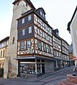
 |
Schmiedgasse 6 Location hall: 21, parcel: 154 |
1704 |
50490 |
||
 |
Strackgasse 3 location hall: 21, parcel: 176 |
50495 |
|||
 |
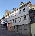
Strackgasse 4, location hall: 21, parcel: 164/1 |
1695 to 1705 |
50499 |
||
 |
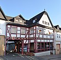
Strackgasse 8 Location hall: 21, parcel: 162 |
1725 to 1775 |
50497 |
||
 |
Strackgasse 10 location hall: 21, parcel: 161 |
50502 |
|||
 |
Strackgasse 14 Location hall: 21, parcel: 159/1 |
50504 |
|||
 |
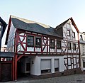
Strackgasse 16 Location hall: 21, parcel: 5/1 |
50508 |
|||
 |
Strackgasse 22/24 Location floor: 21, parcel: 9, 10, 11 |
50510 |
|||
 more pictures |
Way of the Cross | Without address Location corridor: 33, 42, 43, parcel: 33: 38, 53, 45, 2/3; |
The Seven Footfalls are a way of the cross between the cemetery of Bad Camberg and the Kreuzkapelle, laid out around 1700. |
50512 |
|
 |
Catholic Kreuzkapelle (pilgrimage church) and Stations of the Cross | Without Address Location hall: 33, parcel: 3/1 |
1683 |
50517 |
|
 |
Former sexton's house (near the Kreuzkapelle) | Without Address Location hall: 33, parcel: 6/2 |
50519 |
||
 more pictures |
Sub-gate tower | Strackgasse no. Location floor: 21, parcel: 178/1, 29/6, 176 |
68993 |
Individual evidence
- ^ City of Bad Camberg - Tourist Information: Sign on the residential building .
Dombach
| image | designation | location | description | construction time | Object no. |
|---|---|---|---|---|---|
| Hauptstrasse 12 position hallway: 16, plot 54 |
1725 to 1775 |
50531 |
|||
 more pictures |
Old Town Hall School | Hauptstraße 14, corridor location : 16, parcel: 55/1 |
1757 |
50533 |
|
 more pictures |
Catholic parish church of St. Wendelin | Hauptstraße 4, corridor location : 16, parcel: 38/3 |
1876 |
50534 |
|
| Hauptstraße 19 Location hall: 15, parcel: 57/2 |
Late 18th century |
50541 |
|||
| Hauptstraße 20 Location hall: 15, parcel: 33 |
1895 to 1905 |
50542 |
|||
| Hauptstraße 21 Location hall: 15, parcel: 56/1 |
1725 to 1775 |
50544 |
|||
| Behind Gasse 4 position hallway: 16, plot 41 |
1695 to 1705 |
50547 |
Erbach
| image | designation | location | description | construction time | Object no. |
|---|---|---|---|---|---|
| Overall system | Entire facility Erbach location |
50548 |
|||
 more pictures |
Catholic Church tower and grave crosses | Am Kirchberg 5 Location Village: 13 plot: 427/1 |
1095 to 1105 |
50571 |
|
 |
Granulator | Hof-Gnadenthalstraße 23 Location hallway: 16, parcel: 150/1 |
1795 to 1805 |
50572 |
|
 |
Erlenbachstraße 21 Location hallway: 14, parcel: 175/3 |
1725 to 1775 |
50573 |
||
 more pictures |
Erlenbachstraße 45 Location hallway: 14, parcel: 152/2 |
1895 to 1905 |
50574 |
||
 |
Limburger Straße 111 Location floor: 12, parcel: 235/2 |
1905 |
50575 |
||
 |
Limburger Straße 115 Location floor: 12, parcel: 243/1 |
50576 |
|||
 |
town hall | Limburger Straße 120 Location hallway: 14, parcel: 81/3 |
1828 |
50577 |
|
| Limburger Straße 129 Location floor: 14, parcel: 340/2 |
1876 |
50578 |
|||
 |
Limburger Straße 134 Location floor: 15, parcel: 56/4 |
Early 18th century |
50580 |
||
 |
Inn | Limburger Straße 151 Location floor: 15, parcel: 208/144 |
1895 to 1905 |
50579 |
|
 |
Limburger Straße 154 Location floor: 15, parcel: 87 |
1725 to 1775 |
50581 |
||
 |
Limburger Straße 156/158 Location floor: 15, parcel: 88, 90/1 |
1719 |
50582 |
||
 more pictures |
Limburger Straße 161 Location floor: 15, parcel: 137 |
50583 |
|||
 more pictures |
Limburger Straße 163 Location floor: 15, parcel: 230/136 |
1695 to 1705 |
50584 |
||
 |
Catholic rectory | Limburger Straße 170 Location floor: 13, parcel: 63/1 |
1900 |
50585 |
|
| Hof-Gnadenthalstraße 19 Location hall: 14, parcel: 408/1 |
86998 |
||||
| Horstweg o. No. Location floor: 9, parcel: 127 |
87002 |
Oberselters
| image | designation | location | description | construction time | Object no. |
|---|---|---|---|---|---|
| Old town hall and school | Brunnenstraße 23/25 Location hall: 1, parcel: 4/11 |
1752 to 1802 |
50586 |
||
 |
Catholic parish church of St. Antonius | Brunnenstraße 36 Location floor: 1, parcel: 77, 142/76 |
1775 to 1785 |
50587 |
|
| Emsbach Bridge | Brunnenstraße o. No. Location floor: 6, parcel: 37/1 |
Two-arched, classicistically structured road bridge with ashlar cladding made of whitish marble over the Emsbach from the 2nd half of the 19th century. | Late 19th century |
50588 |
|
| Former hammer mill | Hammer web 6 Location Village: 6, parcel: 160 |
1780 |
50589 |
Schwickershausen
| image | designation | location | description | construction time | Object no. |
|---|---|---|---|---|---|
| Field cross | Without Address Location Corridor: 3, parcel: 36 |
1875 to 1925 |
50590 |
||
| Wayside shrine | Without Address Location Corridor: 3, parcel: 144 |
1895 to 1905 |
50591 |
||
| Old school | On the Lück 17 corridor location : 1, parcel: 133/1 |
1835 |
50592 |
||
 |
Catholic parish and pilgrimage church of St. Georg | Heiligenwaldstraße 1 Location floor: 1, parcel: 264, 254 |
1787 |
50594 |
Choke
| image | designation | location | description | construction time | Object no. |
|---|---|---|---|---|---|
| Overall system | Entire facility Würges location |
1745 to 1755 |
50595 |
||
 more pictures |
Chapel to the Holy Family | Without Address Location Corridor: 2, parcel: 135 |
The small, neo-Gothic brick field chapel was built in 1908 by a local family, who thereby fulfilled their vow about the priesthood of their son. | 1908 |
50596 |
 more pictures |
Post Office Gate | Alsdorfer Straße 1 Location hall: 3, parcel: 184/10 |
1802 |
50598 |
|
 |
Frankfurter Straße 150 Location hall: 3, parcel: 253/1 |
1725 to 1775 |
50597 |
||
 |
Schulstraße 3 Location hallway: 3, parcel: 29/1 |
1725 to 1775 |
50599 |
||
 more pictures |
Post Office Gate | Schulstraße 8 Location hallway: 3, parcel: 23/1 |
50600 |
||
 |
Former school | Schulstraße 79 Location hallway: 1, parcel: 210/7 |
In 1829 the now listed school was built. The two-storey, 7-axis plastered framework was built outside of the older town center and is a typical larger country school according to the Nassau school edict of March 24, 1817. The roof is given a lively shape by the eaves and supporting hips. | 1829 |
50601 |
 more pictures |
Catholic Parish Church of St. Ferrutius | Schulstraße 48 Location hall: 3, parcel: 122/1 |
The Catholic Church in Würges was built between 1833 and 1835 by Joh. Lossen. | 1838 |
50602 |
 more pictures |
Emsbach Bridge | Schulstraße o. No. Location floor: 3, parcel: 64/1 |
Two-arch quarry stone bridge from the middle of the 19th century with a rounded center post, a cornice at road level and parapet walls (partially reconstructed). | 1825 to 1875 |
50603 |
Web links
Commons : Kulturdenkmäler in Bad Camberg - Collection of pictures, videos and audio files
- State Office for Monument Preservation Hessen (Ed.): Cultural monuments in Bad Camberg In: DenkXweb, online edition of cultural monuments in Hesse

