List of cultural monuments in Triebischtal (Meißen)
The list of cultural monuments in Triebischtal (Meissen) contains the cultural monuments of the district Triebischtal the district Meissen . It is located south of the old town of the district town of Meißen along the Triebisch on the left bank of the Elbe in the district of Meißen . The listed objects were recorded in the list of monuments by the State Office for Monument Preservation Saxony as of 2017. It is a partial list of the list of cultural monuments in Saxony .
Legend
- Image: shows a picture of the cultural monument and, if applicable, a link to further photos of the cultural monument in the Wikimedia Commons media archive
- Designation: Name, designation or the type of cultural monument
-
Location: If available, street name and house number of the cultural monument; The list is basically sorted according to this address. The map link leads to various map displays and gives the coordinates of the cultural monument.
- Map view to set coordinates. In this map view, cultural monuments are shown without coordinates with a red marker and can be placed on the map. Cultural monuments without a picture are marked with a blue marker, cultural monuments with a picture are marked with a green marker.
- Dating: indicates the year of completion or the date of the first mention or the period of construction
- Description: structural and historical details of the cultural monument, preferably the monument properties
-
ID: is awarded by the State Office for the Preservation of Monuments in Saxony. It clearly identifies the cultural monument. The link leads to a PDF document from the State Office for the Preservation of Monuments in Saxony, which summarizes the information on the monument, contains a map sketch and often a detailed description. For former cultural monuments sometimes no ID is given, if one is given, this is the former ID. The corresponding link leads to an empty document at the state office. The following icon can also be found in the ID column
 ; this leads to information on this cultural monument at Wikidata .
List of cultural monuments in Triebischtal (Meißen)
| image | designation | location | Dating | description | ID |
|---|---|---|---|---|---|
| Sixth mill (so-called) | At the Hohen Eifer 1 (map) |
inscribed 1525 (mill), 1st half of the 19th century (auxiliary building) | Former mill with side building; Of importance in terms of building history, local history and technology history |
09266009 |
|
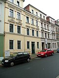 |
Double tenement house in closed development | Böttgerstrasse 1; 2 (card) |
End of the 19th century (double tenement house) | From an urban and architectural point of view of importance, a Wilhelminian style building with a shop fitting |
09265988 |
 |
Apartment building in closed development | Böttgerstrasse 3 (map) |
1890s (tenement) | Significant in terms of urban development and architectural history, a Wilhelminian style house (clinker brick facade) |
09265989 |
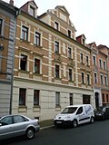 |
Apartment building in closed development | Böttgerstrasse 4 (map) |
marked 1897 (tenement house) | Significant in terms of urban development and architectural history, a Wilhelminian style house (clinker brick facade) |
09265990 |
 |
Apartment building in half-open development | Böttgerstrasse 5; 6 (card) |
around 1880 (tenement) | Urban planning and building history of importance, a Wilhelminian style building (plastered facade) |
09265991 |
 |
Apartment building in semi-open development and corner location | Böttgerstrasse 10 (map) |
around 1880 (tenement) | Significant in terms of urban development and architectural history, a Wilhelminian style house, well-structured plastered facade |
09265980 |
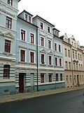 |
Apartment building in closed development | Böttgerstrasse 11 (map) |
around 1880 (tenement) | From an urban and architectural point of view of importance, a Wilhelminian style house |
09265981 |
 |
Apartment building in closed development, corner location | Crassostraße 1 (map) |
after 1895 (tenement) | Significant in terms of urban development and architectural history, a representative Wilhelminian style house (clinker brick facade, corner tower) |
09266034 |
 |
Apartment building in half-open development | Crassostraße 2 (map) |
after 1895 (tenement) | Significant in terms of urban development and architectural history, a Wilhelminian style house (clinker brick facade) |
09266036 |
 |
Apartment building in half-open development | Crassostraße 14 (map) |
after 1895 (tenement) | Significant in terms of urban development and architectural history, a Wilhelminian style house (clinker brick facade) |
09266037 |
 |
Apartment building in closed development, corner location | Crassostraße 15 (map) |
after 1895 (tenement) | Significant in terms of urban development and building history, a Wilhelminian style house (clinker brick facade, corner tower) |
09266035 |
| Villa with enclosure, formerly a manufacturer's villa | Goldgrund 15 (card) |
2nd half of the 19th century (manufacturer's villa) | Architecturally and historically important, a house in the Swiss style |
09265789 |
|
| Villa with enclosure | Hirschbergstrasse 2 (map) |
1874/1875 (villa) | Significant in terms of town planning, building history and local history, home of the Mayor of Meissen, Karl Richard Hirschberg (d. 1886) |
09265853 |
|
| Residential house in open development, with (secondary built-in) seating niche portal | Hirschbergstrasse 3 (map) |
1880s (residential building), marked 1540 (seat niche portal) | Wilhelminian style building, of architectural and local significance, the Renaissance portal of artistic importance, the Renaissance seat niche portal comes from a building in the old town |
09265854 |
|
 |
Apartment building in half-open development | Hirschbergstrasse 14 (map) |
1880s (tenement) | of importance in terms of urban development and architectural history |
09265833 |
| Apartment building in semi-open development and corner location | Hirschbergstrasse 17 (map) |
1881 (tenement house) | Wilhelminian style building, plastered facade still with a classicistic effect, of importance in terms of urban planning and architectural history |
09265834 |
|
 |
Apartment building in half-open development | Hirschbergstrasse 24a (map) |
around 1900 (tenement) | Architecturally important, a Wilhelminian style house in the style of late historicism |
09265803 |
| Meissen-Triebischtal railway station; Borsdorf – Coswig railway line; Narrow-gauge railway Wilsdruff – Döbeln-Gärtitz | Hirschbergstrasse 24 (opposite) | 1910 (reception building) | Station building of a train station; Last structural testimony of the formerly important Meißen-Triebischtal train station and the terminus of the first section of the narrow-gauge Wilsdruff – Döbeln-Gärtitz line in the Wilsdruff narrow-gauge network, as well as the station on the Borsdorf – Coswig railway line (6386; see above BC), for railroad structures rarely elongated In plastered construction with service rooms and waiting hall, of importance in terms of building history and traffic history |
09306618 |
|
 |
Residential house in semi-open development, designed as a closed development | Hirschbergstrasse 60 (map) |
around 1900 (residential building) | From an urban and architectural point of view of importance, a Wilhelminian style house |
09265395 |
| Residential building in closed development | Hirschbergstrasse 70 (map) |
1st half of the 19th century (residential building) | Significant in terms of urban planning and building history, pre-prehistoric building |
09265832 |
|
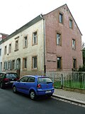 |
Residential house in semi-open development | Hirschbergstrasse 72 (map) |
around 1870 (residential building) | Characteristic building from the 1860s to 1870s (three-gang house), with balanced proportions, simple facade design and small open entrance porch, important in terms of building and urban development history |
09265831 |
 |
Apartment building in closed development | Höroldtstrasse 2 (map) |
Late 19th century (tenement house) | historically important, a Wilhelminian style house |
09265973 |
 |
Apartment building in closed development, corner location | Ilschnerstrasse 12 (map) |
1880s (tenement) | From an urban and architectural point of view of importance, a Wilhelminian style house |
09266022 |
 |
Residential house in closed development and corner location | Jaspisstrasse 1 (map) |
2nd half of the 19th century (residential building) | From an urban point of view of importance, an early Wilhelminian style building (three-gang house) with a shop fitting |
09266017 |
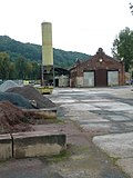 |
Former tram station, wagon and railcar shed | Jaspisstraße 11 (map) |
1899 (tram depot), 1899 (administration building) | Former tram station, wagon and railcar shed as well as administrative building for the former Meißner tram (today part of Triebischtal station), as well as the partially preserved rails; Significant in terms of local history, technology history and architectural history, raw brick buildings from the Wilhelminian era with neo-Gothic elements |
09266024 |
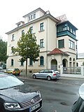 |
Residential house in open development in a corner, with outbuildings and fencing | Karl-Niesner-Strasse 1 (map) |
after 1905 (residential building) | Significant in terms of town planning and building history, a building in the reform style of the period after 1900 |
09265935 |
 |
Administration building in the half-open development of a factory | Karl-Niesner-Strasse 7 (map) |
around 1890 (administration building) | of importance in terms of urban planning, local history and architectural history, a Wilhelminian style building (multi-colored clinker brick facade) |
09265934 |
| Apartment house in open development and corner location | Kerstingstrasse 4 (map) |
marked 1914 (tenement) | Significant in terms of urban development and architectural history, a building in the reform style of the period after 1910, facade with monumental bay windows |
09265847 |
|
| Material entirety, St. Nicolai cemetery (also Neuer Nikolaifriedhof) | Lerchaweg (map) |
around 1910 (cemetery) | Material aggregate Friedhof St. Nicolai (also New Nikolaifriedhof), with the individual monuments: chapel, morgue as well as several grave monuments and the war memorial for the fallen of the First World War (see also individual monument list Obj. 09301257) as well as the aggregate parts: enclosure wall and cemetery design; Significant in terms of local and architectural history, the location above the Triebisch Valley, the chapel was built in the reform style around 1910 |
09266132 |
|
| St. Nicolai Cemetery (also New Nikolaifriedhof): Chapel and separate morgue | Lerchaweg (map) |
around 1910 (cemetery), 1916/1926 (tomb), around 1910 (mortuary), around 1910 (cemetery chapel), 1920s (war memorial) | Individual features of the aggregate cemetery St. Nicolai (also Neuer Nikolaifriedhof): chapel and separately standing morgue as well as some tombs and the war memorial for the fallen of the First World War (see also aggregate list Obj. 09266132); Significant in terms of local and architectural history, the location above the Triebisch Valley, the chapel was built in the reform style around 1910 |
09301257 |
|
| Apartment building in open development | Lerchaweg 2 (map) |
1890s (tenement) | Significant in terms of urban development and architectural history, a Wilhelminian style house (clinker brick facade) with an accentuated hood |
09266131 |
|
 |
Apartment building in a residential complex | Leschnerstrasse 5; 6 (card) |
marked 1927 (double house) | Significant in terms of building history, with echoes of the Art Deco style |
09266020 |
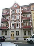 |
Apartment building in semi-open development, designed as a closed development | Lessingstrasse 2 (map) |
after 1895 (tenement) | Significant in terms of urban development and architectural history, a Wilhelminian style house (clinker brick facade) |
09265953 |
 |
Apartment building in closed development | Lessingstrasse 6 (map) |
Late 19th century (tenement house) | From an urban and architectural point of view of importance, an early Wilhelminian style building |
09265959 |
 |
Apartment building in closed development | Lessingstrasse 7 (map) |
Late 19th century (tenement house) | From an urban and architectural point of view of importance, an early Wilhelminian style building |
09265958 |
 |
Apartment building in closed development | Lessingstrasse 8 (map) |
Late 19th century (residential building) | From an urban and architectural point of view of importance, an early Wilhelminian style building |
09265957 |
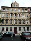 |
Apartment building in closed development | Moritzstrasse 3 (map) |
around 1890 (tenement) | Significant in terms of urban development and architectural history, a Wilhelminian style house (clinker brick facade) |
09265940 |
 |
Apartment building in closed development | Moritzstrasse 4 (map) |
around 1890 (tenement) | Significant in terms of urban development and architectural history, a Wilhelminian style house (clinker brick facade) |
09265939 |
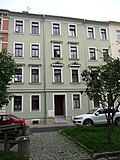 |
Apartment building in closed development | Moritzstrasse 5 (map) |
1880s (tenement) | of urban significance |
09265938 |
 |
Apartment building in closed development | Moritzstrasse 7 (map) |
Late 19th century (tenement house) | From an urban and architectural point of view of importance, a Wilhelminian style house |
09265948 |
 |
Residential building in closed development | Moritzstrasse 9 (map) |
2nd half of the 19th century (residential building) | Significant in terms of urban development and architectural history, an early Wilhelminian style building from the 1860s to 1870s (three-gabled house) |
09265947 |
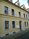 |
Residential building in closed development | Moritzstrasse 10 (map) |
2nd half of the 19th century (residential building) | Significant in terms of urban development and architectural history, an early Wilhelminian style building from the 1860s to 1870s (three-gabled house) |
09265946 |
 |
Residential building in closed development | Moritzstrasse 11 (map) |
2nd half of the 19th century (residential building) | Significant in terms of urban development and architectural history, an early Wilhelminian style building from the 1860s to 1870s (three-gabled house) |
09265945 |
 |
Residential house in closed development and corner location | Moritzstrasse 13 (map) |
2nd half of the 19th century (residential building) | From an urban and architectural point of view of importance, an early Wilhelminian style building from the 1860s to 1870s |
09265943 |
 |
Wetzel mill | Mühlweg 23 (map) |
Origin 16th century (mill), marked 1883 (mill) | Mill with all buildings (mill, residential and office building, two side buildings, two millstones at the driveway, silo, mill technology, mountain cellar) as well as the enclosure of the property; scientifically, historically, locally, artistically and technically of importance, important mill structure |
09266049 |
 More pictures |
Nikolaikirche: Old church and enclosure wall with remaining baroque tombs (formerly a surrounding churchyard, old Nikolaifriedhof, today a park) and a monument to Samuel Hahnemann | Neumarkt 29 (map) |
13th century (church), 1923-1929 conversion to memorial (church) | old parish church in Triebischtal, 1923-1929 after removal of the equipment, conversion of the church into a memorial for the fallen of the First World War, everything in Meissen porcelain (sculptor: Emil Börner ), remains of Romanesque wall paintings, of urban, artistic and architectural significance |
09265855 |
 |
Apartment building in open development | Ossietzkystraße 30 (map) |
around 1900 (tenement) | From an urban and architectural point of view of importance, a Wilhelminian style house in the style of the German neo-renaissance |
09266253 |
 |
Meißen cultural center | Ossietzkystraße 37 (map) |
1950s (Kulturhaus) | Kulturhaus, above the entrance tile picture with a scene from working life; Architecturally important, characteristic building of the traditionally conservative GDR post-war architecture of the 1950s |
09266254 |
 |
Apartment building in semi-open development, designed as a closed development | Ossietzkystraße 40 (map) |
around 1910 (tenement) | Significant in terms of urban planning and building history, a building in the reform style of around 1910 |
09266252 |
 |
Apartment building in semi-open development, designed as a closed development | Ossietzkystraße 43 (map) |
1890s (tenement) | Significant in terms of urban development and architectural history, a Wilhelminian style house (clinker brick facade) |
09266248 |
 |
Apartment building in closed development | Ossietzkystraße 45 (map) |
marked 1901 (tenement house) | From an urban and architectural point of view of importance, a Wilhelminian style house |
09266246 |
 |
German jute spinning and weaving mill (formerly); VEB Tetex (formerly) | Schützestrasse 1 (map) |
around 1890 (part of the textile industry) | Remains of a former spinning and weaving mill, with the old forge, the chimney, surrounding walls and facades / walls of the gable ends; of local and technological importance, an industrial building with brick and quarry stone facades |
09265999 |
 |
Pumping station (formerly): Former pumping station | Schützestrasse 4 (map) |
around 1900 (water supply and sewage system) | Significant in terms of local history and technology, interesting industrial building from the turn of the century around 1900 with clinker brick structure |
09265993 |
 |
Residential house in semi-open development | Schützestrasse 5 (map) |
2nd half of the 19th century (residential building) | of importance in terms of urban planning, building history and social history |
09265998 |
 |
Residential building in closed development | Schützestrasse 6 (map) |
2nd half of the 19th century (residential building) | of importance in terms of urban planning, building history and social history |
09265997 |
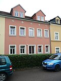 |
Residential building in closed development | Schützestrasse 7 (map) |
2nd half of the 19th century (residential building) | of importance in terms of urban planning, building history and social history |
09265996 |
 |
Residential house in closed development and corner location | Schützestrasse 8 (map) |
2nd half of the 19th century (residential building) | Significant in terms of urban planning and building history, location on Talstrasse that defines the cityscape |
09265995 |
 |
Apartment building in half-open development | Talstrasse 6 (map) |
marked 1888 (tenement house) | Significant in terms of urban planning and building history, a Wilhelminian style house with a corner bay that characterizes the street |
09265617 |
 |
Talbad: Badanstalt | Talstrasse 7 (map) |
End of the 19th century (bathing establishment) | In terms of local history and architecture, it is the oldest public bathing establishment in Meissen |
09265618 |
 |
Meissen Porcelain Manufactory | Talstrasse 9 (map) |
1861-1863, marked 1861 (manufacture) | Meißner Porzellanmanufaktur, including building A (painting / shipping, 1860/1911), B (painting / rough production 1861/1923), D (management 1861, connector 1914/15, exhibition hall 1914/15), E (mold production / painting 1871), S (Schlämmerei / School 1861), X (raw material store, without transition, 1884); Artistically, historically, structurally and historically, an important industrial building, the main building in neo-Gothic style, an extension in the reform style from around 1910 |
09266040 |
 |
Monument to Johann Friedrich Böttger | Talstrasse 9 (opposite) (map) |
marked 1891 (monument) | artistically and historically important |
09266041 |
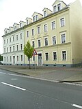 |
Double tenement house | Talstrasse 14; 15 (card) |
around 1880 (double tenement house) | Significant in terms of urban development and architectural history, Wilhelminian style houses |
09265942 |
 |
Apartment building in semi-open development and corner location | Talstrasse 17 (map) |
1880s (tenement) | From an urban and architectural point of view of importance, a Wilhelminian style house |
09265941 |
 |
Double tenement house in closed development | Talstrasse 18; 19 (card) |
End of the 19th century (double tenement house) | From an urban and architectural point of view of importance, a Wilhelminian style house |
09265955 |
 |
Residential house in semi-open development | Talstrasse 21 (map) |
2nd half of the 19th century (residential building) | From an urban and architectural point of view of importance, a Wilhelminian style house |
09265956 |
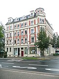 |
Apartment house in a corner | Talstrasse 23 (map) |
before 1900 (tenement) | Significant in terms of urban development and architectural history, a Wilhelminian-style house (clinker brick facade, corner bay window with tower), with built-in shops, location on Wilhelm-Walkhoff-Platz that characterizes the street |
09265954 |
 |
Apartment building in closed development | Talstrasse 25 (map) |
Late 19th century (tenement house) | of importance in terms of urban planning and building history, a Wilhelminian style house (formerly with shop fitting) |
09265965 |
 |
Apartment buildings in a residential complex (with Wettinstrasse 33-35) in closed development | Talstrasse 29; 30 (card) |
1928 (residential building) | Of importance in terms of urban development and architectural history, Heimatstil buildings |
09269140 |
| Apartment building in closed development | Talstrasse 47 (map) |
Late 19th century (tenement house) | From an urban and architectural point of view of importance, a Wilhelminian style house |
09266018 |
|
 |
Apartment building in half-open development | Talstrasse 50 (map) |
1880s (tenement) | From an urban and architectural point of view of importance, a Wilhelminian style house |
09266023 |
 |
Factory owner's villa with wrought iron enclosure | Talstrasse 55 (map) |
around 1890 (manufacturer's villa) | Significant in terms of local history and architectural history, a building in the style of late historicism (with a massive veranda), formerly part of the Schützestrasse 1 factory (jute spinning mill) |
09266000 |
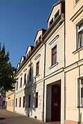 |
Residential building in closed development | Talstrasse 58 (map) |
2nd half of the 19th century (residential building) | Significant in terms of urban planning and building history, an early Wilhelminian style house |
09265994 |
 |
Apartment building in closed development | Talstrasse 62 (map) |
Late 19th century (tenement house) | From an urban and architectural point of view of importance, a Wilhelminian style house |
09265984 |
 |
Apartment building in closed development | Talstrasse 69 (map) |
Late 19th century (tenement house) | From an urban and architectural point of view of importance, a Wilhelminian style house with a shop fitting |
09265986 |
 |
Apartment building in closed development and corner location | Talstrasse 70 (map) |
Late 19th century (tenement house) | Significant in terms of urban planning and building history, a Wilhelminian style house with a shop fitting, a street-defining location on Wilhelm-Walkhoff-Platz |
09265967 |
 |
Apartment building in closed development and corner location | Talstrasse 71 (map) |
Late 19th century (tenement house) | Significant in terms of urban development and architectural history, a Wilhelminian style house with a shop fitting, a street-defining location on Wilhelm-Walkhoff-Platz with a tower-like corner formation |
09266030 |
 |
Apartment building in closed development | Talstrasse 75 (map) |
Late 19th century (tenement house) | From an urban and architectural point of view of importance, a Wilhelminian style house |
09266031 |
 |
Apartment building in closed development | Talstrasse 76 (map) |
Late 19th century (tenement house) | From an urban and architectural point of view of importance, a Wilhelminian style house |
09266032 |
 |
Apartment building in closed development | Talstrasse 77 (map) |
before 1900 (tenement) | Significant urban development and architectural history, representative Gründerzeit house (clinker brick facade) |
09266033 |
 |
Apartment building in half-open development | Talstrasse 78 (map) |
before 1900 (tenement) | Significant in terms of urban planning and building history, a representative Wilhelminian-style house (clinker facade, stepped gable) with a shop fitting |
09269142 |
 |
Kurzsche Druckerei; Paper mill CC Kurz (formerly) | Talstrasse 80a; 80b; 80c; 80d; 80e; 80f; 80g; 80h; 80i (card) |
around 1900 (printer) | Former printing house (now converted into apartments) with gate pillars, wall and wrought iron fence; In terms of technology, local history and urban development, it is of importance, industrial construction as raw brick construction |
09266038 |
 |
Mill, house and outbuildings, with fencing | Talstrasse 81 (map) |
1st half of the 19th century (mill) | Of significance in terms of technology, local history and architectural history |
09266380 |
 More pictures |
Catholic parish church St. Benno | Wettinstrasse 15 (map) |
1885-1887 (church) | Catholic Church; artistically, in terms of town planning and building history of importance, a building in the style of historicism (brick neo-Gothic) |
09265933 |
 |
Triebischtalschule | Wettinstrasse 19 (map) |
1877 (school), 1888-1892 (school expansion) | School; Significant in terms of local history and architectural history, a building in the style of late historicism with gables that characterize the street scene |
09265937 |
 |
Apartment building in half-open development, but designed as a closed development | Wettinstrasse 27 (map) |
around 1900 (tenement) | Significant in terms of urban development and architectural history, a Wilhelminian style house (clinker brick facade, Art Nouveau with floral details, eagle with spread wings above the portal), the balconies and the gable with turrets characterize the street |
09265949 |
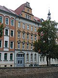 |
Apartment building in closed development | Wettinstrasse 28 (map) |
marked 1898 (tenement house) | Significant in terms of urban development and architectural history, a Wilhelminian style house (clinker brick facade), stepped gable that defines the street scene |
09265950 |
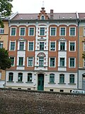 |
Apartment building in closed development | Wettinstrasse 29 (map) |
before 1900 (tenement) | Significant in terms of urban development and architectural history, a Wilhelminian style house (clinker brick facade) |
09265951 |
 |
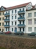
Apartment building in closed development and corner location | Wettinstrasse 30 (map) |
around 1890 (tenement) | From an urban and architectural point of view of importance, a Wilhelminian style house, corner balconies that characterize the street |
09265952 |
 |
Apartment building in closed development | Wettinstrasse 31 (map) |
Late 19th century (tenement house) | From an urban and architectural point of view of importance, a Wilhelminian style house |
09265960 |
 |
Apartment building in closed development | Wettinstrasse 32 (map) |
Late 19th century (tenement house) | From an urban and architectural point of view of importance, a Wilhelminian style house |
09265961 |
 |
Apartment houses in a residential complex in closed and half-open buildings | Wettinstrasse 33; 34; 35 (card) |
marked 1928 (residential building) | Of importance in terms of urban development and architectural history, Heimatstil buildings |
09265962 |
 |
Apartment building in closed development | Wilhelm-Walkhoff-Platz 2 (map) |
Late 19th century (tenement house) | From an urban and architectural point of view of importance, a Wilhelminian style house |
09265968 |
 |
Apartment building in closed development and corner location | Wilhelm-Walkhoff-Platz 3 (map) |
before 1900 (tenement) | Significant in terms of urban development and architectural history, a Wilhelminian style house (clinker brick facade) |
09265969 |
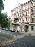 |
Apartment building in semi-open development, designed as a closed development | Wilhelm-Walkhoff-Platz 4 (map) |
around 1890 (tenement) | Significant in terms of urban development and architectural history, a Wilhelminian style house (clinker brick facade), balconies that characterize the square |
09266028 |
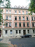 |
Apartment building in closed development | Wilhelm-Walkhoff-Platz 5 (map) |
around 1890 (tenement) | Significant in terms of urban development and architectural history, a Wilhelminian style house (clinker brick facade) |
09266029 |
 More pictures |
Luther Church | Wilhelm-Walkhoff-Platz 7 (map) |
1901-1909 (church), 1845 (organ work), 1904 (organ brochure) | Church of Meißen-Triebischtal; artistically, in terms of town planning and building history, a building in the style of historicism (neo-Gothic with Art Nouveau furnishings) |
09265966 |
| Apartment building in closed development | Wittigstrasse 1 (map) |
1890s (tenement) | historically important, a Wilhelminian style house (clinker brick facade) |
09265974 |
|
 |
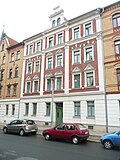
Apartment building in closed development | Wittigstrasse 2 (map) |
1890s (tenement) | historically important, a Wilhelminian style house (clinker brick facade) |
09265975 |
 |
Apartment building in closed development | Wittigstrasse 3 (map) |
1890s (tenement) | historically of importance, a Wilhelminian style house (clinker facade, volute gable) |
09265976 |
 |
Apartment building in closed development | Wittigstrasse 4 (map) |
1890s (tenement) | historically important, a Wilhelminian style house (two-tone clinker brick facade) |
09265977 |
 |
Apartment building in a half-open, now closed building | Wittigstrasse 5 (map) |
1890s (tenement) | Architecturally important, a Wilhelminian style house (clinker facade, stepped gable) |
09265978 |
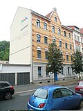 |
Apartment building in half-open development, but designed as a closed development | Wittigstrasse 16 (map) |
before 1900 (tenement) | historically important, a Wilhelminian style house (clinker brick facade) |
09265972 |
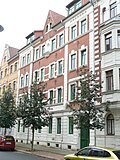 |
Apartment building in closed development | Wittigstrasse 17 (map) |
before 1900 (tenement) | historically important, a Wilhelminian style house (clinker brick facade) |
09265971 |
 |
Apartment building in closed development and corner location | Wittigstrasse 18 (map) |
before 1900 (tenement) | Significant in terms of urban planning and building history, a Wilhelminian style house (clinker brick facade, bay window), location on Wilhelm-Walkhoff-Platz that characterizes the square |
09265970 |
Former cultural monuments
| image | designation | location | Dating | description | ID |
|---|---|---|---|---|---|
| Bus shelter | Talstrasse (map) |
Bus shelter (bus stop) was demolished |
|
Web links
Commons : Triebischtal (Meißen) - Collection of images, videos and audio files