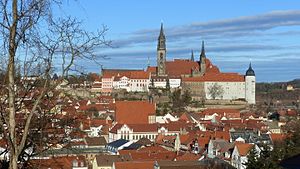
List of cultural monuments in Meißen (left Elbe)
The list of cultural monuments in Meißen (left Elbe ) contains the cultural monuments of the district town of Meißen in the district of Meißen located on the left bank of the Elbe . These around 800 listed objects were recorded in the list of monuments by the State Office for Monument Preservation Saxony as of 2013. It is a partial list of the list of cultural monuments in Saxony .
The 400 or so cultural monuments located on the right bank of the Elbe, including the old town, are shown in the list of cultural monuments in Meissen (right bank of the river) .
Legend
- Image: shows a picture of the cultural monument and, if applicable, a link to further photos of the cultural monument in the Wikimedia Commons media archive
- Designation: Name, designation or the type of cultural monument
-
Location: If available, street name and house number of the cultural monument; The list is basically sorted according to this address. The map link leads to various map displays and gives the coordinates of the cultural monument.
- Map view to set coordinates. In this map view, cultural monuments are shown without coordinates with a red marker and can be placed on the map. Cultural monuments without a picture are marked with a blue marker, cultural monuments with a picture are marked with a green marker.
- Dating: indicates the year of completion or the date of the first mention or the period of construction
- Description: structural and historical details of the cultural monument, preferably the monument properties
-
ID: is awarded by the State Office for the Preservation of Monuments in Saxony. It clearly identifies the cultural monument. The link leads to a PDF document from the State Office for the Preservation of Monuments in Saxony, which summarizes the information on the monument, contains a map sketch and often a detailed description. For former cultural monuments sometimes no ID is given, if one is given, this is the former ID. The corresponding link leads to an empty document at the state office. The following icon can also be found in the ID column
 ; this leads to information on this cultural monument at Wikidata .
List of cultural monuments in Meißen (left Elbe)
The list is subdivided according to the districts of Meissen on the left bank of the Elbe.
Dobritz with Buschbad
| image | designation | location | Dating | description | ID |
|---|---|---|---|---|---|
 More pictures |
Clausmühle | Am Buschbad 12a; 12b (card) |
marked 1868 (residential house), middle of the 19th century (moving house) | Miller's house (No. 12a), moving house (No. 12b) and gate pillar of a former mill; of importance in terms of local history and technology |
09266257 |
 More pictures |
Bushmill | Am Buschbad 13 (map) |
2nd half of the 19th century (grain mill), 2nd half of the 19th century (silo), 2nd half of the 19th century (miller's house), 1909 (elevator), 1909 (aspirator) | System consisting of a street-side storage building (silo), street-side residential building, recessed mill building with complete mill equipment, turbine house, parts of the mill ditch and mill ditch inlet; one of the largest still preserved flour mills in the district of Meißen, remarkable is the still numerous, comparatively old technology, significant in terms of construction, local and technology history |
09266256 |
 |
Main house (no.14b) and two accompanying houses (no.14, no.14c) and gate pillar of a former bathing establishment | Am Buschbad 14; 14b; 14c (card) |
around 1820 (house number 14), around 1820 (house number 14c) | of local history, belonging to a former spa |
09266371 |
 |
Double apartment building in open development | Am Buschbad 19; 20 (card) |
around 1880 (tenement) | of importance in terms of urban planning and building history (Wilhelminian style buildings) |
09266255 |
| Three-sided courtyard with residential stable house (no.3), barn and side building in half-timbered construction (no.3b) | Dobritzer Berg 3; 3b (card) |
19th century (stable house) | Important in terms of building history and landscape design, evidence of the rural way of life of bygone times in the Dobritz district |
09266258 |
|
| Stable house of a farm | Dobritzer Berg 4 (map) |
around 1860 (stable house) | Important in terms of building history and landscape design, evidence of the rural way of life of bygone times in the Dobritz district |
09300906 |
|
| Farm with stable house and barn | Dobritzer Berg 9 (map) |
around 1850 (stable house) | Socially and historically important (half-timbered building), evidence of the rural way of life of bygone times in the Dobritz district |
09266374 |
Fischergasse
| image | designation | location | Dating | description | ID |
|---|---|---|---|---|---|
| Residential house on an angular floor plan | Fischergasse 1 (map) |
Major renovation in 1870 (in the core 17th century), further U | socially and historically important |
09266329 |
|
 More pictures |
Residential building | Fischergasse 11 (map) |
2nd half of the 18th century (residential building) | From a social, urban and architectural point of view of importance, rural residential building with a cloverleaf-shaped front door |
09266259 |
 More pictures |
Residential building | Fischergasse 13 (map) |
2nd half of the 18th century (residential building) | From a social, urban and architectural point of view of importance, rural residential building with clad half-timbering |
09266260 |
 More pictures |
Residential building | Fischergasse 16 (map) |
marked 1770 (or 1772) | Socio-historical, urban and architectural of importance, rural residential building with plastered half-timbering, baroque entrance portal |
09266262 |
 More pictures |
Residential house with two outbuildings in the courtyard (one attached, one standing individually) | Fischergasse 17 (map) |
marked 1793 (residential building) | of importance in terms of social history, urban development and architectural history |
09266263 |
 More pictures |
Apartment building in semi-open development and corner location | Leipziger Strasse 43 (map) |
1880s (tenement) | From an urban point of view of importance, a Wilhelminian style house |
09265642 |
 More pictures |
Apartment building in half-open development | Leipziger Strasse 45 (map) |
around 1890 (tenement) | Significant in terms of urban planning and building history, a Wilhelminian style house (clinker brick facade with striking neo-renaissance gables) |
09265643 |
 More pictures |
Farmhouse with enclosure | Leipziger Strasse 46 (map) |
marked 1810 (farmhouse) | Socially and historically important, evidence of the rural way of life of bygone times (plastered half-timbered building), quarry stone wall as property enclosure |
09265929 |
 More pictures |
Restaurant Am Burgberg: tenement house | Meisastraße 1 (map) |
around 1890 (tenement) | Significant in terms of urban development and architectural history, a Wilhelminian style house, clinker brick facade, volute gables that characterize the street scene (and formerly balconies) |
09265648 |
Klostergasse
| image | designation | location | Dating | description | ID |
|---|---|---|---|---|---|
 More pictures |
Residential house in open development | Drosselgrund 11 (map) |
around 1870 (residential building) | historically important, pre-founding house (so-called three-pigeon house) |
09265768 |
 More pictures |
Apartment building in open development | Leipziger Strasse 49 (map) |
2nd half of the 19th century (tenement house) | From an urban and architectural point of view of importance, a Wilhelminian style house |
09265644 |
 |
Friedenshain (formerly): Former winery with mansion and farm building along the road (no.54) and outbuildings (no.57 and no.64a) | Leipziger Strasse 54; 57; 64a (card) |
around 1800 (viticulture manor house), around 1910 (number 64a) | From an artistic, art-historical, urban and architectural perspective of importance, the main house / mansion is a representative baroque building directly on the mountain slope |
09265645 |
 |
Apartment building in open development | Leipziger Strasse 59 (map) |
Late 19th century (tenement house) | Significant in terms of urban development and architectural history, a Wilhelminian style house with a beautiful entrance door |
09301149 |
 More pictures |
Double apartment building in open development | Leipziger Strasse 60; 61 (map) |
1st half of the 19th century (farmhouse) | Socially and historically significant, evidence of the rural way of life of bygone times (plastered half-timbered building), location-defining location opposite the ruins of the monastery of the Holy Cross |
09265809 |
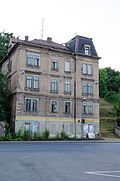 More pictures |
Apartment building in open development | Meisastraße 3 (map) |
around 1870 (tenement) | Significant in terms of urban development and architectural history, a Wilhelminian style house, a corner construction with a tower and balconies that characterizes the street |
09301150 |
Holy Cross Monastery
| image | designation | location | Dating | description | ID |
|---|---|---|---|---|---|
 More pictures |
The whole monastery of the Holy Cross | Leipziger Strasse (map) |
Middle of the 13th century (monastery) | Material entirety Monastery of the Holy Cross, with the individual monument: ruins of the Benedictine nunnery with monastery wall (individual monument ID No. 09265770) and the garden monument: monastery garden; Regional history, architectural history, landscape design, scientifically and artistically important, Romanesque architecture in transition to Gothic . |
09300868 |
 More pictures |
Monastery of the Holy Cross: ruins of the Benedictine nunnery with monastery wall (individual monument for ID No. 09300868) | Leipziger Strasse (map) |
Middle of the 13th century (monastery ruins) | Individual monument belonging to the monastery of the Holy Cross: ruins of the Benedictine nuns monastery with monastery wall; Regional history, architectural history, landscape design, scientifically and artistically important, Romanesque architecture in transition to Gothic. |
09265770 |
Monastery houses
| image | designation | location | Dating | description | ID |
|---|---|---|---|---|---|
 |
Residential house with enclosure | Gasernberg 1 (map) |
2nd half of the 19th century (residential building) | Significant in terms of building history, shaping the townscape |
09265774 |
 |
Former inn, now a residential building | Gasernberg 2 (map) |
Late 19th century (inn) | Significant in terms of local history, shaping the image of the place |
09265773 |
 More pictures |
Farmhouse with barn and retaining wall facing the road | Leipziger Strasse 89 (map) |
1st half of the 19th century (farmhouse) | Socially and historically significant, evidence of the rural way of life of bygone times (plastered half-timbered building), location-defining location opposite the ruins of the monastery of the Holy Cross |
09266264 |
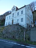 |
Residential house in open development, with retaining walls to the street | Leipziger Strasse 92 (map) |
Mid 19th century (residential building) | Architecturally of importance, location-defining location opposite the ruins of the monastery to the Holy Cross |
09265772 |
Korbitz
| image | designation | location | Dating | description | ID |
|---|---|---|---|---|---|
| Afraner-Kreuz: Iron memorial cross on a base | (Map) | inscribed 1843 (memorial cross) | reminds of the foundation of the Princely School St. Afra by Elector Moritz, historically significant |
09305781 |
|
| Apartment building in half-open development | Am Mühlgraben 1 (map) |
Late 19th century (tenement house) | Wilhelminian style house, clinker brick facade, of importance in terms of urban development and architectural history |
09266006 |
|
| Apartment building in closed development | Am Mühlgraben 2 (map) |
around 1860 (tenement) | simple Wilhelminian style building, of importance in terms of urban planning |
09266005 |
|
| Apartment building in half-open development | Am Mühlgraben 3 (map) |
around 1860, later the facade was smoothed (apartment building) | with shop fitting, historicizing plaster facade, of importance in terms of urban planning |
09266004 |
|
| Apartment building in open development | Am Mühlgraben 4 (map) |
around 1860 (tenement) | of importance in terms of urban development and architectural history |
09266003 |
|
| Villa at home | Ossietzkystraße 61 (map) |
Early 20th century (villa) | Villa with gazebo and enclosure; historically important |
09266008 |
|
| Apartment house designed in closed development | Ossietzkystraße 62 (map) |
Late 19th century (tenement house) | Significant in terms of town planning and building history, a Wilhelminian style house, clinker brick facade, with a shop |
09266007 |
|
 |
Vineyard, main house with side building | Rauhentalstrasse 70 (map) |
around 1850 (winegrower's house) | of importance in terms of urban development and architectural history |
09265922 |
 |
villa | Rauhentalstrasse 78 (map) |
around 1880 (villa) | Significant in terms of urban development and architectural history, a building in the Swiss house style, rafter gable with fretwork |
09265923 |
Lercha
| image | designation | location | Dating | description | ID |
|---|---|---|---|---|---|
| Farmhouse and side building | Bockwener Weg 4 (map) |
1st half of the 19th century (stable house) | socially and historically important, evidence of rural lifestyle (half-timbered construction) |
09266135 |
|
| Old School: Old School of Lercha | Bockwener Weg 18 (map) |
End of the 19th century (school) | historically important, a Wilhelminian style building (partly clinker facade) |
09266138 |
|
| Farmhouse | Dreilindenstrasse 5 (map) |
2nd half of the 19th century (farmhouse) | of building and social history of importance |
09266134 |
|
| Huttenburg: Former villa with a single chapel | Huttenburgweg 1 (map) |
1857 (villa), 1857 (chapel) | Significant in terms of architectural and local history, greatly reduced, but with numerous Gothic elements, such as seat niche portal, vestibule with pointed arches and rib vaults, spiral staircase and Hutten figure, neo-Gothic chapel, architect Oskar Mothes |
09266221 |
Meissen (district)
Old town
The around 380 monuments in the old town are compiled in a separate list .
Back wall, Red House, Kynast
| image | designation | location | Dating | description | ID |
|---|---|---|---|---|---|
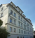 |
Double tenement house | Am Röhrbrunnen 1; 2 (card) |
1892 (double tenement house) | Wilhelminian style house on a hillside, characteristic late-historic residential building from the end of the 19th century, of significance in terms of architectural and urban development. |
09266076 |
 More pictures |
The whole of the rear wall with numerous individual monuments | Back wall 1; 2; 3; 4; 5; 6; 7; 10; 11; 12 (card) |
2nd half of the 17th century (village complex) | Subject aggregate rear wall with the following individual monuments: several houses, some with outbuildings and wall enclosures, see also individual monuments ID no. 09265678, 09265679, 09265680, 09265681, 09265682, 09265683, 09266298, 09265684, 09265685 (back wall 1, 2, 3, 4, 5, 6, 10, 11, 12) and ID no. 09266071, 09301055, 09266077, 09266078 (Nossener Straße 1, 7, 8 and 10) as well as the back wall 7 and the open spaces in front of, between and behind the houses and the adjoining street space; Part of a village west of the city center that is now incorporated into Meissen, as a former gardening village / garden village of historical and urban development significance. |
09306835 |
 |
Back wall: cottage property with ancillary building in the courtyard (individual monuments to ID no. 09306835) | Back wall 1 (map) |
inscribed 1668, in the sill beam, under the initials G (Häusler's property) | Individual features of the aggregate rear wall: Cottage property with ancillary building in the courtyard (located behind Nossener Straße 7); House history, building history, scientifically, town planning and local history of importance, rural, street picture-defining half-timbered building |
09265678 |
 |
Back wall: cottage property with ancillary building (individual monuments to ID no.09306835) | Back wall 2 (map) |
2nd half of the 18th century (cottage), 2nd half of the 17th century, later remodeling, secondary marked 17 (outbuilding) | Individual features of the aggregate rear wall: cottage property with outbuilding; In terms of building history, town planning and local history of importance, rural half-timbered building |
09265679 |
 |
Back wall: residential building (individual monument for ID no.09306835) | Back wall 3 (map) |
marked 1857 (residential building) | Individual monument of the aggregate rear wall: residential building; Once a cottage estate, of architectural and local importance, rural housing |
09265680 |
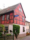 |
Back wall: cottages (individual monument for ID No. 09306835) | Back wall 4 (map) |
2nd half of the 18th century (residential building) | Individual monument of the whole of the back wall: Häusler's property; In terms of building history, town planning and local history of importance, rural half-timbered building |
09265681 |
 |
Back wall: cottages (individual monument for ID No. 09306835) | Back wall 5 (map) |
2nd half 17th / 1st half 18th century (residential building) | Individual monument of the whole of the back wall: Häusler's property; In terms of building history, town planning and local history of importance, rural half-timbered building |
09265682 |
 |
Back wall: cottages (individual monument for ID No. 09306835) | Back wall 6 (map) |
marked 1816 (cottage) | Individual monument of the whole of the back wall: Häusler's property; Significant in terms of building history, urban development and local history, rural residential building with plastered half-timbered upper floor |
09265683 |
 |
Back wall: cottages (individual monument for ID No. 09306835) | Back wall 10 (map) |
1st half of the 18th century (cottage) | Individual monument of the whole of the back wall: Häusler's property; In terms of building history, town planning and local history of importance, rural half-timbered building |
09266298 |
 |
Back wall: House property with wall enclosure (individual monuments to ID No. 09306835) | Back wall 11 (map) |
marked 1842 (cottage) | Individual features of the aggregate rear wall: House property with wall enclosure; In terms of building history, town planning and local history of importance, rural half-timbered building |
09265684 |
 |
Back wall: cottage property with ancillary building (individual monuments to ID no.09306835) | Back wall 12 (map) |
2nd half of the 17th / 1st half of the 18th century (cottage) | Individual features of the aggregate rear wall: cottage property with outbuilding; In terms of building history, town planning and local history of importance, rural half-timbered building |
09265685 |
 |
Residential house in open development, with a park-like garden | Jüdenbergstrasse 5 (map) |
after 1905 (residential building) | Significant in terms of urban development, urban development and architectural history, a building in the reform style of the period after 1910 |
09266069 |
 |
Residential house in open development, with retaining wall and enclosure | Jüdenbergstrasse 9 (map) |
marked 1913 (residential building) | Artistically, in terms of town planning and building history, a building in the reform style or the objectified architecture of the period after 1910. Jüdenbergstraße 9 is a typical objectified residential building with representative cubature from around 1910 , the facades of which, in keeping with the spirit of the times, were only used by a few, but accentuating decorative elements are enlivened. In contrast to the style of historicism that had prevailed until then, at least since the time shortly before the First World War, the focus was more on the functionality of a building than on its display value. The object to be assessed here is therefore suitable for showing the development of architecture at the beginning of the 20th century, which is the reason for its architectural value. The public interest in conservation arises from the fact that comparable buildings are treated as monuments by colleagues in the other federal states, as shown by comparisons with monument topographies published there. |
09266068 |
| Three semi-detached houses in a residential complex, with fencing | Jüdenbergstrasse 40; 41; 42; 43; 44; 45 (card) |
around 1925 (twin house) | Significant in terms of local history and architectural history, a post office complex, important Heimatstil buildings in a balanced design |
09266067 |
|
| Waterworks of the Meißner Felsenkeller brewery | Kynastweg (map) |
marked 1898 (waterworks) | Waterworks of the Meißner Felsenkeller brewery (mainly underground system); It is of local and technological importance, in the neo-Gothic style |
09266126 |
|
 |
Back wall: residential building / cottage (single monument for ID no.09306835) | Nossener Strasse 1 (map) |
around 1705 (residential building) | Individual monument of the aggregate rear wall: residential house / cottage property; Head building with Am Lommatzscher Tor, of urban, social and architectural significance, partly a plastered half-timbered building. |
09266071 |
 |
Back wall: cottages (individual monument for ID No. 09306835) | Nossener Strasse 7 (map) |
around 1800 (cottage) | Individual monument of the whole of the back wall: Häusler's property; Significant in terms of town planning, building history and social history, a half-timbered building (partly slated), location that characterizes the townscape near the street Hintermauer |
09301055 |
 |
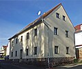
Back wall: cottages (individual monuments to ID no. 09306835) | Nossener Strasse 8 (map) |
1st half of the 19th century, older in the core (cottage) | Individual features of the aggregate rear wall: cottages with enclosure; The building consists of three parts, of architectural and socio-historical significance, the location-defining location opposite Nossener Straße 7 |
09266077 |
 |
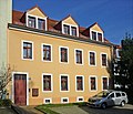
Back wall: residential building (individual monument for ID no.09306835) | Nossener Strasse 10 (map) |
marked 1851 (residential building) | Individual monument of the aggregate rear wall: residential building; of importance in terms of urban development and architectural history |
09266078 |
 |
Residential house in semi-open development | Nossener Strasse 11 (map) |
2nd half of the 19th century (residential building) | of importance in terms of urban development and architectural history |
09266079 |
 |
Residential building, plus an underground corridor 30 meters long to the city cemetery | Nossener Strasse 23 (map) |
marked 1839 (residential building) | rural residential construction, of local and architectural importance |
09265121 |
 |
Former inn | Nossener Strasse 24 (map) |
End of the 18th century (inn) | of importance in terms of local history, urban development and architectural history (upper floor plastered half-timbering) |
09266082 |
 |
Unity of the city cemetery Meißen (also Frauenkirchfriedhof) with several individual monuments | Nossener Strasse 36; 38 (card) |
from 1873 (cemetery) | Meißen city cemetery (also Frauenkirchfriedhof), with the individual monuments: chapel, cemetery administration house (Nossener Straße 36) with enclosure wall to the street, crematorium with morgue (Nossener Straße 38) as well as several tombs (see also obj. 09266065), furthermore the elements: horticultural designed cemetery complex (garden monument); Artistically, landscaping and gardening, building history, local history, art history and technology history of importance, the chapel a historicism building in the neo-Romanesque style, important crematorium in the style of the new building of the 1920s with sculptural decoration, in the cemetery several artistically valuable tombs. |
09301218 |
 |
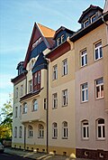
Meißen city cemetery: chapel, house of the cemetery administration | Nossener Strasse 36; 38 (card) |
from 1873 (cemetery), around 1870 (cemetery chapel), beginning of the 20th century (cemetery administration), after 1900 (mortuary), 1933 (crematorium) | Individual monuments of the material entirety Meißen city cemetery: Chapel, house of the cemetery administration (No. 36) with enclosure wall facing the street, crematorium with mortuary (No. 38), war memorial for those who died in World War I and several tombs, including the hereditary burial Biesolt and an obelisk for 15 victims of the explosion on February 9, 1875 (see also Obj. 09301218); Artistically, historically, locally, historically and technically, the chapel is a historicist building in the neo-Romanesque style, an important crematorium in the style of the New Building of the 1920s with sculptural decorations, several artistically valuable tombs in the cemetery. |
09266065 |
 |
Tenement house, in half-open development | Nossener Strasse 45 (map) |
around 1902 (tenement) | Historically important, sophisticated facade with historicizing and Art Nouveau elements |
09265168 |
 |
Brick factory Red House | Nossener Strasse 54 (map) |
End of the 19th century (brick kiln) | Brickworks, Hoffmann ring furnace with chimney; Of importance in terms of local history and technology, a significant industrial historical monument |
09266378 |
 |
Jahnhalle | Schreberstrasse 5 (map) |
1894–1895 (gym) | Gymnasium with annex and plaque; Inside distinctive barrel-vaulted ceiling, side galleries and bust of gymnastics father Jahn, remarkable sports building from 1900 with original equipment, including the railing of the two galleries, Art Nouveau plaster on the exterior still vivid (back), of architectural and local history. |
09266063 |
| Villa with enclosure | Schreberstrasse 10 (map) |
1920s (villa) | Example of reform architecture from 1900 to the 1920s, a simple building with few structural elements, of importance in terms of building history |
09266064 |
Neudörfchen
| image | designation | location | Dating | description | ID |
|---|---|---|---|---|---|
| Residential building | Poetenweg 4 (map) |
2nd half of the 19th century (residential building) | Socially and historically important, a rural half-timbered building |
09266191 |
|
| Villa with enclosure | Poetenweg 7 (map) |
around 1900 (villa) | Architecturally important, a Wilhelminian style building with echoes of the Swiss style |
09266192 |
|
| Residential house with enclosure | Siebeneichener Strasse 18 (map) |
1st half of the 19th century, rebuilt and expanded at the beginning of 2 (villa) | Significant in terms of urban development and architectural history, part of the townscape-defining bank development on the Elbe, a rural residential building |
09266198 |
|
| Rental villa with retaining wall, on a hillside | Siebeneichener Strasse 19 (map) |
Late 19th century (rental villa) | Significant in terms of urban development and architectural history, a Wilhelminian-style house (with an ornamental half-timbered gable), part of the local bank development on the Elbe |
09266197 |
|
| Rental villa with retaining wall and enclosure, on a hillside | Siebeneichener Strasse 20 (map) |
Late 19th century (rental villa) | Significant in terms of urban development and architectural history, a Wilhelminian-style house (with volute gables and loggia), part of the local bank development on the Elbe |
09266196 |
|
| Rental villa with retaining wall and original garden gate | Siebeneichener Strasse 22 (map) |
Late 19th century (rental villa) | Significant in terms of urban development and architectural history, a Wilhelminian-style house (with tower, gable and wooden veranda), part of the local riverbank development on the Elbe |
09266195 |
|
| Villa with enclosure and retaining wall | Siebeneichener Strasse 25 (map) |
Late 19th century (villa) | Significant in terms of urban development and architectural history, a Wilhelminian style house with echoes of the Swiss style, part of the bank development on the Elbe that characterizes the townscape |
09266194 |
|
| Rental villa with enclosure and retaining wall | Siebeneichener Strasse 27 (map) |
Late 19th century (rental villa) | Significant in terms of urban development and architectural history, a Wilhelminian style house (the gable with obelisk and the balcony with decorative grille), part of the bank development on the Elbe that characterizes the townscape |
09266193 |
|
| Residential house with enclosure and outbuildings | Siebeneichener Strasse 29 (map) |
marked 1806, rebuilt around 1850 (residential building) | Significant in terms of urban development, social history and architectural history, a rural residential building, part of the riverbank development that characterizes the townscape on the Elbe |
09266190 |
|
| Two-sided courtyard (hook courtyard), with residential house and side building | Siebeneichener Strasse 36 (map) |
1st half of the 19th century (two-sided courtyard) | Socially and historically important, half-timbered buildings |
09266189 |
|
| Boathouse Walter Brendel: Boathouse | Siebeneichener Strasse 39 (map) |
1st half of the 20th century (boathouse) | Significant in terms of urban planning, local history and architectural history, a building in the local style, part of the local bank development on the Elbe |
09266187 |
|
| House Wobst-Zorn: double villa with enclosure | Siebeneichener Strasse 47; 48 (card) |
1928 (villa) | Remarkably designed residential building around 1930, enlivened by additions, remarkable the old lattice windows with twisted columns, interior design sophisticated equipment, architectural and artistic significant monument text The double villa Siebeneichener Straße 47/48 was built in 1928 in the forms and materials typical of the time, which are still largely today are preserved and easy to read. The flat, two-storey, cubic building with a hipped roof rises above the natural stone base, which was widespread at the time, with regional references being made through the use of red granite for the quarry stone masonry, which was carried out in the same way for the enclosure. Other typical elements of the time are the embossing between the windows, the artificial stone-framed arched doors, the window sills made of the same material and the pike dormer as well as the components or arbors protruding from the facade. The special design quality of the building can be seen, among other things, in the deliberate break in symmetry through the differently shaped balconies, through the concave curved dormer cheeks and the careful shaping of all details inside the building. Mention should be made, for example, of the spiral-shaped outside lamp on the rear corner of the house, the Y-shaped grating of the cellar window, the delicate, classy railing in the stairwell, the twisted pillars in the window mullions. These design peculiarities address the aesthetic sensibility of the viewer to an increased extent and thus give the building an artistic value. In addition, as a significant work from the time of its creation and as part of the oeuvre of the locally important architect Arno Keil, the building is of architectural significance. |
09302562 |
|
| Residential house in open development, with garage and fencing | Siebeneichener Strasse 49 (map) |
1927 (residential building) | Design-highlighted residential building around 1930 in traditional forms with a hipped roof and design elements used sparingly but accentuatingly, in particular a fountain sculpture on the front, significant from an architectural and artistic point of view |
09302563 |
|
| Residential building | Siebeneichener Strasse 55 (map) |
Early 20th century (residential building) | Historically important, a building in the style of the homeland with striking roof houses |
09266184 |
|
| Rental villa with enclosure | Siebeneichener Strasse 56 (map) |
1890s (rental villa) | Artistically and historically of importance, a Wilhelminian style building (clinker facades with volute gables and corner bay windows) in the style of the German neo-Renaissance |
09266183 |
|
 |
Old waterworks: waterworks | Siebeneichener Strasse 60 (map) |
Inscribed in the Meißner city arms 1893 (waterworks) | Artistically, historically, technologically and historically of importance |
09266181 |
 |
Individual monument belonging to the Siebeneichen manor: forester's house with an annex (see also object group Obj. 09301118) | Siebeneichener Strasse 62 (map) |
17th century (Spolien), around 1800 (forester's house) | Forester's house of the Siebeneichen manor (an important country estate of the well-known Meissen noble family von Miltitz), complex of architectural, regional and local history, artistic, urban and landscape design significant, forester's house a renaissance building with seating niche portal and arched curtain windows |
09266182 |
Ploss
| image | designation | location | Dating | description | ID |
|---|---|---|---|---|---|
| Residential house in open development, with garage and fencing | Am Breitenberg 3 (map) |
1930s (residential building), 1930s (enclosure) | From an artistic and architectural point of view of importance, a striking building in the Heimat style |
09266101 |
|
 |
Villa with enclosure | Dr.-Donner-Strasse 2 (map) |
1910s (villa) | Historically significant, a reform-style building after 1900 |
09266098 |
 |
Rental villa with enclosure | Dr.-Donner-Strasse 3 (map) |
around 1900 (rental villa) | historically important, a house in the style of late historicism (with half-timbered gable) |
09266096 |
 |
Villa with fence and gate system and garden | Dr.-Donner-Strasse 4 (map) |
1896 (villa) | a building in the style of late historicism (with a sprinkling gable), a building of importance in terms of building history, urban development history and urban planning |
09266097 |
| Residential house in open development with fencing | Goldgrund 6 (card) |
around 1910 (residential building) | Of architectural significance, in the reform style of the time around 1910 |
09266213 |
|
| Residential house with side building of a former winery | Goldgrund 7 (card) |
marked 1731 and marked 1840 (winery) | Of local, artistic and architectural importance, two excellent baroque stone stairs have been preserved inside |
09265588 |
|
 |
Villa with outbuildings and fencing | Kapellenweg 1 (map) |
1893 (villa) | Significant in terms of local history, artistry, urban development and architectural history, representative Wilhelminian style villa with brick facades and sandstone integration |
09266087 |
 More pictures |
Unity of Martin's Chapel and St. Martini's Cemetery (also Martin's cemetery) | Kapellenweg 5 (next to) (map) |
Mid-12th century, later remodeled (chapel) | Material entirety Martinskapelle and St. Martini cemetery (also Martinsfriedhof), with the individual monuments: Martinskapelle on the Plossenberg (today burial church) and some tombs or grave facilities, cemetery portal and enclosure wall (see obj. 09301241) as well as the cemetery complex as a material part; The church is of Romanesque origin in terms of urban planning, landscape design, architectural history and artistic importance |
09266090 |
 More pictures |
Martinskapelle and St. Martini cemetery: Martinskapelle on the Plossenberg | Kapellenweg 5 (next to) (map) |
Mid-12th century, later reshaped (chapel), 1912/1950 (tomb), 1874/1914 (tomb) | Individual features of the aggregate Martinskapelle and St. Martini cemetery: Martinskapelle on the Plossenberg (today burial church) and some tombs or grave facilities, cemetery portal and enclosure wall (see Obj. 09266090); The church is of Romanesque origin in terms of urban planning, landscape design, architectural history and artistic importance |
09301241 |
 |
Villa with garden, fence and gate | Kapellenweg 8 (map) |
after 1900 (villa) | Representative historicizing building with elaborate brick and sandstone facades, revitalization through stepped gables and corner tower, rich ornamentation with Art Nouveau echoes, interior noteworthy, of local historical, artistic, urban and architectural significance |
09266089 |
 |
Rental villa | Kapellenweg 9 (map) |
around 1890 (rental villa) | of importance in terms of urban planning and building history, Wilhelminian style villa (plastered facade with clinker brick structure) |
09266088 |
 |
Rental villa | Kapellenweg 11 (map) |
after 1905 (rental villa) | Significant urban development and architectural history, representative Wilhelminian style villa in the style of late historicism (wooden veranda and ornamental half-timbered gable, partly slated) |
09266086 |
 |
Villa with gate entrance | Marienhofstrasse 2 (map) |
around 1900 (villa) | Significant in terms of local history, artistry, urban development and architectural history, a villa in the style of the German neo-Renaissance |
09266091 |
 |
Villa with garden terrace including stairs, paving of the driveway, pavilion and fountain in the garden as well as fencing | Marienhofstrasse 3 (map) |
Inscribed 1899 (manufacturer's villa), 1905 (garden pavilion), around 1910 (fountain) | late historical villa with clinker brick facade, echoes of neo-Gothic and neo-renaissance, of importance in terms of local history, artistry, urban development and architectural history |
09266093 |
 |
Residential house (presumably a former winery) in open development, consisting of two wings and a gate to the property | Marienhofstrasse 5; 6 (card) |
End of the 18th century, later remodeled (residential building) | Significant in terms of local history, urban development and architectural history, mansion-like residential building, tower construction that defines the street scene |
09266299 |
 |
Rental villa (villa) with enclosure | Marienhofstrasse 7 (map) |
around 1915 (villa) | Significant in terms of town planning and building history, country house-like house, a building in the reform style after 1910 |
09300986 |
 |
Villa with enclosure, retaining wall to the Poetenweg and villa garden | Marienhofstrasse 8 (map) |
1895–1896, marked 1896 (in weather vane) | Representative late-founding property, villa with historicizing facade (partly in half-timbered construction) and large parts of the original interior (for example lead-glazed windows in the stairwell), significant in terms of local history, artistry, and building and urban development history |
09266095 |
 |
Villa with enclosure | Marienhofstrasse 12 (map) |
around 1900 (villa) | Significant in terms of local history, artistry, urban development and architectural history, a villa in the late historical style (attic half-timbered, massive veranda that defines the facade) |
09266094 |
 |
Garden house with remise (originally part of Villa Kapellenweg 8) | Marienhofstrasse 15 (map) |
around 1900 (Remise) | Significant in terms of urban planning and architectural history, a Wilhelminian style building (clinker brick facade with half-timbering) |
09266092 |
 |
Villa with stairs, vineyard, park, garden house / studio house and enclosure as well as historical bars in the park | Plossenweg 4 (map) |
around 1850 (villa), late 19th century (studio) | Significant in terms of town planning, local history and architectural history, a still classicist building from early historicism, the half-timbered garden house / studio house of the Meissen painter Rudolf Kanka |
09265532 |
 |
Residential house in semi-open development | Plossenweg 5 (map) |
1st half of the 19th century (residential building) | of importance in terms of urban development and architectural history |
09265534 |
 |
Residential house in semi-open development | Plossenweg 6 (map) |
1st half of the 19th century (residential building) | of importance in terms of urban development and architectural history |
09265533 |
| Residential house in open development, with extension as well as wall enclosure and outbuildings | Plossenweg 8 (map) |
around 1800 (residential building) | Simple plastered building with segment arch portal, of importance in terms of urban development and architectural history, location on the Meissen-Nossen railway line that defines the townscape |
09265531 |
|
 |
"Waldschlösschen" inn | Wilsdruffer Straße 1 (map) |
1894 (excursion restaurant) | Excursion restaurant with a park-like garden (formerly called Stadtpark), a female statue in the park; Of local and architectural importance, a Wilhelminian style building with a striking tower and half-timbered upper floor |
09266220 |
| Villa with enclosure (access to the villa via the lamb steps) | Wilsdruffer Strasse 4 (map) |
Late 19th century (villa) | From an urban and architectural perspective of importance, a Wilhelminian style building |
09266219 |
|
 |
Villa with enclosure (wall, archway, gate) and garden house (with coach house) | Wilsdruffer Straße 12 (map) |
marked 1902 on the archway of the enclosure, in the core vie (villa) | Of importance in terms of town planning and building history, a late Wilhelminian style building |
09266100 |
 |
Country house, studio and surrounding garden | Wilsdruffer Straße 24 (map) |
1900 (villa) | Significant in terms of local history and building history, late founding villa, home of the academic painter Richard Blum |
09265886 |
 |
Dr.-Donner-Stift (formerly) | Wilsdruffer Strasse 28 (map) |
around 1870 (home) | Country house / convalescent home (today a youth hostel) with courtyard paving and enclosure; Artistically, historically, locally and in terms of personal history of importance, striking buildings in the style of the early neo-Gothic |
09266099 |
| Katharinenhof | Wilsdruffer Strasse 31 (map) |
formerly marked 1808 (residential building) | Residential house (former country residence of a wealthy person, later nursing home) with side building, gate system, enclosure wall and manor park; Significant in terms of local history, architectural history and garden design, a Wilhelminian style building with an older core |
09266212 |
|
| Plossenschänke: inn | Wilsdruffer Strasse 35 (map) |
marked 1801 (inn) | of local importance |
09266215 |
Rauhenthal
| image | designation | location | Dating | description | ID |
|---|---|---|---|---|---|
 |
Restaurant Schweizerhaus: Restaurant building (two parts of the house) with a wooden annex to the rear, terrace and parts of the enclosure | Rauhentalstrasse 1 (map) |
around 1870 (inn) | Characteristic building with ornamental framework and wide gable overhangs in the Swiss house style, Wilhelminian style massive residential building with well-structured plastered facade, significant building and local history |
09265901 |
 |
Villa with enclosure | Rauhentalstrasse 10 (map) |
inscribed 1904 (villa) | distinctive historical building with a gabled risalit, corner tower and wooden, two-storey veranda, shows forms of neo-Gothic and German neo-renaissance ("old German style"), also art nouveau, important in terms of urban planning, architectural history and artistically. Architect Adalbert Erlebach . |
09265902 |
 |
Residential building | Rauhentalstrasse 15 (map) |
marked 1744 (residential building) | Socially and historically important, rural half-timbered building |
09265920 |
 |
Rental villa with retaining wall and two gate pillars | Rauhentalstrasse 24 (map) |
around 1900 (rental villa) | From an urban and architectural point of view of importance, a Wilhelminian style building with echoes of the Swiss house style |
09265909 |
 |
Apartment building in open development | Rauhentalstrasse 27 (map) |
1880s (tenement) | Significant in terms of urban development and architectural history, a Wilhelminian style house in the neo-renaissance style, gable that defines the street scene |
09265917 |
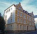 |
Apartment building in open development | Rauhentalstrasse 29 (map) |
1890s (tenement) | Significant in terms of urban planning and building history, a Wilhelminian style house (clinker brick facade) in the neo-renaissance style, gable that defines the street scene |
09265916 |
 |
Apartment house in half-open development, with a side archway | Rauhentalstrasse 30 (map) |
around 1915 (tenement) | Significant in terms of urban planning and building history, a building in the reform style of around 1910 |
09265912 |
 |
Former wine-growing house and separate vineyard cellar | Rauhentalstrasse 50 (map) |
marked 1820 (farmhouse) | Regional and architectural significance, a half-timbered building |
09265914 |
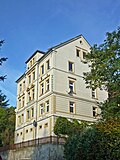 |
Vettersches Weingut: Former winery with main building and two side buildings, wine cellar and retaining wall facing the street | Rauhentalstrasse 58 (map) |
17th century (winegrower's house) | Regionally and historically important, one of the oldest wineries on the slopes near the Triebischtal, ancient half-timbered construction with St. Andrew's cross and K-struts |
09265915 |
Triebisch Valley
| image | designation | location | Dating | description | ID |
|---|---|---|---|---|---|
| Sixth mill (so-called) | At the Hohen Eifer 1 (map) |
inscribed 1525 (mill), 1st half of the 19th century (auxiliary building) | Former mill with side building; Of importance in terms of building history, local history and technology history |
09266009 |
|
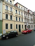 |
Double tenement house in closed development | Böttgerstrasse 1; 2 (card) |
End of the 19th century (double tenement house) | From an urban and architectural point of view of importance, a Wilhelminian style building with a shop fitting |
09265988 |
 |
Apartment building in closed development | Böttgerstrasse 3 (map) |
1890s (tenement) | Significant in terms of urban development and architectural history, a Wilhelminian style house (clinker brick facade) |
09265989 |
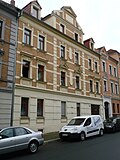 |
Apartment building in closed development | Böttgerstrasse 4 (map) |
marked 1897 (tenement house) | Significant in terms of urban development and architectural history, a Wilhelminian style house (clinker brick facade) |
09265990 |
 |
Apartment building in half-open development | Böttgerstrasse 5; 6 (card) |
around 1880 (tenement) | Urban planning and building history of importance, a Wilhelminian style building (plastered facade) |
09265991 |
 |
Apartment building in semi-open development and corner location | Böttgerstrasse 10 (map) |
around 1880 (tenement) | Significant in terms of urban development and architectural history, a Wilhelminian style house, well-structured plastered facade |
09265980 |
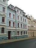 |
Apartment building in closed development | Böttgerstrasse 11 (map) |
around 1880 (tenement) | From an urban and architectural point of view of importance, a Wilhelminian style house |
09265981 |
 |
Apartment building in closed development, corner location | Crassostraße 1 (map) |
after 1895 (tenement) | Significant in terms of urban development and architectural history, a representative Wilhelminian style house (clinker brick facade, corner tower) |
09266034 |
 |
Apartment building in half-open development | Crassostraße 2 (map) |
after 1895 (tenement) | Significant in terms of urban development and architectural history, a Wilhelminian style house (clinker brick facade) |
09266036 |
 |
Apartment building in half-open development | Crassostraße 14 (map) |
after 1895 (tenement) | Significant in terms of urban development and architectural history, a Wilhelminian style house (clinker brick facade) |
09266037 |
 |
Apartment building in closed development, corner location | Crassostraße 15 (map) |
after 1895 (tenement) | Significant in terms of urban development and building history, a Wilhelminian style house (clinker brick facade, corner tower) |
09266035 |
| Villa with enclosure, formerly a manufacturer's villa | Goldgrund 15 (card) |
2nd half of the 19th century (manufacturer's villa) | Architecturally and historically important, a house in the Swiss style |
09265789 |
|
| Villa with enclosure | Hirschbergstrasse 2 (map) |
1874/1875 (villa) | Significant in terms of town planning, building history and local history, home of the Mayor of Meissen, Karl Richard Hirschberg (d. 1886) |
09265853 |
|
| Residential house in open development, with (secondary built-in) seating niche portal | Hirschbergstrasse 3 (map) |
1880s (residential building), marked 1540 (seat niche portal) | Wilhelminian style building, of architectural and local significance, the Renaissance portal of artistic importance, the Renaissance seat niche portal comes from a building in the old town |
09265854 |
|
 |
Apartment building in half-open development | Hirschbergstrasse 14 (map) |
1880s (tenement) | of importance in terms of urban development and architectural history |
09265833 |
| Apartment building in semi-open development and corner location | Hirschbergstrasse 17 (map) |
1881 (tenement house) | Wilhelminian style building, plastered facade still with a classicistic effect, of importance in terms of urban planning and architectural history |
09265834 |
|
 |
Apartment building in half-open development | Hirschbergstrasse 24a (map) |
around 1900 (tenement) | Architecturally important, a Wilhelminian style house in the style of late historicism |
09265803 |
| Meissen-Triebischtal railway station; Borsdorf – Coswig railway line; Narrow-gauge railway Wilsdruff – Döbeln-Gärtitz | Hirschbergstrasse 24 (opposite) | 1910 (reception building) | Station building of a train station; Last structural testimony of the formerly important Meißen-Triebischtal train station and the terminus of the first section of the narrow-gauge Wilsdruff – Döbeln-Gärtitz line in the Wilsdruff narrow-gauge network, as well as the station on the Borsdorf – Coswig railway line (6386; see above BC), for railroad structures rarely elongated In plastered construction with service rooms and waiting hall, of importance in terms of building history and traffic history |
09306618 |
|
 |
Residential house in semi-open development, designed as a closed development | Hirschbergstrasse 60 (map) |
around 1900 (residential building) | From an urban and architectural point of view of importance, a Wilhelminian style house |
09265395 |
| Residential building in closed development | Hirschbergstrasse 70 (map) |
1st half of the 19th century (residential building) | Significant in terms of urban planning and building history, pre-prehistoric building |
09265832 |
|
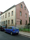 |
Residential house in semi-open development | Hirschbergstrasse 72 (map) |
around 1870 (residential building) | Characteristic building from the 1860s to 1870s (three-gang house), with balanced proportions, simple facade design and small open entrance porch, important in terms of building and urban development history |
09265831 |
 |
Apartment building in closed development | Höroldtstrasse 2 (map) |
Late 19th century (tenement house) | historically important, a Wilhelminian style house |
09265973 |
 |
Apartment building in closed development, corner location | Ilschnerstrasse 12 (map) |
1880s (tenement) | From an urban and architectural point of view of importance, a Wilhelminian style house |
09266022 |
 |
Residential house in closed development and corner location | Jaspisstrasse 1 (map) |
2nd half of the 19th century (residential building) | From an urban point of view of importance, an early Wilhelminian style building (three-gang house) with a shop fitting |
09266017 |
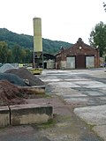 |
Former tram station, wagon and railcar shed | Jaspisstraße 11 (map) |
1899 (tram depot), 1899 (administration building) | Former tram station, wagon and railcar shed as well as administrative building for the former Meißner tram (today part of Triebischtal station), as well as the partially preserved rails; Significant in terms of local history, technology history and architectural history, raw brick buildings from the Wilhelminian era with neo-Gothic elements |
09266024 |
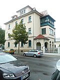 |
Residential house in open development in a corner, with outbuildings and fencing | Karl-Niesner-Strasse 1 (map) |
after 1905 (residential building) | Significant in terms of town planning and building history, a building in the reform style of the period after 1900 |
09265935 |
 |
Administration building in the half-open development of a factory | Karl-Niesner-Strasse 7 (map) |
around 1890 (administration building) | of importance in terms of urban planning, local history and architectural history, a Wilhelminian style building (multi-colored clinker brick facade) |
09265934 |
| Apartment house in open development and corner location | Kerstingstrasse 4 (map) |
marked 1914 (tenement) | Significant in terms of urban development and architectural history, a building in the reform style of the period after 1910, facade with monumental bay windows |
09265847 |
|
| Material entirety, St. Nicolai cemetery (also Neuer Nikolaifriedhof) | Lerchaweg (map) |
around 1910 (cemetery) | Material aggregate Friedhof St. Nicolai (also New Nikolaifriedhof), with the individual monuments: chapel, morgue as well as several grave monuments and the war memorial for the fallen of the First World War (see also individual monument list Obj. 09301257) as well as the aggregate parts: enclosure wall and cemetery design; Significant in terms of local and architectural history, the location above the Triebisch Valley, the chapel was built in the reform style around 1910 |
09266132 |
|
| St. Nicolai Cemetery (also New Nikolaifriedhof): Chapel and separate morgue | Lerchaweg (map) |
around 1910 (cemetery), 1916/1926 (tomb), around 1910 (mortuary), around 1910 (cemetery chapel), 1920s (war memorial) | Individual features of the aggregate cemetery St. Nicolai (also Neuer Nikolaifriedhof): chapel and separately standing morgue as well as some tombs and the war memorial for the fallen of the First World War (see also aggregate list Obj. 09266132); Significant in terms of local and architectural history, the location above the Triebisch Valley, the chapel was built in the reform style around 1910 |
09301257 |
|
| Apartment building in open development | Lerchaweg 2 (map) |
1890s (tenement) | Significant in terms of urban development and architectural history, a Wilhelminian style house (clinker brick facade) with an accentuated hood |
09266131 |
|
 |
Apartment building in a residential complex | Leschnerstrasse 5; 6 (card) |
marked 1927 (double house) | Significant in terms of building history, with echoes of the Art Deco style |
09266020 |
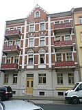 |
Apartment building in semi-open development, designed as a closed development | Lessingstrasse 2 (map) |
after 1895 (tenement) | Significant in terms of urban development and architectural history, a Wilhelminian style house (clinker brick facade) |
09265953 |
 |
Apartment building in closed development | Lessingstrasse 6 (map) |
Late 19th century (tenement house) | From an urban and architectural point of view of importance, an early Wilhelminian style building |
09265959 |
 |
Apartment building in closed development | Lessingstrasse 7 (map) |
Late 19th century (tenement house) | From an urban and architectural point of view of importance, an early Wilhelminian style building |
09265958 |
 |
Apartment building in closed development | Lessingstrasse 8 (map) |
Late 19th century (residential building) | From an urban and architectural point of view of importance, an early Wilhelminian style building |
09265957 |
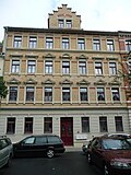 |
Apartment building in closed development | Moritzstrasse 3 (map) |
around 1890 (tenement) | Significant in terms of urban development and architectural history, a Wilhelminian style house (clinker brick facade) |
09265940 |
 |
Apartment building in closed development | Moritzstrasse 4 (map) |
around 1890 (tenement) | Significant in terms of urban development and architectural history, a Wilhelminian style house (clinker brick facade) |
09265939 |
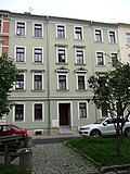 |
Apartment building in closed development | Moritzstrasse 5 (map) |
1880s (tenement) | of urban significance |
09265938 |
 |
Apartment building in closed development | Moritzstrasse 7 (map) |
Late 19th century (tenement house) | From an urban and architectural point of view of importance, a Wilhelminian style house |
09265948 |
 |
Residential building in closed development | Moritzstrasse 9 (map) |
2nd half of the 19th century (residential building) | Significant in terms of urban development and architectural history, an early Wilhelminian style building from the 1860s to 1870s (three-gabled house) |
09265947 |
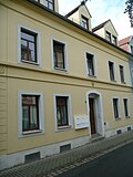 |
Residential building in closed development | Moritzstrasse 10 (map) |
2nd half of the 19th century (residential building) | Significant in terms of urban development and architectural history, an early Wilhelminian style building from the 1860s to 1870s (three-gabled house) |
09265946 |
 |
Residential building in closed development | Moritzstrasse 11 (map) |
2nd half of the 19th century (residential building) | Significant in terms of urban development and architectural history, an early Wilhelminian style building from the 1860s to 1870s (three-gabled house) |
09265945 |
 |
Residential house in closed development and corner location | Moritzstrasse 13 (map) |
2nd half of the 19th century (residential building) | From an urban and architectural point of view of importance, an early Wilhelminian style building from the 1860s to 1870s |
09265943 |
 |
Wetzel mill | Mühlweg 23 (map) |
Origin 16th century (mill), marked 1883 (mill) | Mill with all buildings (mill, residential and office building, two side buildings, two millstones at the driveway, silo, mill technology, mountain cellar) as well as the enclosure of the property; scientifically, historically, locally, artistically and technically of importance, important mill structure |
09266049 |
 More pictures |
Nikolaikirche: Old church and enclosure wall with remaining baroque tombs (formerly a surrounding churchyard, old Nikolaifriedhof, today a park) and a monument to Samuel Hahnemann | Neumarkt 29 (map) |
13th century (church), 1923-1929 conversion to memorial (church) | old parish church in Triebischtal, 1923-1929 after removal of the equipment, conversion of the church into a memorial for the fallen of the First World War, everything in Meissen porcelain (sculptor: Emil Börner ), remains of Romanesque wall paintings, of urban, artistic and architectural significance |
09265855 |
 |
Apartment building in open development | Ossietzkystraße 30 (map) |
around 1900 (tenement) | From an urban and architectural point of view of importance, a Wilhelminian style house in the style of the German neo-renaissance |
09266253 |
 |
Meißen cultural center | Ossietzkystraße 37 (map) |
1950s (Kulturhaus) | Kulturhaus, above the entrance tile picture with a scene from working life; Architecturally important, characteristic building of the traditionally conservative GDR post-war architecture of the 1950s |
09266254 |
 |
Apartment building in semi-open development, designed as a closed development | Ossietzkystraße 40 (map) |
around 1910 (tenement) | Significant in terms of urban planning and building history, a building in the reform style of around 1910 |
09266252 |
 |
Apartment building in semi-open development, designed as a closed development | Ossietzkystraße 43 (map) |
1890s (tenement) | Significant in terms of urban development and architectural history, a Wilhelminian style house (clinker brick facade) |
09266248 |
 |
Apartment building in closed development | Ossietzkystraße 45 (map) |
marked 1901 (tenement house) | From an urban and architectural point of view of importance, a Wilhelminian style house |
09266246 |
 |
German jute spinning and weaving mill (formerly); VEB Tetex (formerly) | Schützestrasse 1 (map) |
around 1890 (part of the textile industry) | Remains of a former spinning and weaving mill, with the old forge, the chimney, surrounding walls and facades / walls of the gable ends; of local and technological importance, an industrial building with brick and quarry stone facades |
09265999 |
 |
Pumping station (formerly): Former pumping station | Schützestrasse 4 (map) |
around 1900 (water supply and sewage system) | Significant in terms of local history and technology, interesting industrial building from the turn of the century around 1900 with clinker brick structure |
09265993 |
 |
Residential house in semi-open development | Schützestrasse 5 (map) |
2nd half of the 19th century (residential building) | of importance in terms of urban planning, building history and social history |
09265998 |
 |
Residential building in closed development | Schützestrasse 6 (map) |
2nd half of the 19th century (residential building) | of importance in terms of urban planning, building history and social history |
09265997 |
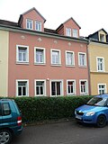 |
Residential building in closed development | Schützestrasse 7 (map) |
2nd half of the 19th century (residential building) | of importance in terms of urban planning, building history and social history |
09265996 |
 |
Residential house in closed development and corner location | Schützestrasse 8 (map) |
2nd half of the 19th century (residential building) | Significant in terms of urban planning and building history, location on Talstrasse that defines the cityscape |
09265995 |
 |
Apartment building in half-open development | Talstrasse 6 (map) |
marked 1888 (tenement house) | Significant in terms of urban planning and building history, a Wilhelminian style house with a corner bay that characterizes the street |
09265617 |
 |
Talbad: Badanstalt | Talstrasse 7 (map) |
End of the 19th century (bathing establishment) | In terms of local history and architecture, it is the oldest public bathing establishment in Meissen |
09265618 |
 |
Meissen Porcelain Manufactory | Talstrasse 9 (map) |
1861-1863, marked 1861 (manufacture) | Meißner Porzellanmanufaktur, including building A (painting / shipping, 1860/1911), B (painting / rough production 1861/1923), D (management 1861, connector 1914/15, exhibition hall 1914/15), E (mold production / painting 1871), S (Schlämmerei / School 1861), X (raw material store, without transition, 1884); Artistically, historically, structurally and historically, an important industrial building, the main building in neo-Gothic style, an extension in the reform style from around 1910 |
09266040 |
 |
Monument to Johann Friedrich Böttger | Talstrasse 9 (opposite) (map) |
marked 1891 (monument) | artistically and historically important |
09266041 |
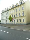 |
Double tenement house | Talstrasse 14; 15 (card) |
around 1880 (double tenement house) | Significant in terms of urban development and architectural history, Wilhelminian style houses |
09265942 |
 |
Apartment building in semi-open development and corner location | Talstrasse 17 (map) |
1880s (tenement) | From an urban and architectural point of view of importance, a Wilhelminian style house |
09265941 |
 |
Double tenement house in closed development | Talstrasse 18; 19 (card) |
End of the 19th century (double tenement house) | From an urban and architectural point of view of importance, a Wilhelminian style house |
09265955 |
 |
Residential house in semi-open development | Talstrasse 21 (map) |
2nd half of the 19th century (residential building) | From an urban and architectural point of view of importance, a Wilhelminian style house |
09265956 |
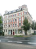 |
Apartment house in a corner | Talstrasse 23 (map) |
before 1900 (tenement) | Significant in terms of urban development and architectural history, a Wilhelminian-style house (clinker brick facade, corner bay window with tower), with built-in shops, location on Wilhelm-Walkhoff-Platz that characterizes the street |
09265954 |
 |
Apartment building in closed development | Talstrasse 25 (map) |
Late 19th century (tenement house) | of importance in terms of urban planning and building history, a Wilhelminian style house (formerly with shop fitting) |
09265965 |
 |
Apartment buildings in a residential complex (with Wettinstrasse 33-35) in closed development | Talstrasse 29; 30 (card) |
1928 (residential building) | Of importance in terms of urban development and architectural history, Heimatstil buildings |
09269140 |
| Apartment building in closed development | Talstrasse 47 (map) |
Late 19th century (tenement house) | From an urban and architectural point of view of importance, a Wilhelminian style house |
09266018 |
|
 |
Apartment building in half-open development | Talstrasse 50 (map) |
1880s (tenement) | From an urban and architectural point of view of importance, a Wilhelminian style house |
09266023 |
 |
Factory owner's villa with wrought iron enclosure | Talstrasse 55 (map) |
around 1890 (manufacturer's villa) | Significant in terms of local history and architectural history, a building in the style of late historicism (with a massive veranda), formerly part of the Schützestrasse 1 factory (jute spinning mill) |
09266000 |
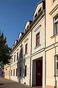 |
Residential building in closed development | Talstrasse 58 (map) |
2nd half of the 19th century (residential building) | Significant in terms of urban planning and building history, an early Wilhelminian style house |
09265994 |
 |
Apartment building in closed development | Talstrasse 62 (map) |
Late 19th century (tenement house) | From an urban and architectural point of view of importance, a Wilhelminian style house |
09265984 |
 |
Apartment building in closed development | Talstrasse 69 (map) |
Late 19th century (tenement house) | From an urban and architectural point of view of importance, a Wilhelminian style house with a shop fitting |
09265986 |
 |
Apartment building in closed development and corner location | Talstrasse 70 (map) |
Late 19th century (tenement house) | Significant in terms of urban planning and building history, a Wilhelminian style house with a shop fitting, a street-defining location on Wilhelm-Walkhoff-Platz |
09265967 |
 |
Apartment building in closed development and corner location | Talstrasse 71 (map) |
Late 19th century (tenement house) | Significant in terms of urban development and architectural history, a Wilhelminian style house with a shop fitting, a street-defining location on Wilhelm-Walkhoff-Platz with a tower-like corner formation |
09266030 |
 |
Apartment building in closed development | Talstrasse 75 (map) |
Late 19th century (tenement house) | From an urban and architectural point of view of importance, a Wilhelminian style house |
09266031 |
 |
Apartment building in closed development | Talstrasse 76 (map) |
Late 19th century (tenement house) | From an urban and architectural point of view of importance, a Wilhelminian style house |
09266032 |
 |
Apartment building in closed development | Talstrasse 77 (map) |
before 1900 (tenement) | Significant urban development and architectural history, representative Gründerzeit house (clinker brick facade) |
09266033 |
 |
Apartment building in half-open development | Talstrasse 78 (map) |
before 1900 (tenement) | Significant in terms of urban planning and building history, a representative Wilhelminian-style house (clinker facade, stepped gable) with a shop fitting |
09269142 |
 |
Kurzsche Druckerei; Paper mill CC Kurz (formerly) | Talstrasse 80a; 80b; 80c; 80d; 80e; 80f; 80g; 80h; 80i (card) |
around 1900 (printer) | Former printing house (now converted into apartments) with gate pillars, wall and wrought iron fence; In terms of technology, local history and urban development, it is of importance, industrial construction as raw brick construction |
09266038 |
 |
Mill, house and outbuildings, with fencing | Talstrasse 81 (map) |
1st half of the 19th century (mill) | Of significance in terms of technology, local history and architectural history |
09266380 |
 More pictures |
Catholic parish church St. Benno | Wettinstrasse 15 (map) |
1885-1887 (church) | Catholic Church; artistically, in terms of town planning and building history of importance, a building in the style of historicism (brick neo-Gothic) |
09265933 |
 |
Triebischtalschule | Wettinstrasse 19 (map) |
1877 (school), 1888-1892 (school expansion) | School; Significant in terms of local history and architectural history, a building in the style of late historicism with gables that characterize the street scene |
09265937 |
 |
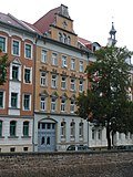
Apartment building in half-open development, but designed as a closed development | Wettinstrasse 27 (map) |
around 1900 (tenement) | Significant in terms of urban development and architectural history, a Wilhelminian style house (clinker brick facade, Art Nouveau with floral details, eagle with spread wings above the portal), the balconies and the gable with turrets characterize the street |
09265949 |
 |
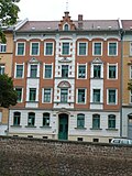
Apartment building in closed development | Wettinstrasse 28 (map) |
marked 1898 (tenement house) | Significant in terms of urban development and architectural history, a Wilhelminian style house (clinker brick facade), stepped gable that defines the street scene |
09265950 |
 |
Apartment building in closed development | Wettinstrasse 29 (map) |
before 1900 (tenement) | Significant in terms of urban development and architectural history, a Wilhelminian style house (clinker brick facade) |
09265951 |
 |
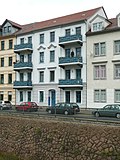
Apartment building in closed development and corner location | Wettinstrasse 30 (map) |
around 1890 (tenement) | From an urban and architectural point of view of importance, a Wilhelminian style house, corner balconies that characterize the street |
09265952 |
 |
Apartment building in closed development | Wettinstrasse 31 (map) |
Late 19th century (tenement house) | From an urban and architectural point of view of importance, a Wilhelminian style house |
09265960 |
 |
Apartment building in closed development | Wettinstrasse 32 (map) |
Late 19th century (tenement house) | From an urban and architectural point of view of importance, a Wilhelminian style house |
09265961 |
 |
Apartment houses in a residential complex in closed and half-open buildings | Wettinstrasse 33; 34; 35 (card) |
marked 1928 (residential building) | Of importance in terms of urban development and architectural history, Heimatstil buildings |
09265962 |
 |
Apartment building in closed development | Wilhelm-Walkhoff-Platz 2 (map) |
Late 19th century (tenement house) | From an urban and architectural point of view of importance, a Wilhelminian style house |
09265968 |
 |
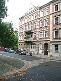
Apartment building in closed development and corner location | Wilhelm-Walkhoff-Platz 3 (map) |
before 1900 (tenement) | Significant in terms of urban development and architectural history, a Wilhelminian style house (clinker brick facade) |
09265969 |
 |
Apartment building in semi-open development, designed as a closed development | Wilhelm-Walkhoff-Platz 4 (map) |
around 1890 (tenement) | Significant in terms of urban development and architectural history, a Wilhelminian style house (clinker brick facade), balconies that characterize the square |
09266028 |
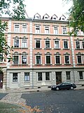 |
Apartment building in closed development | Wilhelm-Walkhoff-Platz 5 (map) |
around 1890 (tenement) | Significant in terms of urban development and architectural history, a Wilhelminian style house (clinker brick facade) |
09266029 |
 More pictures |
Luther Church | Wilhelm-Walkhoff-Platz 7 (map) |
1901-1909 (church), 1845 (organ work), 1904 (organ brochure) | Church of Meißen-Triebischtal; artistically, in terms of town planning and building history, a building in the style of historicism (neo-Gothic with Art Nouveau furnishings) |
09265966 |
| Apartment building in closed development | Wittigstrasse 1 (map) |
1890s (tenement) | historically important, a Wilhelminian style house (clinker brick facade) |
09265974 |
|
 |
Apartment building in closed development | Wittigstrasse 2 (map) |
1890s (tenement) | historically important, a Wilhelminian style house (clinker brick facade) |
09265975 |
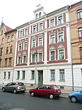 |
Apartment building in closed development | Wittigstrasse 3 (map) |
1890s (tenement) | historically of importance, a Wilhelminian style house (clinker facade, volute gable) |
09265976 |
 |
Apartment building in closed development | Wittigstrasse 4 (map) |
1890s (tenement) | historically important, a Wilhelminian style house (two-tone clinker brick facade) |
09265977 |
 |
Apartment building in a half-open, now closed building | Wittigstrasse 5 (map) |
1890s (tenement) | Architecturally important, a Wilhelminian style house (clinker facade, stepped gable) |
09265978 |
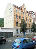 |
Apartment building in half-open development, but designed as a closed development | Wittigstrasse 16 (map) |
before 1900 (tenement) | historically important, a Wilhelminian style house (clinker brick facade) |
09265972 |
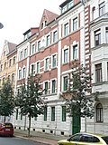 |
Apartment building in closed development | Wittigstrasse 17 (map) |
before 1900 (tenement) | historically important, a Wilhelminian style house (clinker brick facade) |
09265971 |
 |
Apartment building in closed development and corner location | Wittigstrasse 18 (map) |
before 1900 (tenement) | Significant in terms of urban planning and building history, a Wilhelminian style house (clinker brick facade, bay window), location on Wilhelm-Walkhoff-Platz that characterizes the square |
09265970 |
Triebischvorstadt
List of cultural monuments in Triebischvorstadt
Obermeisa
List of cultural monuments in Obermeisa
Questenberg
List of cultural monuments in Questenberg (Meißen)
Seven oaks
List of cultural monuments in Siebeneichen (Meißen)
Detailed memorial texts
- ↑ The preserved parts of the former Holy Cross Monastery are located a few hundred meters below the Meißner Albrechtsburg and form an impressive prelude to the primarily medieval architecture of the cathedral city. As a foundation of Margrave Dietrich (1162–1221) it served as a Benedictine nunnery for the high and low nobility. After it was moved to its present location in 1217, the convent was subject to the Cistercian rule. The supervision was given to the Abbot of Altzella. The monastery was completed at the new location around 1221/22, while the completion of the church continued until around 1241. Since the middle of the 13th century the complex has been used as a Benedictine monastery again . The monastery was dissolved in 1568 during the Reformation. During the Seven Years' War 1756–1763 it was destroyed by Prussian troops. The first ruins were secured in 1883 and increasingly since 1990. Of the monastery wings that were once grouped around a cross courtyard, the eastern parts of the church in the south, essential parts of the ground floor of the east wing and the basement under the north wing have been preserved. There are still numerous remarkable architectural details of the monastery church built on a cross-shaped floor plan, such as one and a half shield walls from the north wall with an ogival window, the surrounding wall of the sanctuary (choir) with a semicircular apse, outside with pilaster strips , the vaulted sacristy and services with cruciform pillars Chalice capitals presumably to accommodate the ribs of a ribbed vault . The construction of the church is similar to that of the Cistercian monastery church Altzelle. The east wing consists of four rooms on the ground floor, two of which have an upper end. What is most remarkable is the former chapter house, which is marked outwards by a stepped round arch portal, flanked by two groups of three of window openings in a rectangular frame. This dominating detail of simple beauty is completed by a round opening at the top. The formal language of the vaulted consoles in the chapter house is also Cistercian. A few barrel-vaulted cellars from the north wing have come down on us. The monastery of the Holy Cross goes back to the late High Middle Ages . Despite the reduction of the complex to a few structural remains, the high quality of the architecture, which represents the Cistercian style in the transition from Romanesque to early Gothic, is clear in every detail. The predominantly medieval building stock is one of the oldest and most important cultural monuments in Saxony. As Cistercian architecture at a certain stage of development, it can also be assigned to Germany's national cultural heritage. The ruins of the former Benedictine nunnery of the Holy Cross were a motif for famous artists. There are several drawings of the complex by Caspar David Friedrich (1774–1840). In addition, it is part of the cityscape of Meissen, which is unique in terms of urban planning, with the castle hill, old town and historical courtyards. Since the early Middle Ages, the castle hill was the military headquarters as well as the secular and ecclesiastical administrative center of the Mark Meissen, from which the later Saxony emerged. Meissen is therefore considered the cradle of Saxony. Apart from that, Meissen is probably the most depicted place in Saxony besides Dresden (LfD / 2008).
- ↑ The three-storey double tenement house Am Röhrbrunnen 1/2, in the once independent village of Hintermauer, has been incorporated into Meißen for some time, and is located on the property of the former Rabenhorst garden, was built in 1892 by master builder Franz Maudrich, as was often typical for the time, as a speculative object . It is a characteristic late-historic residential building from the late 19th century with partly strong decorative and structural elements, such as cornices, profiles, ribbons, straight lintels, window frames, sills and consoles, which are mainly characterized by their horizontal arrangement and also in detail based on the Renaissance as a model. The house, which is covered by a hipped roof , is simply plastered. The broad base, highlighted by a visible Cyclops masonry after completion , was later changed. The large structure of the double house was designed functionally using regular floor plans. The rooms in one half are mirrored in the other half. The floors each show three rooms, a chamber, a girl's chamber and an entrance as well as the staircase in the rear, outer corner. This functional and objective structure is also visible on the exterior, wherein the road facade and the gable sides by the mentioned decorative and structural elements within the meaning of Historismus underwent a design enhancement. As a characteristic structural testimony to the time it was built, the double apartment building Am Röhrbrunnen 1/2 in Meißen is of great architectural and historical value. In addition, it documents the urbanization of Meissen and its surroundings (including its peripheral locations and suburbs) in a vivid way, which explains the significance of the former speculative object in terms of urban development.
- ↑ The Meißner Jahnhalle is a remarkable sports building that was built between 1894 and 1895 according to plans by the city architect Frey. The execution was in the hands of the well-known Meissen master builder Georg Gröschel. The hall is located in close proximity to the old town of Meißner, at the top of the ridge between Triebischtal and Jüdenbergstraße. That, despite some later objectification, still representative building consists of a brick masonry structure with a crooked hip roof and four angled corner tower roofs. The facade is plastered, with the basement appearing separate in structure and division. The bezels and soffits are smooth. The windows consist of segment-arched, partly round-arched wooden elements. The supporting structure, the fixtures and the ceiling of the hall are made of wood. The roof covering on the main roof is a pan covering in wave form, the roofing of the corner towers are still original straight-cut plain tiles in crown covering. Particularly noteworthy are the distinctive barrel-vaulted ceiling and the two flanking side galleries inside the Jahnhalle. Much of the original furnishings, such as the railings of the galleries mentioned, have also been preserved. Initially the hall served the local gymnastics club Frisch-Auf. Friedrich-Ludwig Jahn (also gymnastics father Jahn), who initiated the German gymnastics movement, which later played an important role in the wars of liberation as a program for physical and military training, was commemorated not only with the name of the hall, but also with a bust. Apart from Meißen, numerous Jahnhallen were built across Germany, the Meißner is a testament to the architecture of its time and is of local importance as a locally important public building in the city.
swell
Individual evidence
- ^ Gerhard Peter Thielemann: Adalbert Erlebach, Bozen 2010, p. 26
