List of natural monuments in Edertal
The list of natural monuments in Edertal calls in the municipality Edertal in Waldeck-Frankenberg in Hesse located natural monuments . They are protected according to Sections 28, 22 of the Hessian Law on Nature Conservation and Landscape Management and Section 12 of the Hessian Implementation Act for the Federal Nature Conservation Act.
| image | designation | District, location | description | Art | No. |
|---|---|---|---|---|---|
| old oak |
Bergheim 51 ° 10 ′ 10.1 ″ N , 9 ° 9 ′ 14.4 ″ E |
Old oak on the slope return path, in the forest east of Hepemühle and Bergheim. | Oak | 08 001 | |
| "Heidenbluteiche" |
Bergheim 51 ° 11 ′ 2.3 ″ N , 9 ° 10 ′ 28.1 ″ E |
About 200 years old oak southeast of Königshagen. | Oak | 08 002 | |
| "Sengelsberg" |
Böhne 51 ° 12 ′ 1.4 ″ N , 9 ° 7 ′ 10 ″ E |
1.61 hectare biotope important for rare amphibian species approx. 500 m west of Böhne, south of the Sengelsberg. | 08 003 | ||

|
Prehistoric site |
Buhlen 51 ° 11 '26.3 " N , 9 ° 5' 11.8" E |
0.13 hectare area at the foot of a Zechstein dolomite rock. Two settlements from the older Stone Age, 70,000 and 25,000 to 30,000 years old, added to the age of the Neanderthals, unique in Hessen. | 08 004 | |
| two linden trees |
Gellershausen 51 ° 7 '45.8 " N , 9 ° 0' 50.3" E |
Two church linden trees in the area of the cemetery, on the level opposite the church and to the east of the church. | Linden tree | 08 005 | |
| "Schrumbachsrain" |
Giflitz 51 ° 8 ′ 58.1 ″ N , 9 ° 5 ′ 53.5 ″ E |
1.26 hectare geologically and floristically valuable landscape element on the east side of the Schrumbach valley. | 08 006 | ||

|
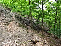
"Klausberg" |
Hemfurth 51 ° 10 '26.1 " N , 9 ° 2' 58" E |
4.27 hectare area. Rock slope on the northern outskirts of Hemfurth. | 08 007 | |

|
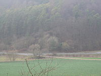
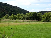
Reed area with adjacent wet meadows |
Minor 51 ° 8 ′ 32 ″ N , 9 ° 4 ′ 16.8 ″ E |
2.23 hectare landscape complex with rare animal and plant species approx. 300 m east of Kleinern. | 08 008 | |
| former hut with slate quarry |
Minor 51 ° 8 ′ 18.8 ″ N , 9 ° 2 ′ 26.5 ″ E |
0.34 hectare former Hutung with slate quarry approx. 1 km west of Kleinern. | 08 009 | ||
| Goat oak |
Königshagen 51 ° 11 ′ 59.7 ″ N , 9 ° 8 ′ 56.3 ″ E |
Striking solitary tree with historical significance approx. 450 m north of Königshagen on the school festival area. | Oak | 08 010 | |
| Caroline Oak |
Königshagen 51 ° 11 ′ 32.3 ″ N , 9 ° 9 ′ 20.3 ″ E |
Mighty, vital oak of historical importance east of Königshagen on the "Jesen mountain". | Oak | 08 011 | |
| Cemetery linden tree |
Flours 51 ° 9 ′ 44.6 " N , 9 ° 6 ′ 18.3" E |
Striking solitary tree in the cemetery. | Linden tree | 08 012 | |
| Swallow sleeping place "Lieschensruh" |
Flours 51 ° 10 ′ 15.3 " N , 9 ° 6 ′ 25.3" E |
0.78 hectare resting place for swallowing swallows south of "Lieschensruh", on the north bank of the Eder. | 08 013 | ||
| Ederal arm "cellar" |
Waves 51 ° 10 ′ 15.3 " N , 9 ° 6 ′ 25.3" O |
0.78 hectare area. Backwater remnants and alluvial woodland southeast of Wellen. | 08 014 |
See also
Web links
Commons : Naturdenkmäler in Edertal - Collection of pictures, videos and audio files
supporting documents
- ↑ Appendix 1 to the Ordinance on the Protection of Natural Monuments in the Waldeck-Frankenberg District. (pdf; 374 kB) Waldeck-Frankenberg district, March 18, 2013, accessed on January 24, 2016 .
- ^ Ordinance on the protection of natural monuments in the Waldeck-Frankenberg district. (pdf; 1.42 MB) Waldeck-Frankenberg district, March 18, 2013, accessed on January 24, 2016 .
- ↑ Details 08 001
- ↑ Details 08 002
- ↑ Details 08 003
- ↑ Details 08 004
- ↑ Details 08 005
- ↑ Details 08 006
- ↑ Details 08 007
- ↑ Details 08 008
- ↑ Details 08 009
- ↑ Details 08 010
- ↑ Details 08 011
- ↑ Details 08 012
- ↑ Details 08 013
- ↑ Details 08 014