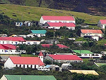
List of places in St. Helena, Ascension and Tristan da Cunha
This is a non-exhaustive list of places in the British Overseas Territory of St. Helena, Ascension and Tristan da Cunha , sorted alphabetically by place name.
St. Helena
| place | most densely 's population |
District | Remarks |
|---|---|---|---|
| Alarm Forest | ... | Alarm Forest | |
| Blue Hill Village | ... | Blue Hill | |
| Francis Plain | ... | St. Paul's | |
| Half Tree Hollow | 984 (2016) | Half Tree Hollow | largest settlement in the overseas area |
| Head o'Wain | ... | Blue Hill | |
| Jamestown | ... | Jamestown | de facto capital of the overseas territory |
| Levelwood | ... | Levelwood | |
| Longwood | ... | Longwood | |
| Ruperts | ... | Jamestown | |
| Sandy Bay | ... | Sandy Bay | |
| Scotland | ... | St. Paul's | |
| St. Paul's | ... | St. Paul's |
Ascension
| place | most densely 's population |
District | Remarks |
|---|---|---|---|
| Georgetown | 450 | Ascension | |
| Two Boats Village | 110 | Ascension |
Tristan da Cunha
| place | most densely 's population |
District | Remarks |
|---|---|---|---|
| Edinburgh of the Seven Seas | 278 | Tristan da Cunha | |
| Weather station on Gough Island | 6-8 | Tristan da Cunha | South African weather station |
See also
Individual evidence
- ^ Official map of the Alarm Forest district. GIS St Helena. ( Memento of January 21, 2016 in the Internet Archive ) Retrieved January 21, 2016
- ↑ a b Official Map of Blue Hill District. GIS St Helena. ( Memento of January 21, 2016 in the Internet Archive ) Retrieved January 21, 2016
- ↑ a b c Official Map of St. Paul's District. GIS St Helena. ( Memento of January 21, 2016 in the Internet Archive ) Retrieved January 21, 2016
- ↑ Official Map of Half Tree Hollow District. GIS St Helena. ( Memento of January 21, 2016 in the Internet Archive ) Retrieved January 21, 2016
- ↑ a b Official Jamestown District Map. GIS St Helena. ( Memento of January 21, 2016 in the Internet Archive ) Retrieved January 21, 2016
- ↑ Levelwood District Official Map. GIS St Helena. ( Memento of January 21, 2016 in the Internet Archive ) Retrieved January 21, 2016
- ^ Official Map of Longwood District. GIS St Helena. ( Memento of January 21, 2016 in the Internet Archive ) Retrieved January 21, 2016
- ^ Official map of the Sandy Bay District. GIS St Helena. ( Memento of January 21, 2016 in the Internet Archive ) Retrieved January 21, 2016


